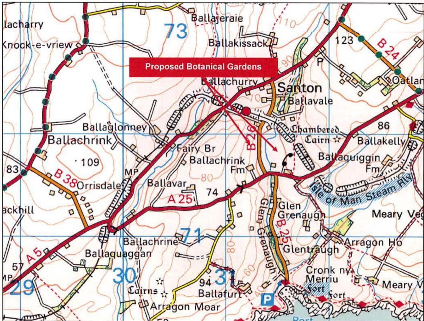
A site location map showing the Santon area with a red label indicating 'Proposed Botanical Gardens' and red arrows pointing to the site.
Site Location in respect of the Local Highway Network
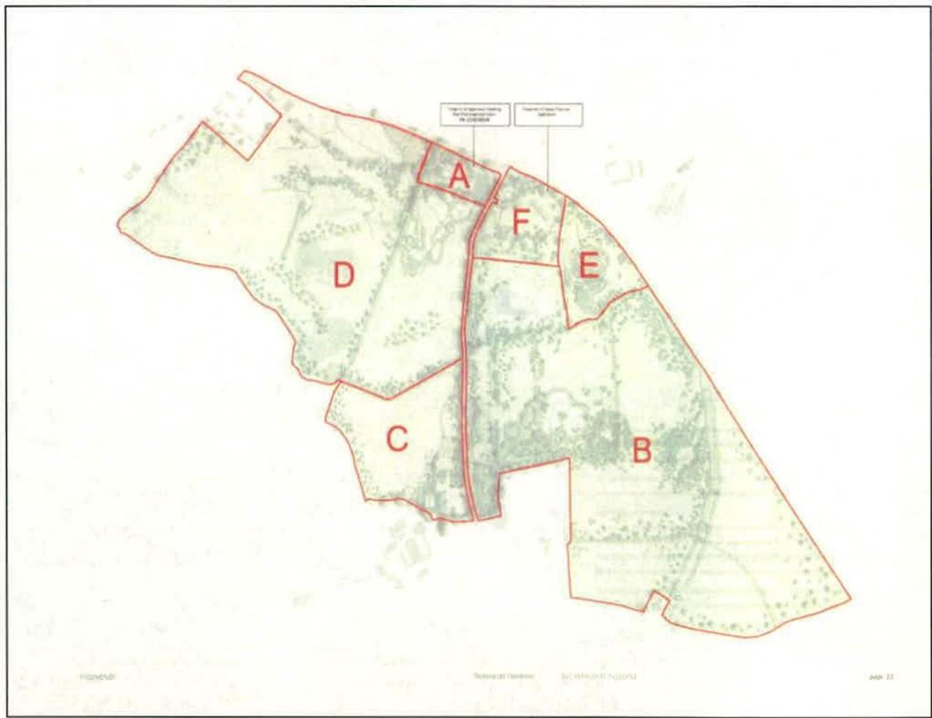
Appendix B
The image displays a site plan or location map with red boundary lines dividing the land into sections labeled A through F. The background appears to be an aerial view or topographical map showing vegetation and terrain features.
Planning Applications in relation to Development
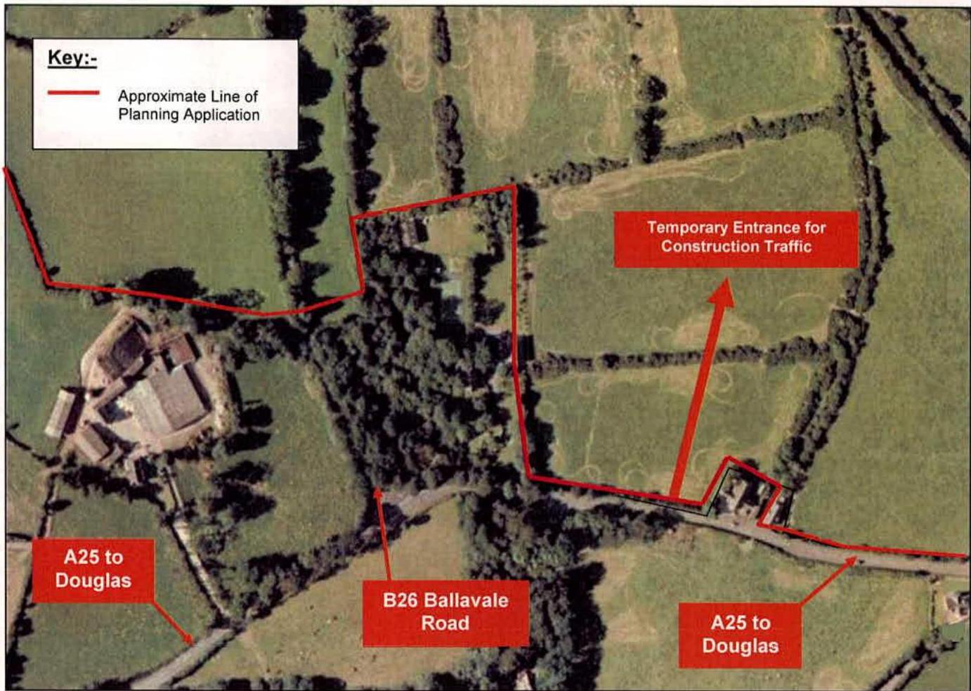
Appendix C
An aerial site plan showing the application boundary, nearby roads like B26 Ballavale Road, and a temporary construction entrance.
Location of Construction Traffic Access
Copyright in submitted documents remains with their authors. Request removal
Source & Provenance
Official reference
13/00831/B
Source authority
Isle of Man Government Planning & Building Control