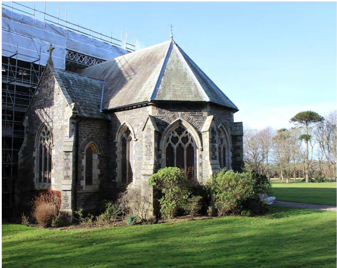
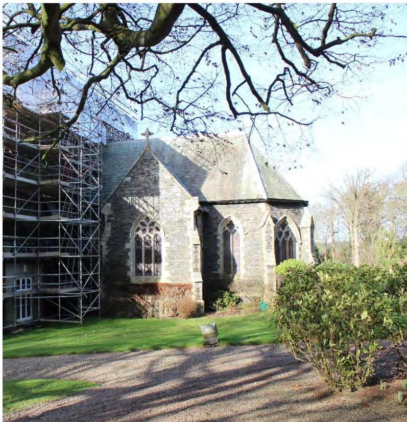
A photograph showing the exterior of a stone chapel with Gothic-style windows and scaffolding on the left side, set against a grassy lawn.
TO SUPPORT A PLANNING APPLICATION AND REGISTERED BUILDING CONSENT APPLICATION FOR WORK TO CORRECT DAMP IN THE CHAPEL AND WASH HOUSE AT
Bishopscourt Kirk Michael
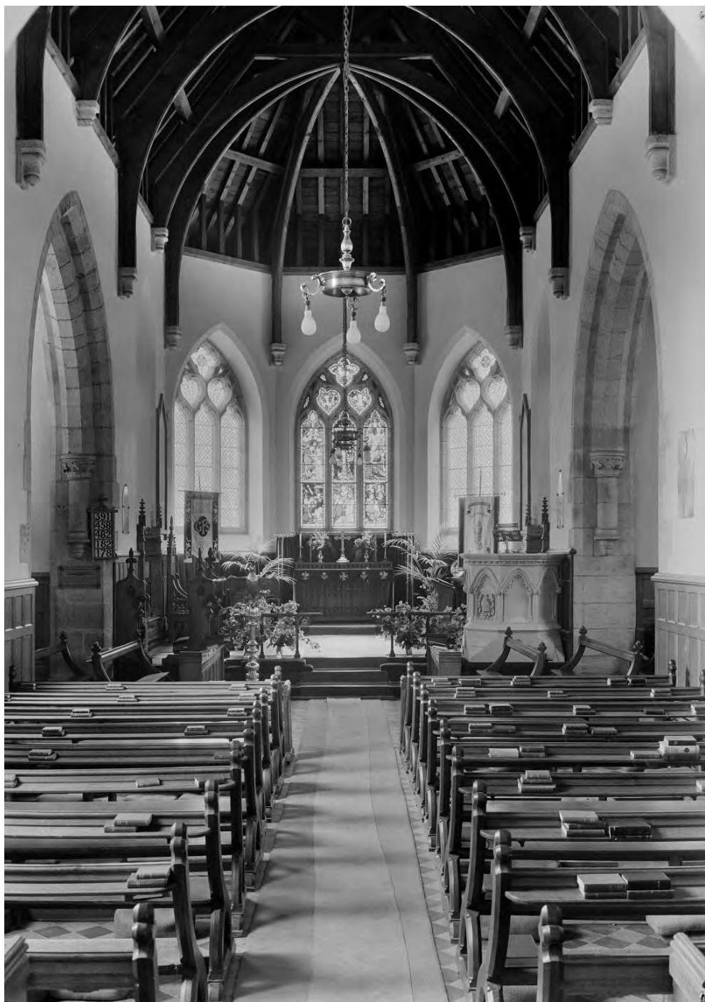
For circulation to the planning authorities, Manx National Heritage and other relevant departments Figure 1. The chancel of Bishop Powys’s Chapel of 1857 photographed during the restoration of Bishopscourt in February 2021. RK/6296 February 2023
Planning Statement Addendum For work to correct damp in the Chapel and Wash House at Bishopscourt Kirk Michael, Isle of Man IM6 2EZ
Contents
1.0 Introduction & Site Context page 03
2.0 Historical Background page 05
3.0 Proposals page 07
4.0 Conclusion page 20
1.0 INTRODUCTION & SITE CONTEXT
1.1 This planning statement addendum has been prepared for the purpose of supporting a planning application and registered building consent application for the correction of damp in the chapel and wash house at Bishopscourt. This application forms an addendum to application 21/01297/B submitted on the 29th of November 2021.
1.2 The application is submitted by ADAM Architecture, acting as Agents for the Applicants, the present owners of Bishopscourt.
1.3 This document aims to explain the methodology and justification for the proposals in design and heritage terms, and should be read in conjunction with the application drawings.
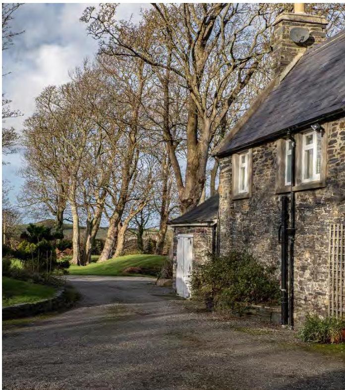
1.4 Bishopscourt comprises the principal mansion associated with the Bishops of Sodor and Man and, with a collection of associated structures, including utilitarian outhouses, as well as the Chapel to the north east side of the group, is designated a Registered Building by the Isle of Man Government (RB No. 1, 23rd May 1983). The Estate is located to the north west side of the Main Road (A3) leading north from Kirk Michael to Ramsey and close to the west coast of the island in a relatively open landscape close characterised by agricultural enclosures, pastures, woodlands and scattered dwellings.
1.5 Bishopscourt is a Registered Building (Isle of Man Government, Code MH/H/R/A, RB No. 1, 23rd May 1983) comprising the principal mansion house and the ‘buildings contiguous therewith’. It is located beyond the boundaries of the nearest Conservation Areas, including Kirk Michael to the south (designated 2006) and Glen Wyllin Conservation Area (also designated 2006); and the Ramsey Conservation Area (Planning Amendment Order, 1992), albeit at some distance to the east. Each is beyond the scope of the subject site, and their setting is not affected.
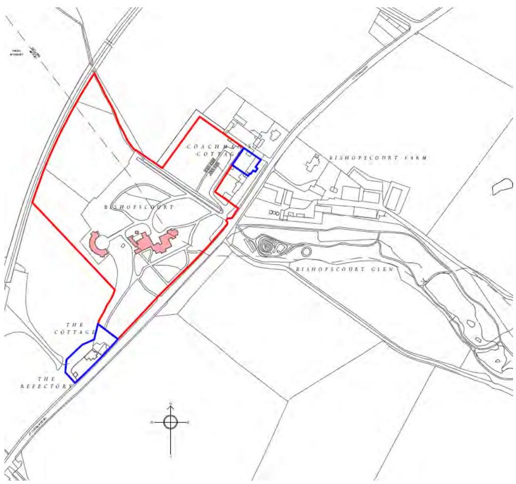
Figure 2. Existing site plan showing the location and context of Bishopscourt
A site plan showing the layout of the Bishopscourt estate with red property boundaries and blue outlines highlighting specific buildings like the Coach House Cottage and The Refectory.
2.0 HISTORICAL BACKGROUND
2.1 The extant structures at Bishopscourt constitute an exceptional group of buildings, including the main house and the Chapel of St Nicholas, the former private chapel to the Bishop of Sodor and Man. It was built in 1857 and designated a pro-cathedral in 1895 (until 1979 when the house was sold.) On initial inspection the buildings collectively appear to date from the 17th to the 19th and up to the late 20th centuries, although the original peel tower, much altered and ‘domesticated’, will retain 14th century fabric.
2.2 Segments of the principal structure suggest a style which is redolent of the defensive towers in Cumbrian style built to withstand unrelenting border raids, infused with an eccentric fusion of Scottish Baronial architectural vigour and the unadorned vernacular form. If there is a distinctive heterogeneity in the historic demographic of the island characterised by a mingling of populations from Scotland, Ireland, and England, then Bishopscourt represents their collective aesthetic input, alongside the patronage of a succession of episcopal tenants, some more determined contributors than others to the form of the building; others apparently never even visited, considering the island ‘barbaric’.
2.3 The historical evolution of the site at Bishopscourt is elaborate in its complexity and it has been significantly transformed since its inception in the 13th century as a timber edifice, of which no obvious trace survives. Its 17th century form would have resembled a structure similar to the extant Yanwath Hall in Cumbria, although there have been multiple changes to the external form and interior aesthetics, especially after the 1893 fire at Bishopscourt, which ‘completely gutted the central portion of the interesting historic building… [it] appears to have originated in the Bishop’s study, in which were stored valuable and historic Church documents and records which have been destroyed.’ Early views of Bishopscourt of the mid-17th century by Daniel King prepared post-surrender of the Isle of Man during the Civil War ‘formed a visual supplement to a written report commissioned by the Lord Mann, Thomas, Lord Fairfax appointed by Parliament in the place of James Stanley, 7th Earl of Derby, staunch Royalist’ and confirm substantial modifications to a structure which is labyrinthine in its complexity, chronology, and surviving elements. Many additions and alterations were made throughout the 19th century and the early 20th century, all of them detailed in previously submitted heritage reports.
2.4 The proposals included in this application have arisen from on-site discoveries made during the construction phase of previously approved proposals, new research into Bishopscourt’s history and slight alterations to the brief in the way some rooms will be used and how they may be effectively serviced. In line with previous proposals, maintaining, restoring and re-instating fabric of historical value has been the primary aim.
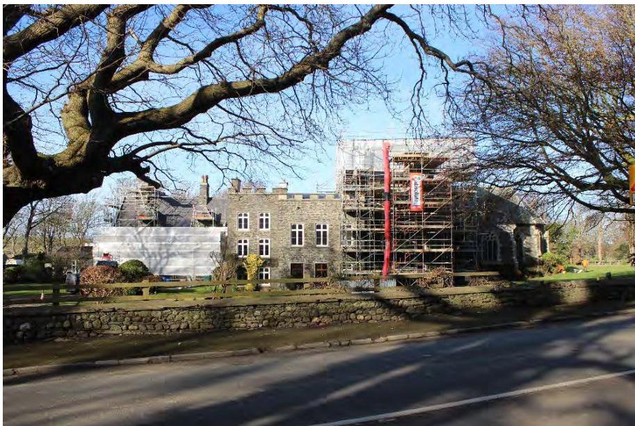
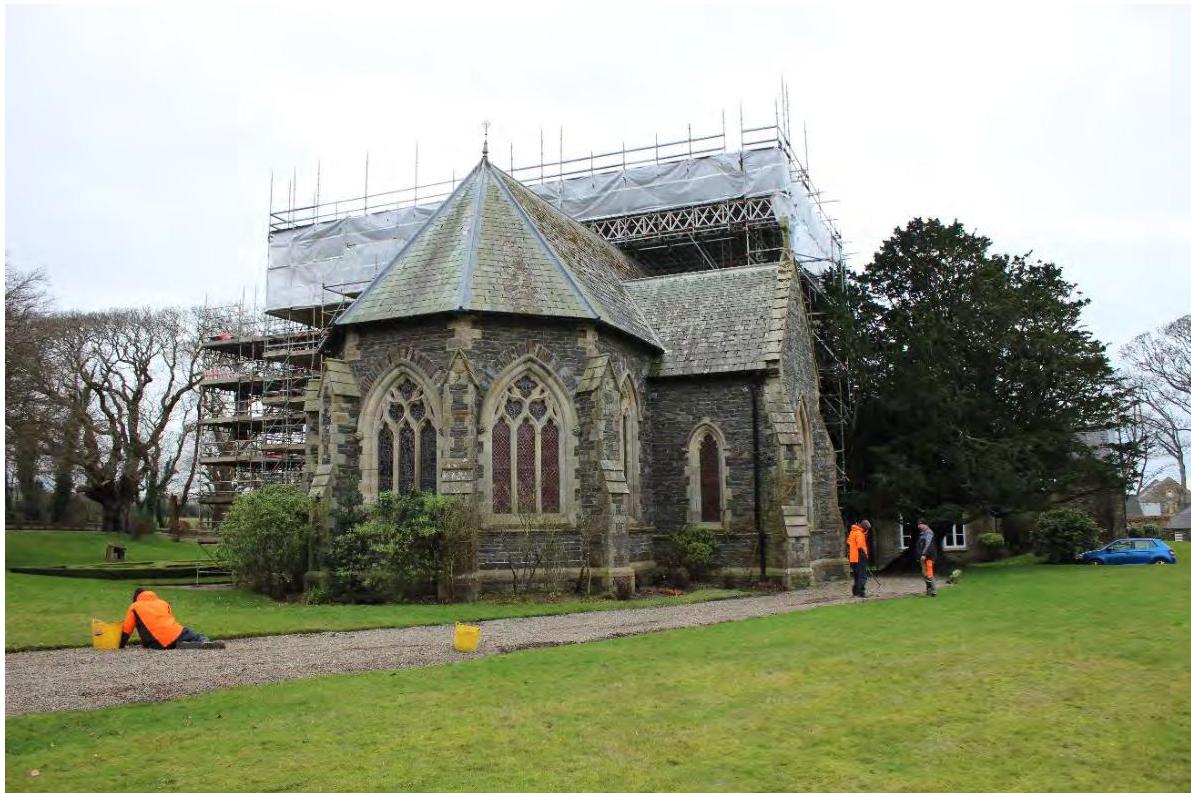
Figure 3. The restoration of Bishopscourt in progress in February 2023.
A photograph showing a large stone building, likely a chapel, covered in scaffolding and protective sheeting.
2.5 In June 2022 specialist historic building surveyors Hutton and Rostron visited Bishopscourt with a brief to advise on the damp, decay and salt efflorescence in the Chapel. They were also tasked with proposing all possible methods of correcting these problems in order to conserve the historical building fabric. Their advice was sought subsequently on the issue of the damp in the west wall of the Wash House.
2.6 Hutton and Rostron made it clear that the damp in the Chapel was caused by external ground levels having risen over time above internal floor levels, allowing water penetration while making subsequent drying difficult. The Chapel’s not being heated for long periods when the building was unoccupied as well as the silting up of the culvert which runs beneath it from the Glen have also contributed to damp ingress.
2.7 Hutton and Rostron’s least invasive recommendation for reversing damp in the floor and lower walls was to reduce landscaped ground levels to approximately 150mm below the internal floor levels and this has been chosen as the most appropriate remedial course. Alternative recommendations were to dig covered land drains against the foundation walls or to dig and construct air drains to the full depth of the foundations, which would pull the ground completely back from the chapel walls. The recommendation for a land drain cannot be followed at the Chapel on account of proximity to archaeological remains identified by Wessex Archaeology in nearby trial pits. The recommendation of an air drain cannot be followed anywhere against the historical buildings on account of the visual change this would represent. A land drain is a possible remedy, however, on the west side of the Wash House, where no archaeology has been found and where a reduction of external levels to below the floor level of the Wash House would be too extreme and impractical. A further recommendation was to create an air gap between the internal finishes of the chapel – for the most part the panelling – but this was deemed too invasive to the historical fabric.
2.8 In all cases Hutton and Rostron recommended improving surface drainage: there is evidence that this survives in part beneath modern landscaping, in the form of brick and cobble or brick and slate surface drains and the restoration and re-instatement of these features would not be invasive.
3.0 PROPOSALS
3.1 Land Drain and other Corrections to Wash House
Recent investigations in the Manx Museum’s archive show that the engine house was built as an addition in 1925 and that the first floor of the Wash House was built at the same time as the Chapel in 1857, the intention being to replace three bedrooms lost when the old chapel and the rooms above it were demolished. These phases of development and an undated photograph show that the ground level here has been much the same since at least the mid-19th century, although the old photograph below shows that it was at least some inches below the surviving threshold of the wood shed door. The ground floor of the Wash House – that is, of the double-storey section – is an older building which originally had a single-storey form, and the addition of a first floor is clearly visible in the changing quality of the masonry. There is also archaeological evidence and evidence in the depth of the gullies that the ground around the Wash House may have been raised on both the drive (west) and the yard (east) sides. As it is, the Wash House Floor (27.47m) is 450mm below the level of the yard (27.92m) and 660mm below the level of the drive (28.13.) This depth is exacerbated by a modern planter built against the west wall of the wash house, which adds another 400mm of wet soil against the Wash House wall. The foundations of the Wash House run very deep below the current ground level. The result of the ground having been raised on all sides means that the Wash House wall is suffering from severe damp, with its internal lime render and lime wash rotting and peeling off the walls. This has damage has been exacerbated by layers of modern alkyd paints which have trapped in the moisture and as they have peeled, have pulled away the old lime plaster with them. The two archaeological test pits dug against this wall revealed no historical material below save for the wall’s own foundations and the old surface drains described in detail below.
As detailed in the first draft of this application, it is still proposed to install a land-drain against this wall, excavating a 600mm wide trench along the whole length of the Engine Room and Wash House, just short of the depth of the foundations, and once provided with a drain, back-filled with gravel as shown in the accompanying detail. It is further proposed to demolish the modern planter and lower the level of the drive by 130mm, restoring it to the level shown in historical photographs. Both of the archaeological test pits against the Engine House and Wash House walls show that 130mm below the present gravel there is a linear brick and cobble surface seemingly made in 1925 as a splash-guard and surface drain to protect the walls, providing further evidence as to the lower ground level shown in the historical photograph. It is proposed to restore this feature. It would seem that modern gravel and mud have slowly accumulated here since then. It is hoped that the combined measures of a land drain, the removal of the planter and a slightly lowered level of the drive would enable the Wash House wall to dry out and prevent further damp. In concert with the re-finishing of the interior Wash House walls with lime render and limewash, the wall would become breathable and have damp soil moved away from its outer face.
A 600mm wide trench is to be hand-dug and wrapped in a permeable geotextile layer to allow water to pass through it but not large stones or soil. This trench is to be filled with gravel and with a 100mm perforated pipe laid to a minimum 1:150 fall and linked to existing or new drains to carry water away from the building. A permeable weed barrier is to be laid on top of the trench to prevent root ingress. Soil or gravel are to be replaced above this to a maximum depth of 150mm and the cobbled margin re-instated and restored as far as possible. The digging of the trench will be done with the attention and care appropriate for any digging in an historical setting of the importance of Bishopscourt. Any digging will be carried out by hand.
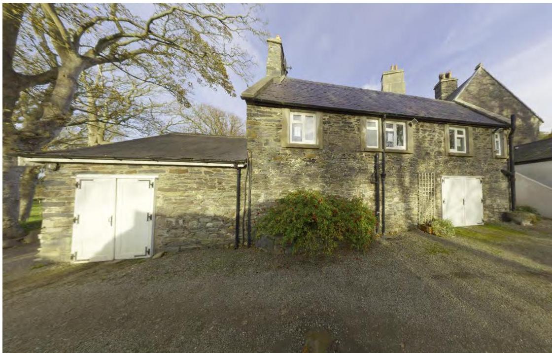
Figure 4. The west elevation of the Engine House (left) and Wash House (right)
Figure 5. Severe damp on outside (west) wall of the Wash House.
A photograph showing the exterior of a stone building complex with white double doors and a gravel driveway. The structure appears to be an old stone chapel or outbuilding in a rural setting.Interior photograph of a dilapidated room with stone flooring, peeling paint, and significant ceiling damage exposing wooden laths.
Figure 6. The Wash House and Engine House and a view of the modern planter built against the dampest of the Wash House walls.
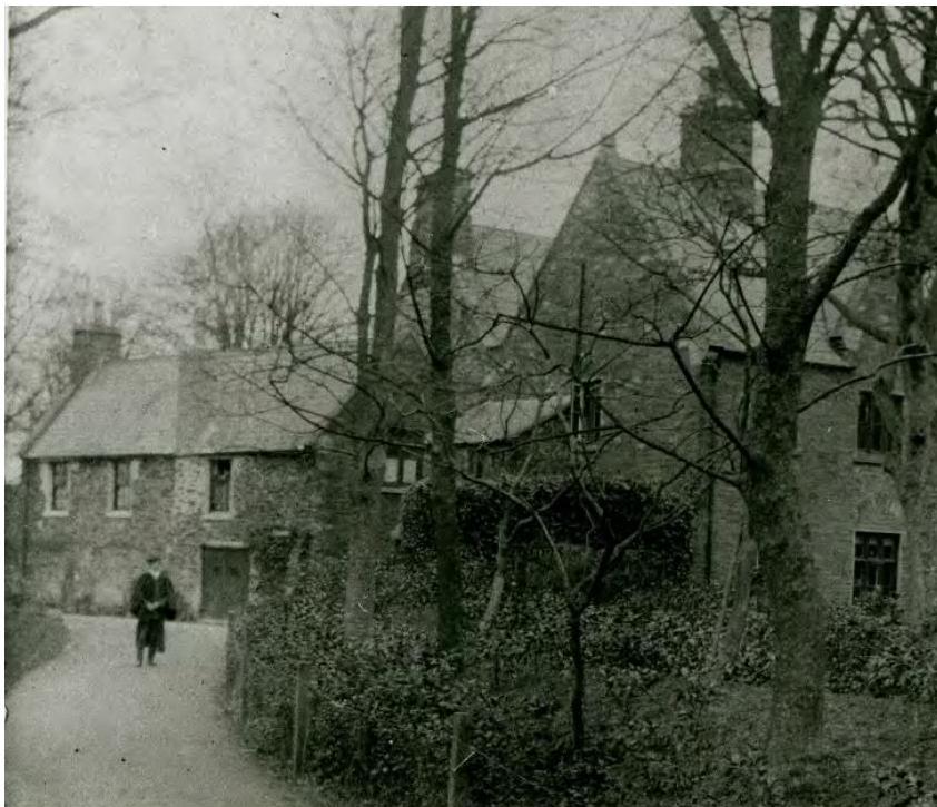
Figure 7. The Wash House wing and the West Wing some time after Bishop Powys’s additions to both buildings in 1857.The threshold at the door into the Wood Shed appears to be a little higher than the
ground level: currently they are level with one another.
A photograph showing the exterior of a stone building with a slate roof, situated next to a gravel driveway and large trees.A black and white photograph showing a historic stone building complex with a person walking on a path in the foreground.
Figure 8. The opening visible in Fig. 7, from what was once the Wood Shed and latterly the Oil Tank Room. Note how the external level has risen up to meet the threshold.
Figure 9. The Wash Copper abuts the wall in question and is also suffering from damp ingress.
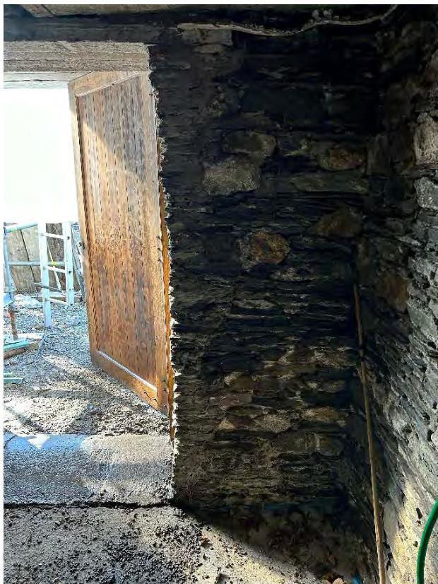
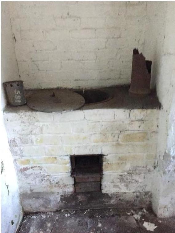
A close-up photograph showing a rough stone wall and a wooden door, likely part of the historic Chapel of St. Nicholas mentioned in the application.Interior photograph of an old white-washed brick range cooker or fireplace featuring a metal lid and rusty flue pipe.
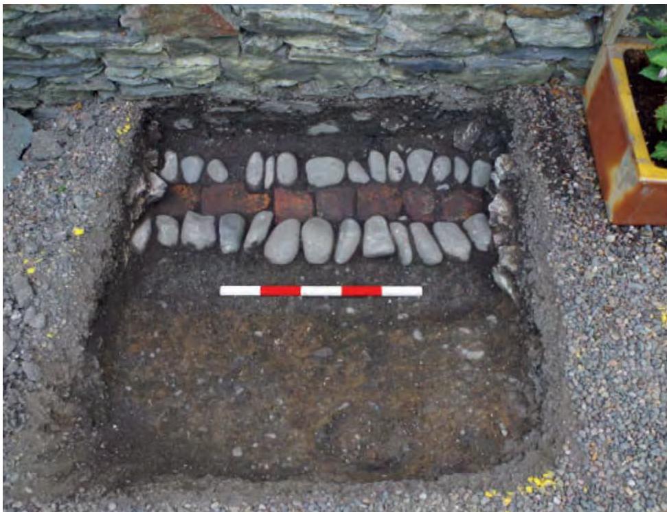
Figure 10. Brick and cobble surface drain in Test Pit 2, approximately 100mm below the modern gravel, indicating the 19th century level of the drive. Remnants of this survive in Test Pit 1, too, which indicates it was in laid after 1925 when the Engine House was built.
A photograph showing a square excavation pit dug next to a stone wall, revealing layers of stones and bricks with a red and white scale bar for reference.
3.2 Lowering of Ground Levels Around Chapel
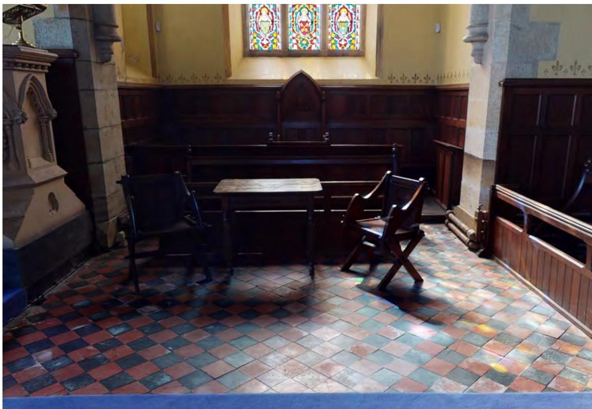
The Chapel was built in 1857 by Bishop Powys, replacing an earlier and smaller Chapel (contiguous with the present nave) built by Bishop Murray (1814 to 1827). This in turn replaced an earlier Regency Gothick Chapel on a different site further to the South, as depicted in Daniel King’s drawings of the 1650s. Powys’s Chapel was built in the decorated gothic style (late 13th ot late 14th centuries) characterised by the elaborate decoration of all elements. Originally, the walls inside the chapel were painted and exposed to their full height, as shown in the watercolour below. Recent analysis by conservators suggests that the 1.6m high panelling in both chancel, nave and transepts was installed by Bishop Straton round the time of his restoration of the palace in 1895. It is of similar detailing to the panelling he installed in the Great Hall, and is moreover designed to accommodate exposed cast-iron heating pipes along the base of the Chapel walls. Bishop Straton installed underfloor heating in the Great Hall, and in 1925 an existing furnace in the undercroft below the Nave was altered to improve its ventilation, the safety of the workmen and the functioning of the heating system. It is conceivable that the panelling was installed to hide rising damp in the walls, and that it was hoped the heating would remedy this problem in addition to keeping the congregation warm.
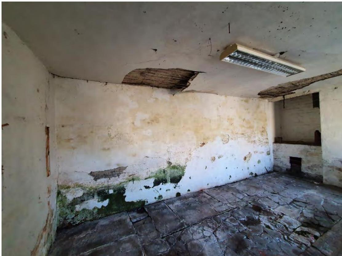
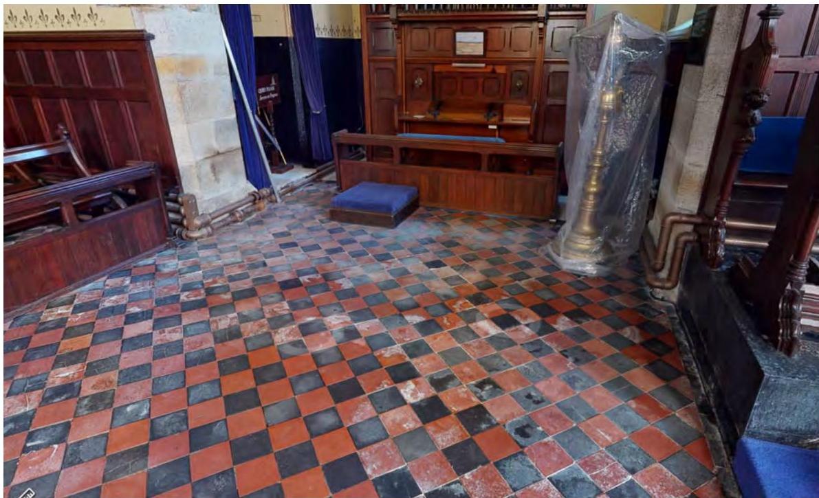
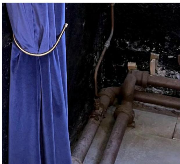
Presently, damp ingress is damaging several parts of the chapel interior: the walls are suffering from the soil banked against them as well as on account of the modern alkyd paints which are sealing in the damp and causing the paint layers to blister and damp has caused salt efflorescence across the nave floor of black and red geometric tiles. It is a concern that if no remedy is made then the damp will move to the rarer Minton tiles in the chancel. The timber furniture and fittings are as yet in a stable condition but prolonged exposure to damp must be avoided. Damp also appears to have been the reason why the three 19th century murals behind the altar were abandoned, covered up and in some places removed – what survives is in the process of being uncovered so that it may be conserved. Behind the organ in the North Transept and behind the low-level exposed heating pipes black, damp-proof paint has been applied and is blistering as it causes the damp to rise even higher and into the adjacent flagstones floor tiles.
It would appear that although there has not been a dramatic change in the external level of the lawns around the chapel since 1858, the flower beds around its perimeter have been heaped with soil and compost over the years and the gravel at the two doors on the North side of the chapel has been banked up against the walls to a higher level than was originally envisaged: 0.11 to 0.22m below the gravel there is a brick and slate drain seemingly constructed as a splash guard for the walls. Given that there is a similar arrangement at the Engine House (1925) and that adjacent to this drain small openings were cut to ventilate the heating furnace in the undercroft
(1925) this may indicate that the gravel build-up has been in the last hundred years.
It is proposed to lower some of the external ground levels (lawn, flower beds and gravel) around the chapel so as to achieve external levels slightly below the different internal floor levels and to ensure that water runs away from the chapel walls. This is to be done conservatively, section-bysection as required, and is not a blanket approach. The accompanying plan shows how of the three different levels within the chapel – that of Nave, Chancel and Altar footpace – only the latter sits above above the external ground levels. The others sit below it, exacerbating the damp ingress across the floor.
Wessex Archaeology has made investigations and their test pits are shown in relation to the proposed lowering of the levels. Test pits 12, 13 and 14 appear to show foundations of the lost Kitchen building visible in the 1650s drawings. This find is 100 to 350mm below the current ground level and the proposed reduction in levels is well away from this archaeology. Test Pit 5 adjacent to the Altar has a foundation at exactly the same level as the foundations of the Lost Kitchen, and may be related to it: no change in levels is proposed here, and the ground level is already below the footpace of the Altar. It is important to note that these four test pits, which may or may not contain the footings of the lost 1650s kitchen building, are not affected by the current proposals.
At test pit 11, where is proposed to lower the ground level by 140mm, there is a evidence of a crop dryer 800mm below ground level. At test pit 10, where it is proposed to lower the ground level by 130mm, there is the top of a stone wall at a depth of 220mm. Adjacent to the Yew it is proposed to only lower the external level by 50mm, increasing in depth towards the Chapel so as to restore the earlier level subsumed by modern gravel. The rest of the affected test pits contain modern drainage, construction debris or the chapel’s own foundations.
Adjacent to the north transept the ground levels is between 200mm and 500mm than the Nave floor level. The optimal proposed external level is at least 100mm below the Nave floor (28.72m.) This may result in the partial exposure of the upper foundations of two walls of the North Transept (28.84m.) This reduction will be monitored with the structural engineer and if reducing the ground to the optimal level is impossible then it will be reduced to just above the top of the foundation. This proposal does not affect known archaeology and is not thought to be a problem elsewhere.
In order to improve surface drainage it is proposed to restore and re-instate where missing the brick and slate surface drain found in Test Pit 7, which helped carried water away from the walls before it was filled in with modern landscaping material. The lowering of the ground levels will be done with the attention and care appropriate to any digging in an historical setting of the importance of Bishopscourt. Any removal of soil or gravel will be carried out by hand.
Figure 11. A watercolour of the chapel, possibly mislabelled 1858 – an article in the Manx Sun from
September that year notes that at its consecration on Thursday the 2nd of September 1858 only part of the nave and one of the transepts was completed – the second transept and the apse were yet to come. This illustration dates to the completion of the building some time afterwards. Note how the panelling was not installed as part of the initial scheme, but the altar, the pews, the St. Nicholas window in the south transept and the Minton tiles in the chancel were all in place.
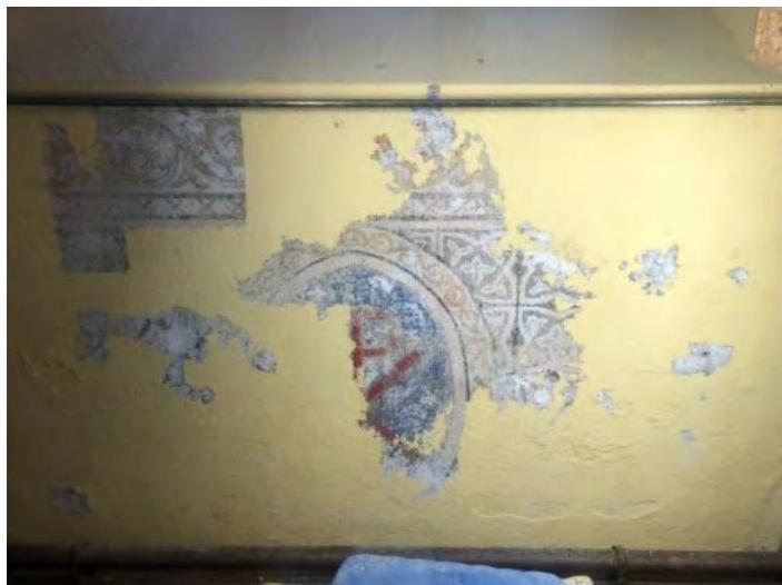
Figure 12. The 19th century mural revealed on the lower chancel wall to the right-hand-side of the altar. This has been partly damaged by damp, and the other two murals on the left-hand side and behind the altar appear to have been so damaged as to have been partly removed and plastered over. Damp may
have caused the murals to be abandoned as a decorative scheme and painted over. What survives is to be conserved but further damp ingress will endanger this rare survival.
A sepia-toned historical interior view of the Chapel of St. Nicholas, showing the wooden vaulted ceiling, Gothic arched windows, and pews.A close-up photograph of a yellow interior wall with peeling paint and exposed underlying decorative patterns, likely documenting the condition of a historic building.
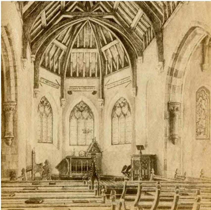
Figure 13. The Chapel in 1936, four decades after Bishop Straton's panelling and wall-mounted heating pipes were installed, perhaps to conceal damp ingress and to keep it at bay through heating the building. A stone pulpit, altar rails and more chancel furniture has been added, in addition to the stained glass in the East Window and several wall plaques. The chancel murals are curtained over and possibly painted over; likewise the banners above the chancel windows have been painted over.
A black and white photograph showing the interior of a historic chapel, featuring rows of wooden pews, a central aisle, and a vaulted ceiling.
Figure 14. Present day salt salt efflorescence to the geometric tiles in the Nave, facing the south transept.Note the position of the heating pipes relative to the panelling and the modern damp-proof paint
Interior photograph of a historic chapel showing a red and black checkered tile floor, wooden pews, and stone walls with visible piping near the base.Interior photograph of a historic chapel featuring stained glass windows, wooden paneling, and a checkered tiled floor.
exacerbating damp damage behind the organ.
Figure 15. Present day salt efflorescence to the geometric tiles in the Nave, facing the north transept.
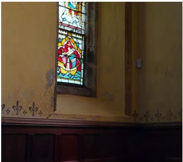
Figure 16. Paint blistering due to damp at the St Nicholas Window in the south transept.
Figure 17. Blistering of modern, ‘damp-proof’ paint below the level of the panelling in the nave, where the external ground level is consistently higher than that of the floor of the nave.
Figure 18. Blistering of modern, ‘damp-proof’ paint in the north transept, behind the organ.
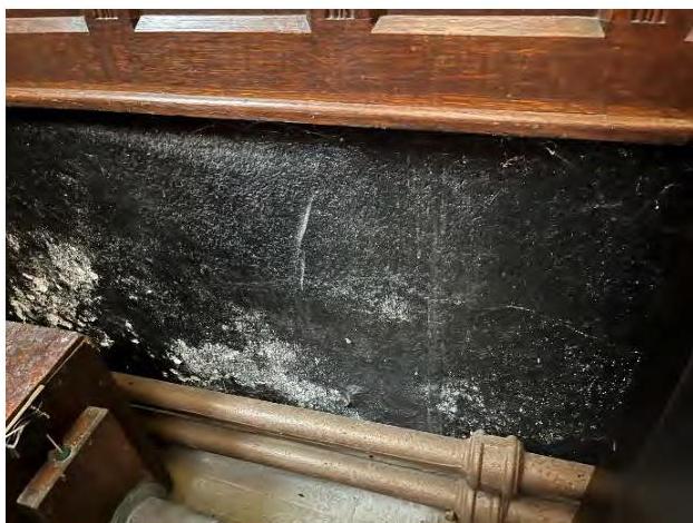
Interior photograph showing a stained glass window in a corner with yellow walls and dark wood paneling.A close-up photograph of a dark, textured stone wall showing signs of damp or soot, with wooden pipes and a wooden structure in the foreground.A close-up photograph showing rusty metal pipes running along a dark wall next to a blue curtain with a metal tie-back.
Figure 19. The chapel from the south, showing the flower beds and lawn which it is proposed to lower in part between 100mm and 260mm.
Figure 20. The chapel from the East, showing the bed which is not be lowered (central altar window) and the beds, lawn and path to the right of that bay which it is proposed to lower between 50mm and 200mm. Test Pit 12 – containing the foundations of the 17th century kitchen building – lies between the man sitting on the path and the viewer. Test Pit 14 with similar archaeology lies to the left, out of view. Neither is affected by the proposals.
Exterior photograph of a stone chapel with Gothic windows and scaffolding erected on the adjacent wing.A photograph of the Chapel of St. Nicholas showing scaffolding on the roof for renovation, with workers in high-visibility clothing on the grounds.
Figure 21. The chapel from the North, showing the section of lawns, beds and path which it is proposed to lower between 50mm and 200mm, the whole draining towards the entrance court on the right.
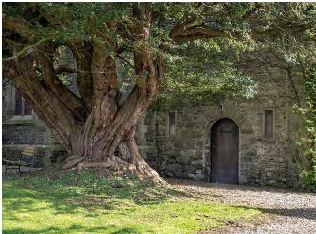
Figure 22. The ante Chapel door and the old yew, where between 110mm and 220mm of modern gravel has raised the ground level above its original level, as shown by the brick and slate drain surviving below.
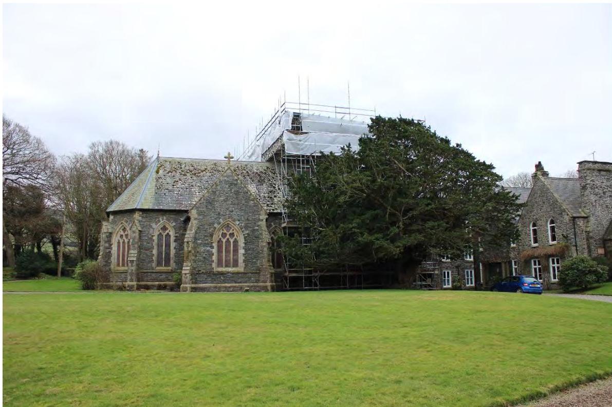
A photograph showing a stone chapel with Gothic windows adjacent to a larger stone building covered in scaffolding, set on a grassy lawn.A photograph showing the exterior of a historic stone building, likely the Chapel of St. Nicholas, featuring a massive ancient tree in the foreground and a gravel path leading to an arched wooden door.
4.0 CONCLUSION
4.1 It is hoped that a land drain at the Wash House and the partial lowering of the ground levels around the Chapel will do a great deal to correct damp ingress in both parts of the building. This approach is being co-ordinated with other applications to remove impermeable modern materials and restore breathability to historical walls in material danger from damp. Potential archaeology has been assessed and is contributing to a greater understanding about the history of the site, and the current works will not effect known deposits while helping to conserve historical building fabric.
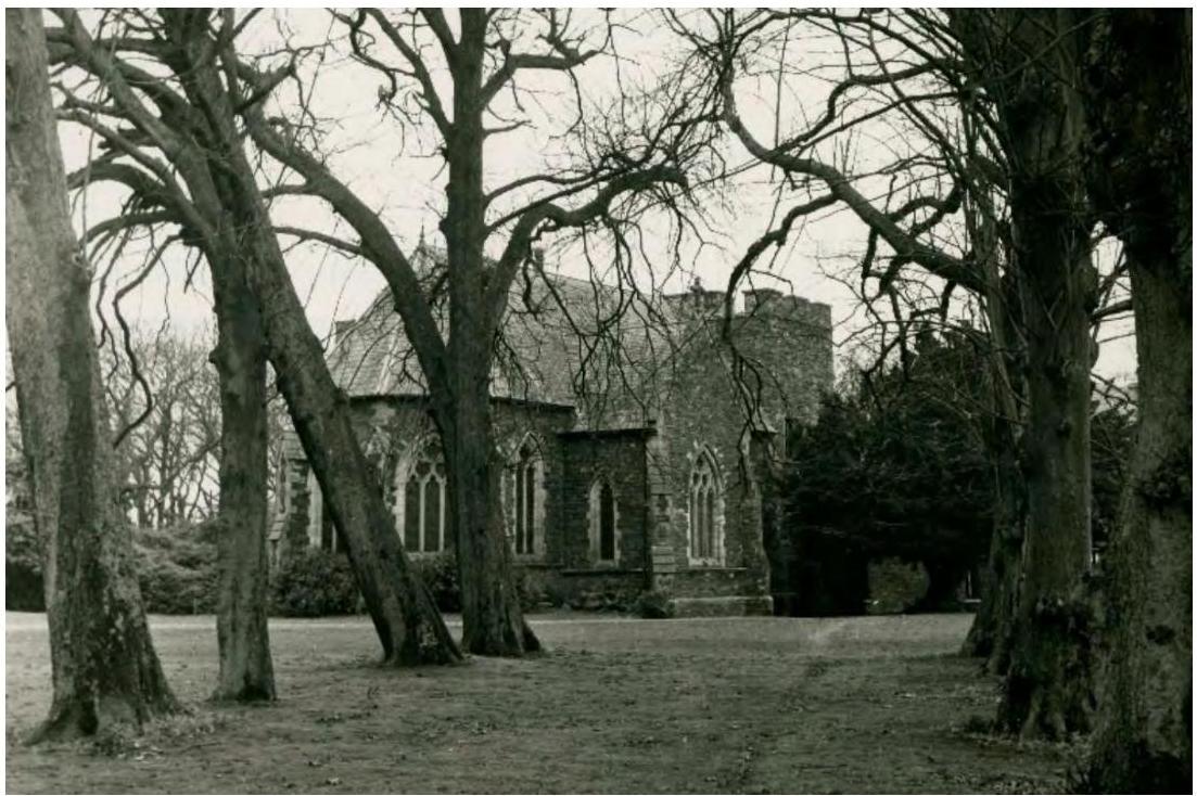
Figure 23. The Chapel at Bishopscourt from Bishop Wilson’s lost Apostles Avenue of Elms which lead from the Chapel to the Kitchen Garden. Matthew Hannah, 1940s.
A black and white photograph showing a stone chapel or church building with Gothic-style windows viewed through large bare trees.
Copyright in submitted documents remains with their authors. Request removal
Source & Provenance
Official reference
21/01297/B
Source authority
Isle of Man Government Planning & Building Control