Project: Creation of two flats above Clagh Vane Stores, Ballasalla. Project no: 2202-CV Date: March 2022
Creation of two flats above Clagh Vane Stores, Ballasalla
Planning and Design Statement
Contents
1.0 Site and Surroundings
2.0 Planning History and Policy
3.0 Services and Bin Storage
4.0 Parking and Access
5.0 The Proposal
6.0 Summary
Appendix 1 Photographs of parking survey
1.0 Site and Surroundings
1.1 Clagh Vane Stores and Barney’s Fish and Chip Shop occupy the ground floor of a former pair of semi-detached houses. At the present most of the upper floor is unoccupied with some space being used for storage and the shop’s office.
1.2 Most of the surrounding buildings have been rebuilt in recent years as part of the Clagh Vane redevelopment.
1.3 In 2020/2021 the whole building was refurbished both at ground floor level and externally with the rear boundary being realigned as part of the Clagh Vane estate rebuilding.
1.4 The proposed site is the whole of the upper floor of the building and the staircase up from the existing front door.
2.0 Planning History and Policy
2.1 There have been several planning applications over the years. The most relevant to the current application are the three most recent.
19/01434/B was a permitted application by the Department of Infrastructure for the building’s reroofing and removal of chimney stacks.
19/01040/B was a permitted application for the rerendering of the external walls, installation of access ramps, remodelling of the ground floor
doors and windows and a single storey flat roofed extension to the rear.
22/00071/D is a 2022 application for false ground floor windows to show Spar window vinyls.
2.2 The land use is “predominantly residential” on Map 4 of the Area Plan for the South
2.3 The building is not registered or located within a conservation area.
2.4 The proposal would be subject to Strategic Policy 1, Strategic Policy 11, Strategic Policy 12, General Policy 2, Housing Policies 1-3, Housing Policy 17 and Transport Policy 7 of the Isle of Man Strategic Plan 2007 and the Area Plan for the South.
2.5 Strategic Policy 1: Development should make the best use of resources by:
(a) optimising the use of ……. unused and underused land and buildings.
(b) ensuring efficient use of sites, taking into account the needs for access, landscaping, open space and amenity standards; and
(c) being located so as to utilise existing and planned infrastructure, facilities and services.
2.6 Strategic Policy 12: Favourable consideration will generally be given to ……. the creation of flats by conversion of redundant boarding houses, and vacant or under-used space above commercial premises.
2.7 Housing Policy 17: The conversion of buildings into flats will generally be permitted in residential areas provided that:
(a) adequate space can be provided for clothesdrying, refuse storage, general amenity, and, if practical, car-parking;
(b) the flats created will have a pleasant clear outlook, particularly from the principal rooms and
(c) if possible, this involves the creation of parking on site or as part of an overall traffic management strategy for the area.
2.8 Paragraph 8.13.4 of the Strategic Plan states that “the department generally supports the conversion of redundant storage space above shops into residential development”
2.9 Strategic Policy 11 and Housing Policy 1 both call for sufficient development opportunities for the addition of 5,100 dwellings, including those formed by conversion. Housing Policy 3 states that 1,120 of those dwellings should be in the South.
3.0 Services and Bin Storage
3.1 There is existing foul water drainage to the rear of the building which will be easy to connect to. This drainage was installed to serve two semi-detached houses.
3.2 The proposal will require three new water mains. There is a water supply in the road to the front of the shop.
3.3 The site is located next to an electric substation.
3.4 There is a large yard to the rear currently used for bin storage by the ground floor businesses. There is plenty of room for the addition of two 240 litre wheelie bins for the proposed flats.
4.0 Parking and Access
4.1 Transport Policy 7 would require each apartment to have a single parking space to comply with the standards detailed in appendix 7 of the Strategic Plan.
4.2 Consultation has taken place with the Department of Infrastructure’s housing office who have advised that when allowing for 2 cars per household the estate still has a surplus of three parking spaces.
4.3 Although there is sufficient parking capacity in the area, Appendix 7 states that where new dwellings are created by the conversion of existing buildings …. the need to find a use for redundant buildings which are in sound condition will outweigh the drawback of any shortfall in parking provision.
4.4 The flats are located approximately 200 metres from the main bus stop in Ballasalla, from here there are direct buses to Port Erin, Port St Mary, Castletown, Foxdale, the airport, Douglas, Onchan and the hospital.
4.5 There is plenty of space in the rear yard for the provision of secure bicycle storage lockers.
4.6 Consultation has taken place with one of the Department of Infrastructure’s Highways Officers. Following the consultation, a site visit was made at 19:15 on Monday 28th March 2022 to witness how close the available parking was to capacity. A tour of the parking opposite the shop, the roads to either side of the shop and the car parks at the top showed that of the 77 spaces along the route walked only 39 were occupied.
5.0 The Proposal
5.1 The application seeks to convert the entire upper floor into a one-bedroom flat and a studio apartment. The flats are intended to be just over 45 sqm and therefore suitable to let to a couple.
5.2 The entrance will be via the existing front door and staircase between the shop and the fish & chip shop. A small area in the corner of the shop will be required to form a ground level service cupboard.
5.3 There will be space in the rear yard for a bicycle locker and wheelie bin storage.
5.4 Pre-application consultation has taken place with the Fire & Rescue Service, Environmental Health and Building Control and the design has been amended to address their concerns.
5.5 The proposal will result in 4 windows being closed on the north (rear) elevation to allow for the installation of kitchen wall units and fridges. There will also be a single window closed on the west elevation due to the location of the existing flue from the fish & chip shop.
5.6 Mannin Retail Ltd, who trade as Spar, have sufficient space on the ground floor to maintain an office and storage space for the shop.
6.0 Summary
6.1 The proposal is in accordance with the Strategic Plan’s Strategic Policy 11 and Housing Policy 1 by creating an additional 1,120 dwellings in the south of the island.
6.2 The proposal makes best use of an underused space above shops as encouraged by Strategic Policy 12 and fulfils the amenity requirements of Housing Policy 17 and the Housing (Standards) Regulations 2017.
6.3 The proposal can be supplied with all necessary services and there is plenty of space for waste storage in the rear yard.
6.4 The estate’s owner, the Department of Infrastructure, has been consulted about parking provision. They believe there is an overcapacity of 3 on the estate. An evening site visit has shown that the available parking spaces are at approximately 50% capacity.
6.5 The proposal will be supplied with bicycle lockers in the rear yard and the site is located close to a busy bus route with services across the south and east of the island.
6.6 The proposal is in accordance with the policies of the Strategic Plan 2016.
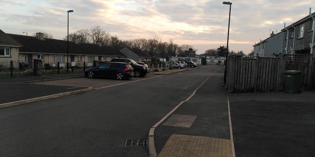
Appendix 1
A street-level photograph showing a paved road with parked cars, terraced bungalows on the left, and a wooden fence on the right.
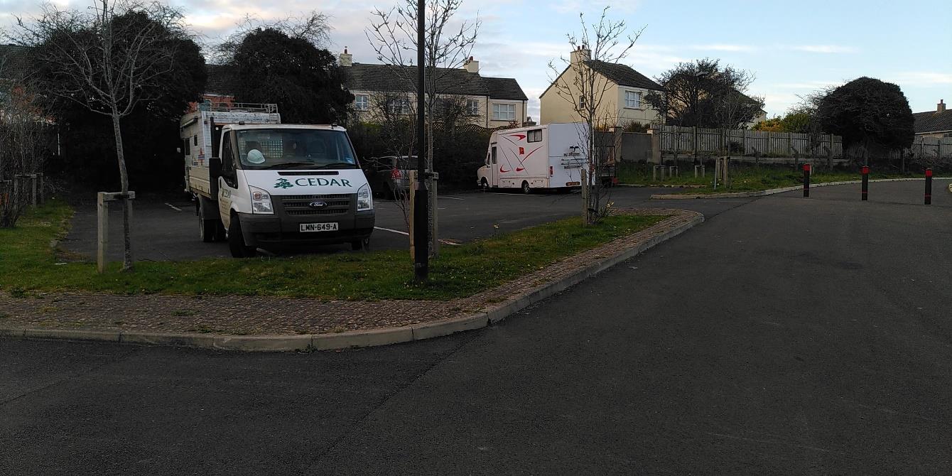
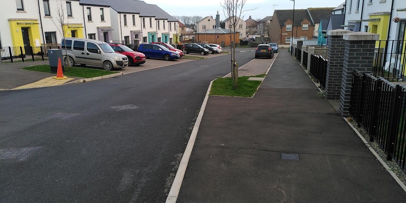
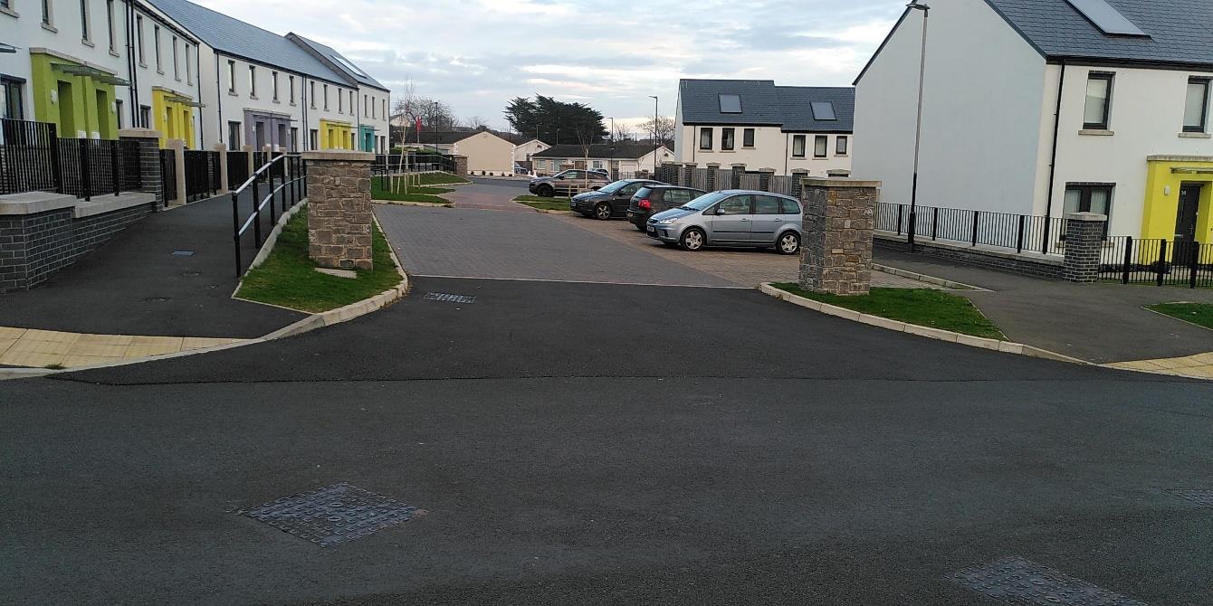
Photographs of the formal parking areas around the Spar shop taken on 28/03/22 at 19:15. All parking spaces counted are within 160 metres of the front door to the proposed apartments. The spaces counted included 3 blue badge spaces.
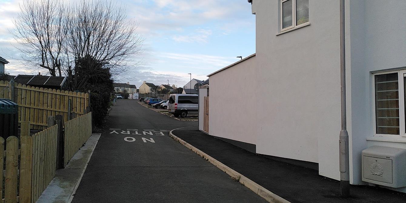
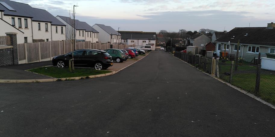
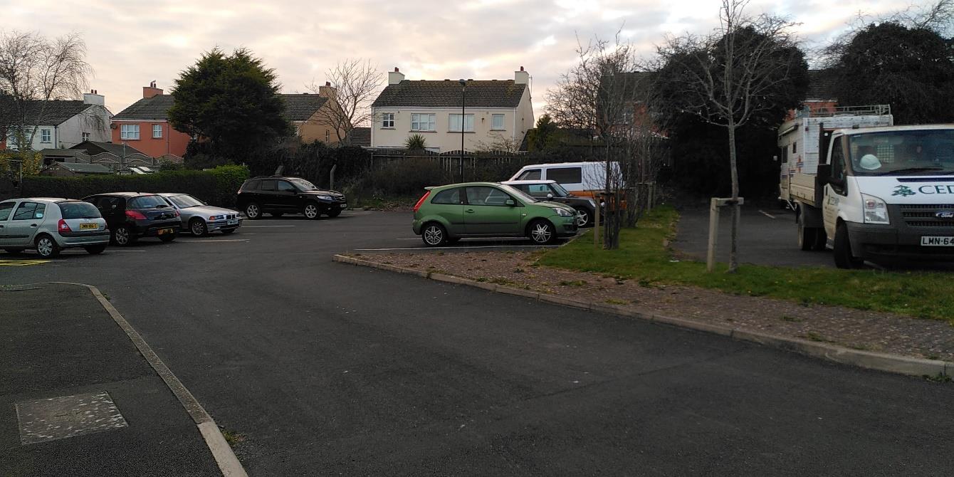
Photo 1 Parking opposite the Spar shop, 6/12 spaces occupied Photos 2 & 3 Street to the west side of the Spar shop 9/17 spaces occupied. Photos 4 & 5 Car parks at top of street in photos 2 & 3. 12/24 spaces occupied. Photo 6 & 7 Street to the east of the Spar shop and parking on side street. 12/24 spaces occupied
1
2
3
4
A street-level photograph showing a white building on the right and a wooden fence on the left, with a paved road marked 'NO ENTRY' leading towards a parking area in the background.A street-level photograph showing a residential road with modern white houses and parking bays on the left, and older bungalows on the right.A street-level photograph showing a paved parking area with several cars and a white van, with residential houses visible in the background.
5
6
7
A photograph showing a paved parking area with a work truck and a camper van, with residential houses and trees visible in the background.A street-level photograph showing a row of terraced houses with cars parked along the curb and a paved sidewalk on the right.A street-level photograph of a modern residential development featuring terraced houses with colorful doors on the left and detached houses on the right.
Copyright in submitted documents remains with their authors. Request removal
Source & Provenance
Official reference
22/00396/B
Source authority
Isle of Man Government Planning & Building Control