Loading document...
Proposed single dwelling and associated parking to Field 134001, Bride Road, Ramsey, Isle of Man.
PROPOSED SITE PLAN.
A new access to the proposed site would be created off Bride Road. A vision splay can be achieved to circa 70m+ if required. The new access would be in the 30mph zone and road classification would fall under a minor distributor on the Isle of Man.
Existing images below show the road and areas of the proposed new access. {{image:114916}} 79 Parliament Street
Ramsey
Isle of Man
IM8 1AQ
Tel 01624 810810
Fax 01624 810811
www.csarc.im
architects
development consultants interior designers project managers planning supervisors
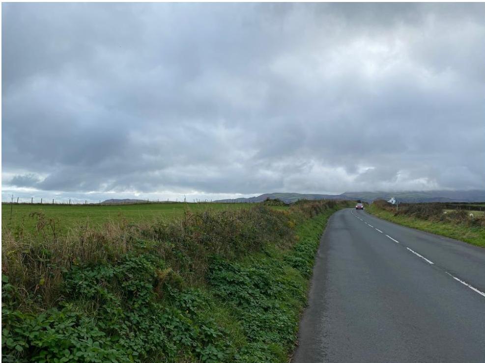
Image of existing road heading north towards the Dog Mills. Proposed access to site is on the right.
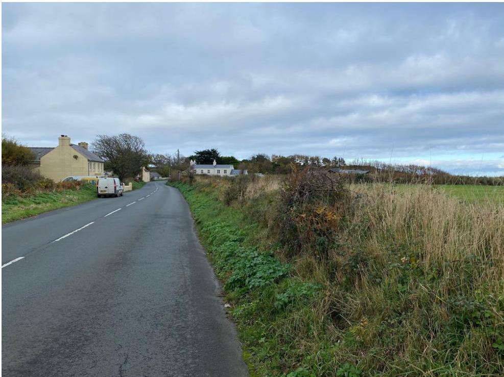
Image of existing road heading South towards the Ramsey. Proposed access to site is on the left.
Design The existing topography of the site would be sympathetically adjusted to allow for the finished floor level to site 1m below that of the adjacent road level to reduce any visual impact the new dwelling may have.
The proposal would sit in between existing houses on the east coast on land not designated for any particular use class. 2 of the neighbouring properties to this site have recently benefitted from extensive refurbishment, rebuilding and extensions.
The area is noted of high landscape value and as such the proposal has been designed to minimise any impact to the surrounding area by being set lower than the adjacent road and by also utilising natural finished to both the walls and the roof.
The dwelling, although not traditional would fall under the section of the Isle of Man Strategic Plan which makes provision for high-quality, innovative, modern designs in exceptional circumstances. In our view the design would be of an innovative design and would benefit both the area with modern development and also the end user in being able to take full advantage of the location of the site.
Trees / Landscape The proposed development is positioned away from any existing trees. The existing Manx sod hedge will be altered to suit the new vision splays as required but rebuilt to match existing levels to aid in screening the proposed dwelling. Landscaping plan as required can be provided under a condition to the Planning Department prior to commencement of any works.
Flood Risk The below maps are taken from the Department of Infrastructures Floor Risk Viewer website. The red arrow indicates the position of the proposed dwelling on the site which shows it to be out of any highlighted flood risk areas.
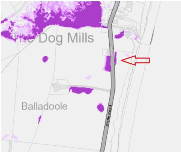
Flood Risks highlighted on part of the site are shown to be medium / high likelihood of surface water in the areas as identified in purple. These areas are not in the development area so would remain unaffected albeit land drains can be installed to drain to purpose made soakaways as required.
Permeable paving will be utilised in some hardstanding areas to minimise the impact of the reduced natural ground covered areas.
Sustainability / Environment The key sustainable principles of the proposed development are the following:
Copyright in submitted documents remains with their authors. Request removal