Loading document...
IM8 2JJ
25 MAR 2021
Chris Balmer Esq., MA(Hons), MTCP, RTPI, Principal Planner, Department of Environment, Food and Agriculture, Planning and Building Control Directorate, Murray House, Mount Havelock, Douglas, Isle of Man.
24th March 2021.
Dear Mr. Balmer,
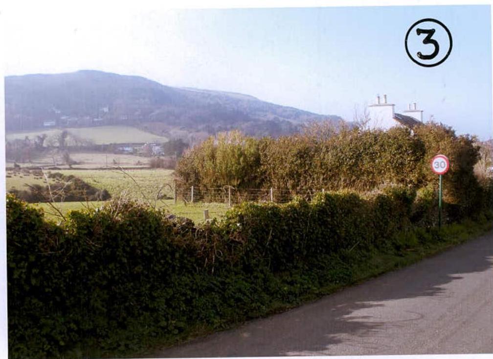
Re: P.A. no. 21/00091/C : Change of use of part of field n. 624032 from agricultural use into residential use, land at the rear of no.'s 1 and 2 Mount Sayle, Port e Vullen, Maughold for Mr. & Mrs. B. Corlett.
Further to my letter dated 9th March 2021 and our subsequent discussions, please find enclosed four copies of my amended drawing number SM21/538/1/A indicating the Block Plan and Location Plan for the above works to change the use of a section of agricultural land into residential use at the rear of numbers 1 and 2 Mount Sayle, Port e Vullen, Maughold together with four copies of the supporting Planning Statement and colour photographs.
As discussed, the suggested residential curtilage has been reduced from the initial 25,000 metres suggested to the 15,000 metre wide strip as agreed. I have enclosed supporting information indicating approximate locations of any future rear extensions to both dwellings together with installation of a separate foul drainage system and Klargester Bio-disc sewage treatment unit for each dwelling that would be contained within the proposed residential curtilage.
Two copies of each of the enclosed drawings and Planning Statement are for onward transmission to the Maughold Parish Commissioners and the Network Planning Officer of the Highways Division of the Department of Infrastructure for their consideration.
I would be obliged if this application could proceed with the amended information and supporting Statement and that I be advised of the outcome in due course.
Yours sincerely, Redacted Glenn Kinrade. KINRADE ASSOCIATES LIMITED. Encls..
The purpose of this planning application is to seek planning permission for the proposed change of use of a parcel of agricultural land at the rear of numbers 1 and 2 Mount Sayle, Port e Vullen, Maughold into a private residential use.
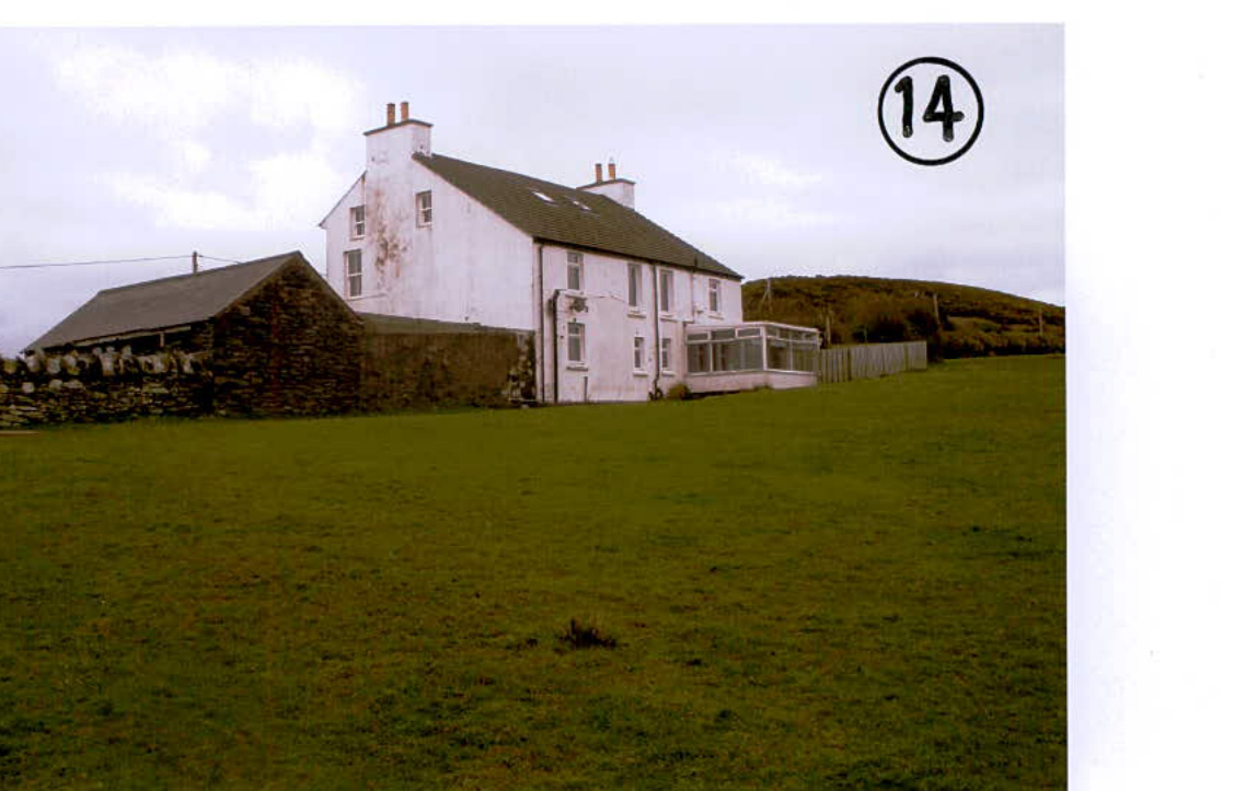
Numbers 1 and 2 Mount Sayle are a pair of semi-detached two storey dwellings sitting adjacent to the Main Road leading towards Maughold Village and are situated just beyond the main built development forming Port e Vullen. Each dwelling has garage accommodation and an existing vehicular access on to the Main Road, there is off-road car parking for two vehicles at the front of each dwelling. There is also a separate pedestrian access from the Main Road to each dwelling.
There are small garden areas to the front of each dwelling as well as to the side of each property.
Number 1 Mount Sayle has a garden area to the south east side of the main dwelling but currently, this is largely overgrown. The garden is surrounded by hedging and trees and the main south east boundary situated adjacent to the agricultural land forming field no. 624032 is a substantial run of hedging with trees forming a dense barrier which largely obscures the gable end of the dwelling. There is also a post and wire fence on the field side of the hedging.
Number 2 Mount Sayle has a garden area to the north west side of the dwelling set beyond the existing garage, this area is largely overgrown but could be restored to a more formal garden area with some maintenance work carried out.
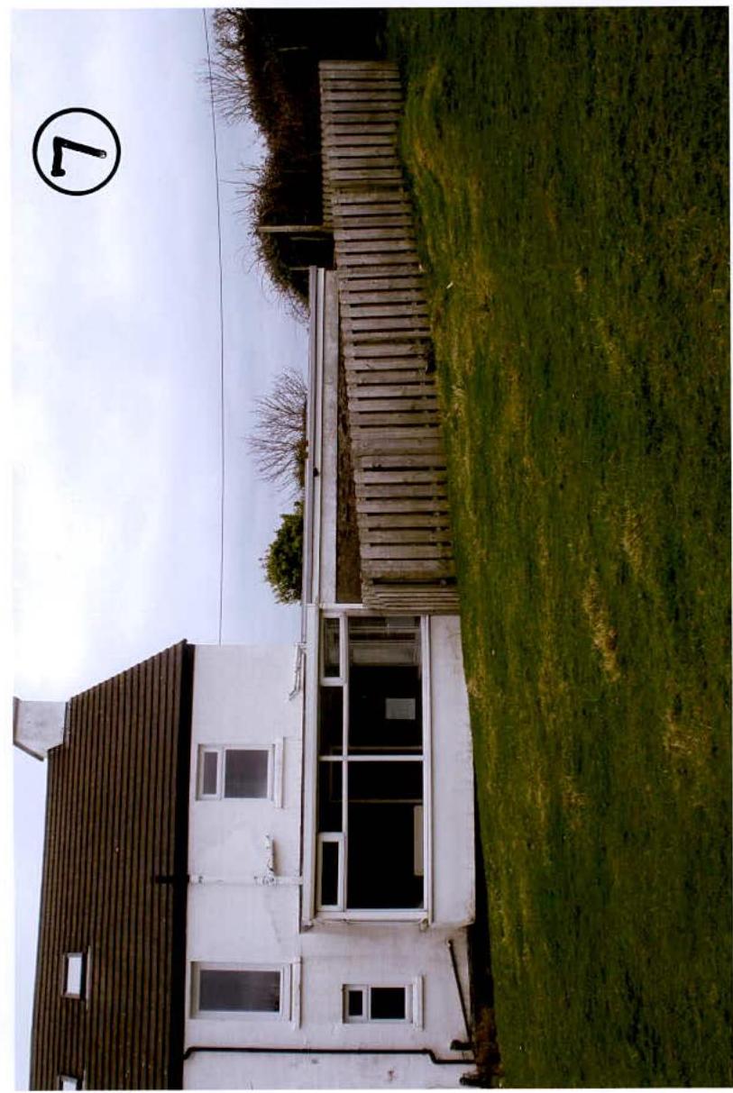
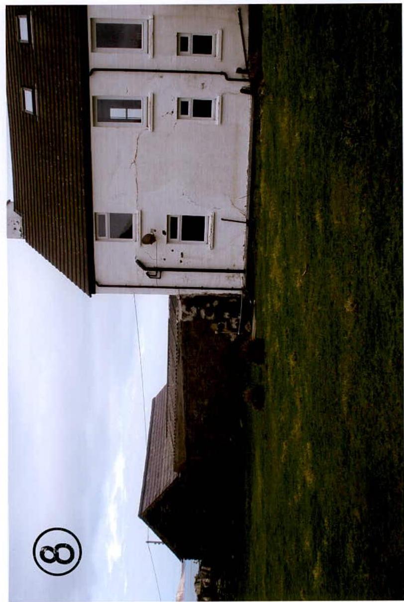
Behind each dwelling, the agricultural land runs up to the rear wall of each property. There is no outside space and for any re-decoration or maintenance purposes, the owner/occupier would have to seek permission from the landowner to carry out any works to the rear of the dwelling. Number 1 Mount Sayle has a small polycarbonate sheet roof Conservatory projecting from the rear wall face as well as a small patio area surrounded by wooden fencing. Both properties are served by a single septic tank and tail drain system situated in the field and the current drainage system runs down the field towards Port e Vullen with a series of manholes set in the field. The drainage run is set approximately 1.500 metres away from the rear face of the property. The drainage is in an exposed location but, whilst the field is used for grazing purposes, the likelihood of damage is much less than if the field were to be ploughed and used for arable purposes. The landowner would have to ensure a safe working distance away from the rear wall of numbers 1 and 2 Mount Sayle to ensure that no damage was caused to the existing drains.
As there is no land to the rear of either property, the intention was to seek planning approval for the change of use of a strip of land running parallel to each dwelling and starting off from a point in the south east corner of the site where the existing hedge and post and wire field boundary would be extended. The strip of land would extend 15.000 metres from the rear wall face of each dwelling and run in a north west direction until meeting with the substantial boundary hedge adjoining field no 624031 (adjacent to "Cottimans").
The 15.000 metre wide strip of land would be used for any possible future extension to each dwelling as neither property could be realistically be extended at the front. It would be difficult to extend number 1 Mount Sayle as the overgrown garden is set at a much higher level than the main dwelling and any form of extension would, effectively, have to be constructed in an excavated area much lower than the surrounding natural ground level. The garden is currently 1.000 metre above the drive and floor level of number 1 Mount Sayle and the natural ground level then rises up towards "Dreem Aalin". Number 2 Mount Sayle currently has an outlet and link leading to a garage on the north west side of the site and this property would be easier to alter and extend as the ground falls down across the rear of each dwelling towards field no. 624031 .
However, a more practical solution would be to have a section of residential land to the rear which would enable each dwelling to have some form of extension if required. It would also ensure that each dwelling would have full unrestricted access for the purposes of repairs, maintenance or re-decoration. The most important point is that the existing drainage system and septic tank could be removed and each property could then be served by their own independent Klargester Bio-disc sewage treatment unit and tail drain system which would replace the existing unsatisfactory drainage system. The 15.000 metre wide strip would enable an extension to be added to the rear of each dwelling together with installation of a Klargester Bio-disc unit and tail drain system on their own residential area of land. The minimum distance for location of a Bio-disc unit is 5.000 metres away from any built structure, more if possible. The 15.000 metre strip would allow for any future extension together with positioning of a Bio-disc unit on the residentially related land should this planning application be approved.
The main views from the dwelling would be at the rear of each property over open countryside, the aspect is south west facing and the sun would be rising and setting along the full rear elevation of each dwelling. The rear boundary fence would be constructed in a stock proof post and wire fence so as to not interrupt the views over the open countryside. The rear strip of land would provide a valuable amenity space for each dwelling where there would be privacy for occupants of each dwelling to enjoy the use of their own individual outside space.
The extended boundary fence on the south east side of number 1 Mount Sayle could have a stock-proof post and wire boundary fence to match the existing for its' 15.000 metre extension but, a new hawthorn hedge with some tree planting could be carried out on this boundary to help shield the proposed 15.000 metre wide residential strip that would be created behind each dwelling. The angle of the boundary fence and hedge would ensure that there would be no view of the suggested residential area from any public viewpoint along the Main Road.
The existing south east boundary fence and hedge is some 15.000 metres long and our suggested increase of 15.000 metres would give a boundary 30.000 metres in length abutting field no.624032. In comparison, the boundary hedge abutting field no. 624032 at "Dreem Aalin" on the south east side of numbers 1 and 2 Mount Sayle is 77.000 metres long.
The area of field no. 624032 is 4.016 acres or thereabouts and the strip of land proposed for change of use from agricultural use into residential use is 0.247 acres. The loss of this strip would represent a $6.15 \%$ decrease in the overall area of the agricultural land forming field no. 624032 . At the present time, because of the siting of fence and Conservatory at number 1 Mount Sayle together with the line of existing foul drains running along the rear of 1 and 2 Mount Sayle, the actual usable area of agricultural land for grazing purposes is slightly less than the 4.06 total acreage and the change of use of this strip of land into residential use will have no detrimental effect on the current agricultural use of field no. 624032.
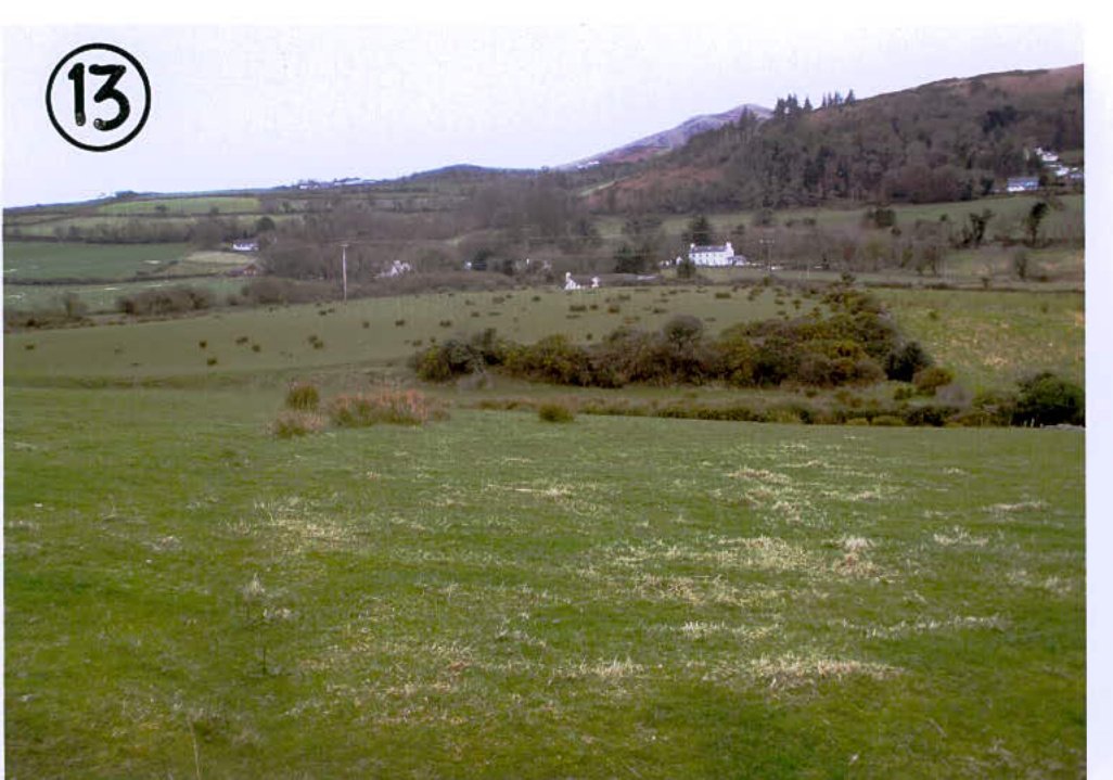
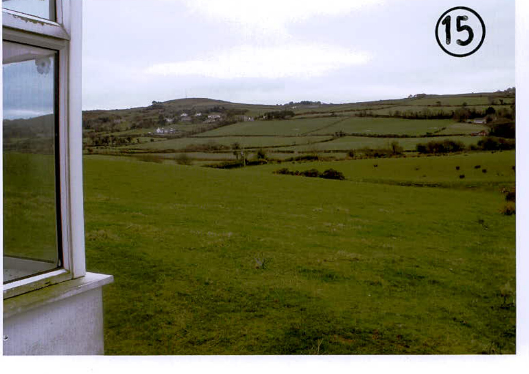
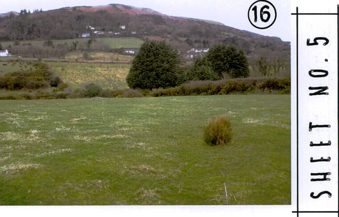
A number of sheets of colour photographs have been enclosed to help identify the current boundary treatments and views of numbers 1 and 2 Mount Sayle from public viewpoints as well as photographs indicating the existing dwelling with current rearward outlooks.
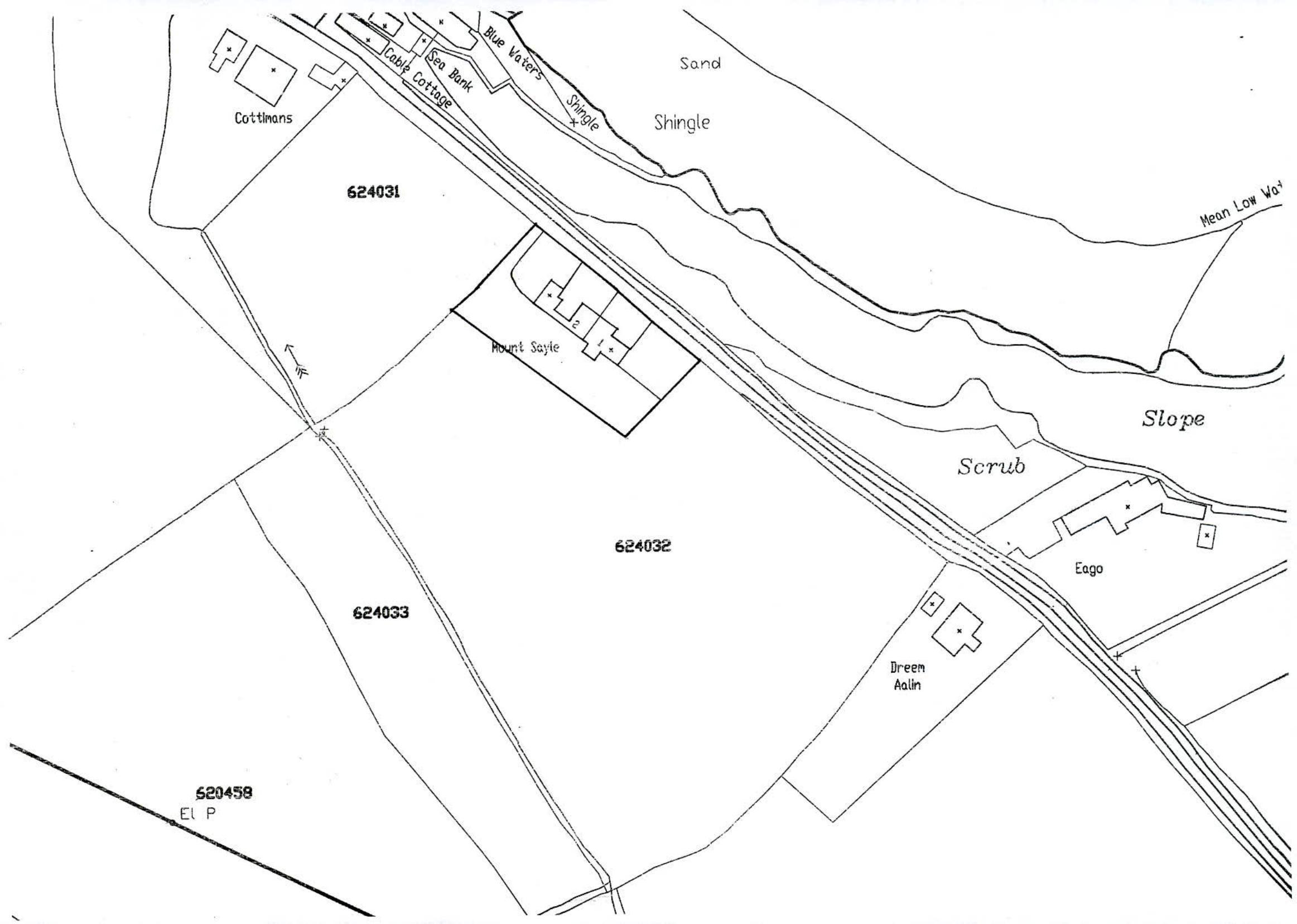
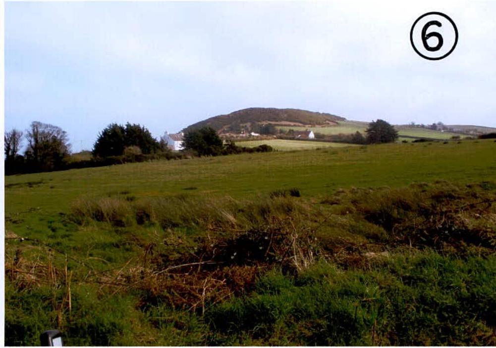
This photograph is taken from the entrance of Ballaterson West Farm looking towards "Dreem Aalin, the roof line of "Dreem Aalin is visible above the boundary hedges and trees.
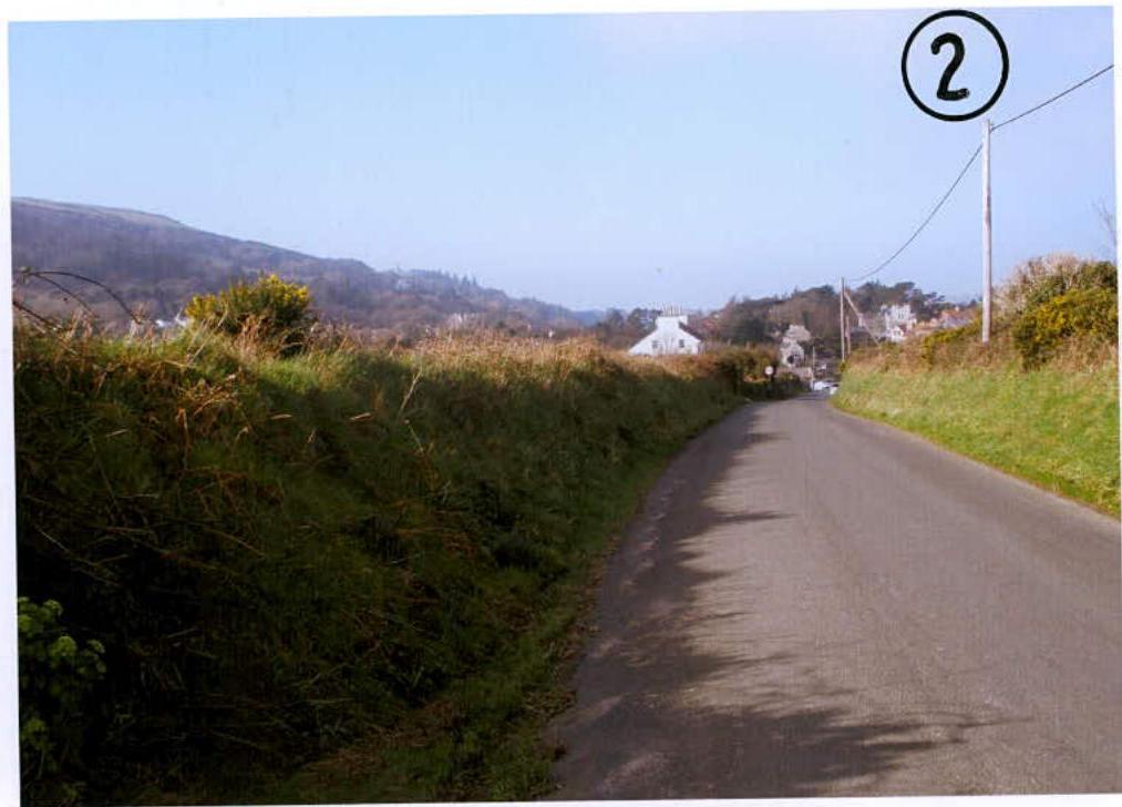
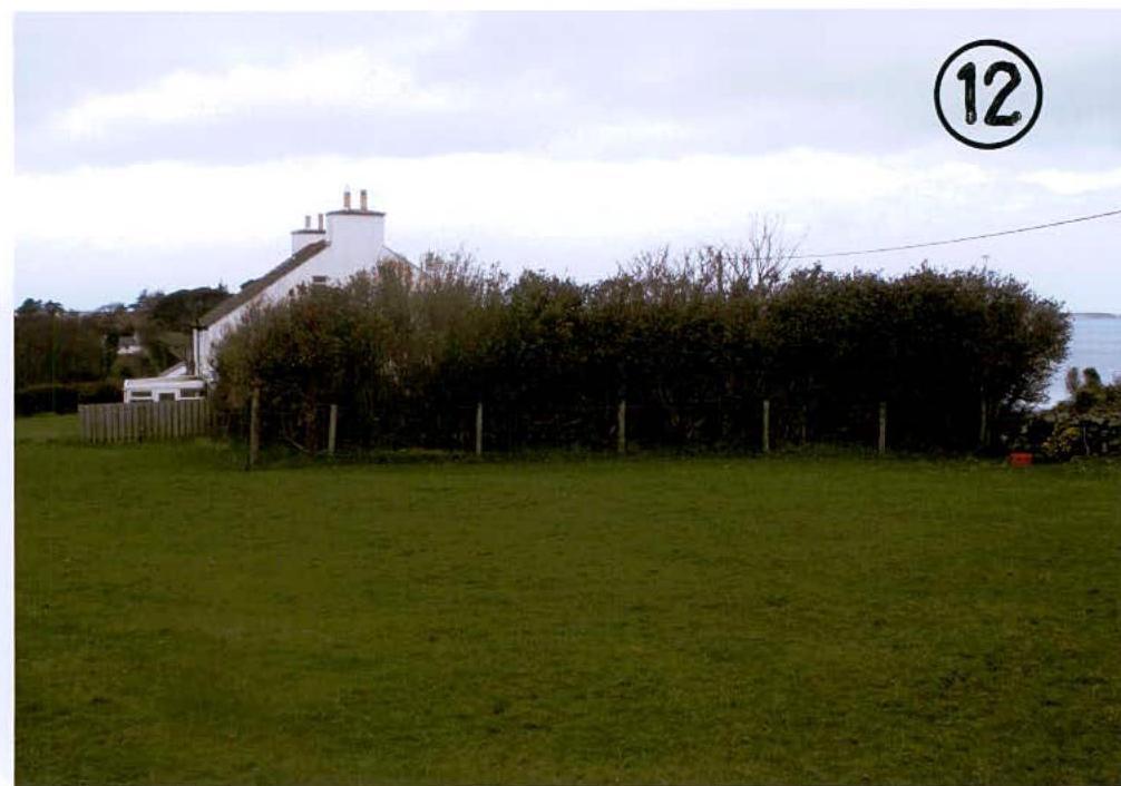
This photographs is taken from the Main Road adjacent to "Dreem Aalin" looking towards 1 Mount Sayle, the height of roadside hedging prevents a public view of the existing boundary hedge to 1 Mount Sayle.
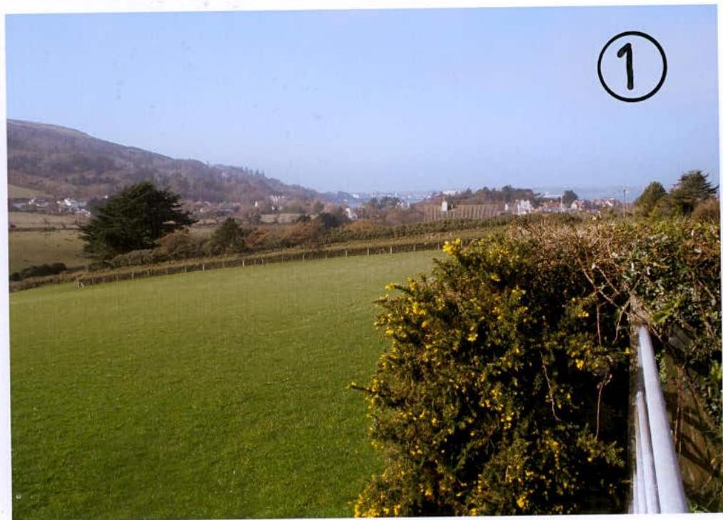
This photograph is taken from the Main Road overlooking roadside hedging and looking towards the existing south east boundary of number 1 Mount Sayle.
SHEET NO. 1
{{image:7232498}} {{image:7232499}}
{{image:7218182}} {{image:7218183}} {{image:7218184}}
Copyright in submitted documents remains with their authors. Request removal