Loading document...
August 2020 Prepared by: Ellis Brown, Architects 12 Strathallan Crescent, Queen’s Promenade, Douglas IM2 4NR
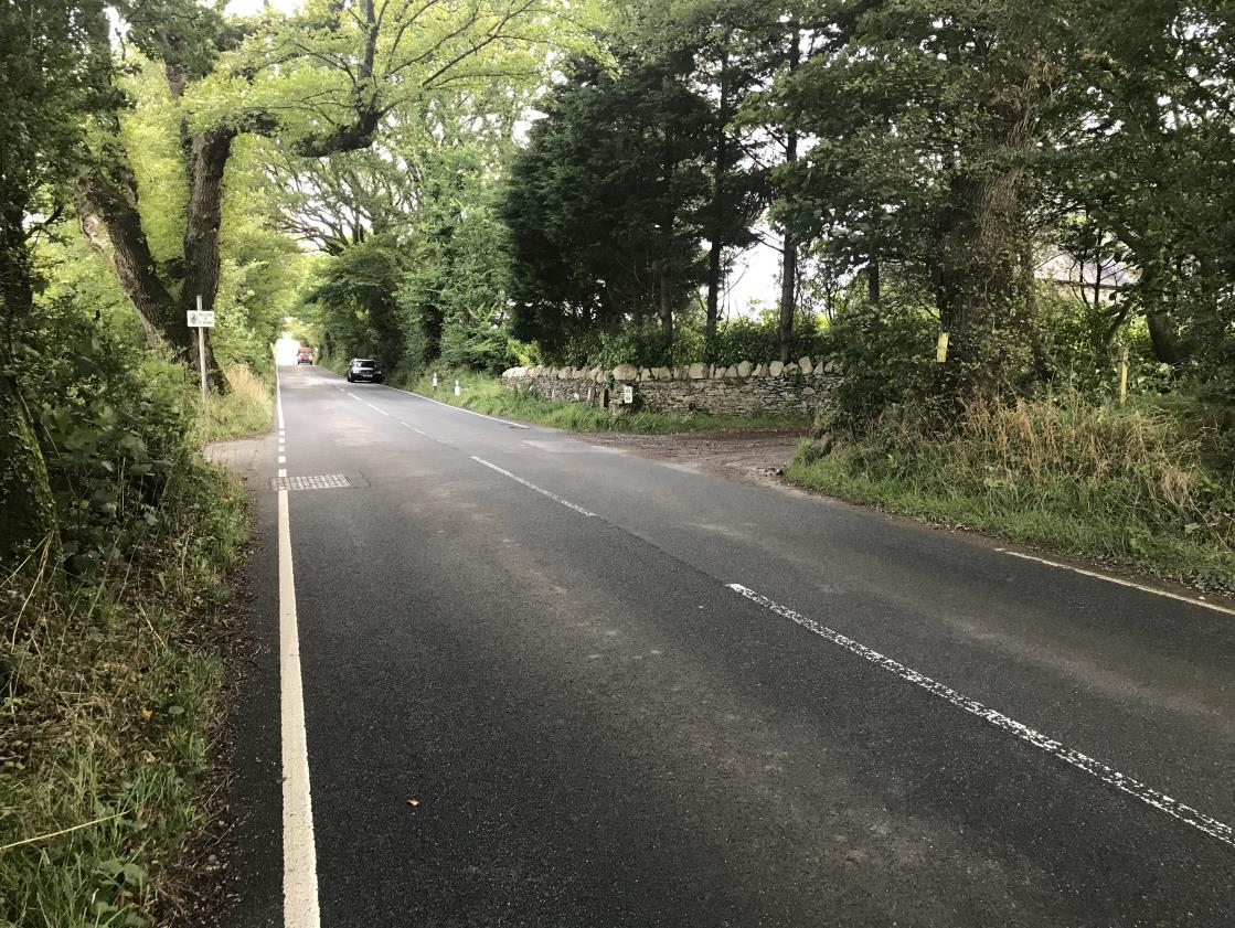
The existing property at Ballavarvane Farm is located on the outskirts of St Marks Village in the south of the Island. Existing access to Ballavarvane Farm is via a single narrow shared track that is accessed from the A26 road approx. 650m North of the Millennium Way crossroads, St Marks. The A26 in this location is subject to a 50mph speed limit.
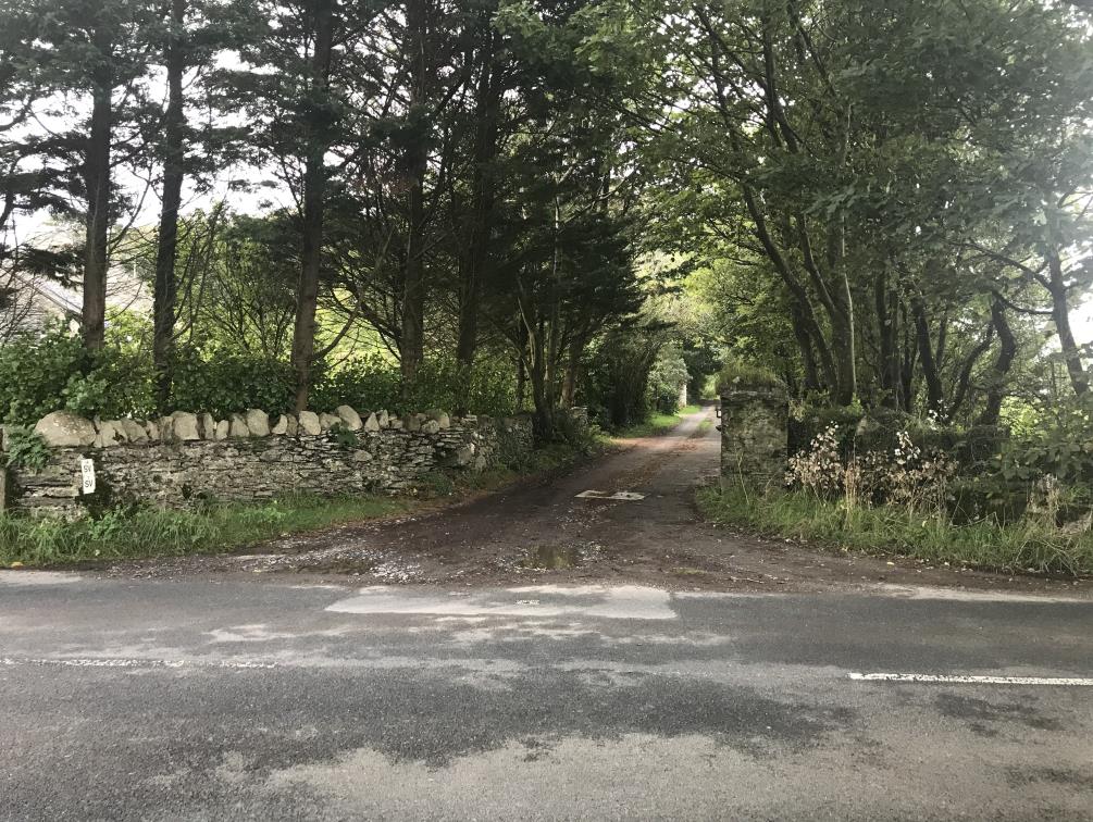
This access off the main road also serves The Old Mill property to the left of the track and leads onto Ballavarvane Farm area at the top of the track. Making up part of the existing/proposed site is Field 434586 directly North of the access track. This field is lined with a variety of tree and shrub species as identified on the tree survey information supplied.
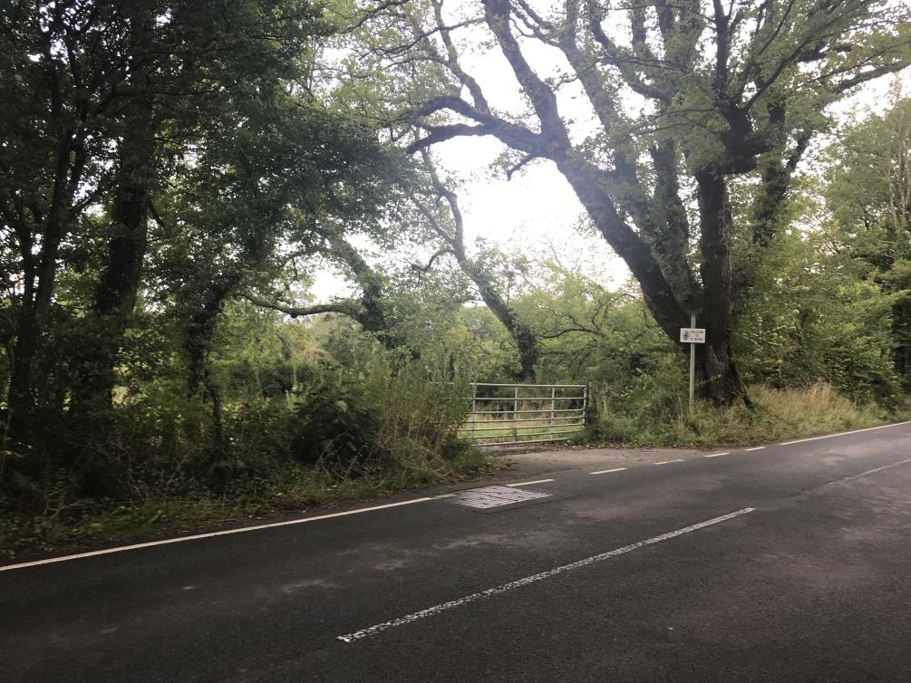
Opposite the existing access is an agricultural yard (under the same land ownership) and used in conjunction with the working Ballavarvane Farm. This site was once used by the Department of Infrastructure during works in the area. The access for this yard also serves as a cattle/livestock crossing point from the main farm track.
The existing track is a gravelled narrow access track predominantly used for farming vehicles, cattle/livestock and a single residential dwelling (not associated with Ballavarvane Farm). The Entrance to the track is lined with a Manx stone wall to the Southern most side and a tree lined sod bank to the North. The existing Southern side wall is currently 1.3m in height and set back less than 1m from the road edge. The existing Northern side consists of a low stone wall formation partly embedded into a low sod bank with a vest tree line set on top and with a culvert under.
Visibility to the main A26 road from the farm access track is currently 18m to the South and 43m to the North. Visibility to the main A26 road from the agricultural yard opposite the existing farm entrance also has poor visibility in both directions with 11m to the South and 19m to the North. Both of which is considerably below the Highways Departments recommended 120m unobstructed visibility in both directions for a road with a speed limit up to 50mph.
The residents of Ballavarvane Farm have first hand experience of the hazardous nature of the current access arrangement as the applicant has had a collision while exiting the access and the daughter of the applicant has had several ‘near misses’ when exiting the track. The concerns of previous hazards are to such an extent that to submit an application to create a better access/egress is of the client’s foremost interest.
Our proposal is to create a new access road serving Ballavarvane Farm only. The gated access comprising to 2No stone pillars will be set back from the roadway at 8.5m as to create an openly visible access/egress for vehicles of all sizes. We also propose to re-align the current low level banking for splayed visibility purposes in both directions and incorporating some low level planting and grassed area – proposed vegetation is to be agreed with landscaping specialist.
General day to day access to Ballavarvane Farm will cease via the existing track following the erection of a gate immediately following the entrance to The Old Mill property
Further proposal forming part of this application is to create a new access to the existing agricultural yard directly opposite the proposed farm entrance. This will comprise of a gated access set between newly positioned low level banking with planting and grassed area maintained to heights below 1.05m to maintain visibility.
The existing gate to the agricultural yard access is to be removed and void infilled to create continuous banking and match existing heights, shrub planting to be incorporated to this area as advised by landscaping specialist.
The new access road is to join the existing track at the farm entrance area as indicated on drawing - ‘19/3003/02 Rev A – Proposed Site Plan’.
The existing trees and shrubs lining the road edge off Field No’s 434586 & 430769 are to be removed under this application as part of the current proposals. Refer to drawing – ‘19/3003/02 Rev A – Proposed Site Plan’ and further tree survey information drawings, documents/reports and proposals enclosed from Manx Roots, tree management specialists.
Proposals for mitigating planting in terms of location and species has been discussed with DEFA as indicated on the enclosed information.
Lining proposals whilst not fully designed are to be included of a type and style that would be appropriate to the location. These details are to be agreed with the highways authority and could include for example solid white lining that would indicate a restriction to overtaking in the area, should it be deems required.
Signage proposals are also yet to be finalised but would include signage advising highway users of the new access points formed, this will include shorter term signage to advise of new arrangement.
A Stage 1 Road safety Audit has been carried out with designer’s response incorporated / commented upon as required at this stage.
The applicant is agreeable that full details of these to be subject to a condition for final design and installation.
The proposed visibility from both junctions have been designed that a view of 120m can be seen in both directions at a set back of 2.4m from the roadway with no obstruction over 1.05m in height. The set back of 2.4m has been taken from a position of 0.5m into the roadway as deemed acceptable from the Highways Department with a view that would better reflect a vehicle driving position on a road of this nature.
A vehicle tracking drawing has been provided for this development using the recommended vehicle of a refuse collection vehicle as discussed and advised by the Department of Infrastructures Highways division.
Ellis Brown Documents Supporting Statement
TS – 12520 – Tree Survey & Constraints Plan TR – 20520 – Tree Impact Plan Tree Survey Data
HMTC Ref 20-010 Road Safety Audit Stage 1 Designers response document (3 sheets)
Copyright in submitted documents remains with their authors. Request removal