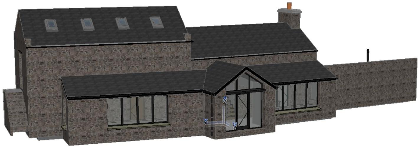
A 3D architectural rendering showing a stone dwelling with a proposed single-storey rear extension featuring a new roofline and large windows.
Proposed entrance extension to rear elevation and new window in the south-east elevation of Rearyt-nyMarrey, Ballabooie, Road, Ballakaighen, Peel, IM5 2AH
13 October 2023
3D VISUAL OF REAR EXTENSION.
1. Introduction
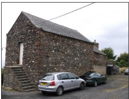
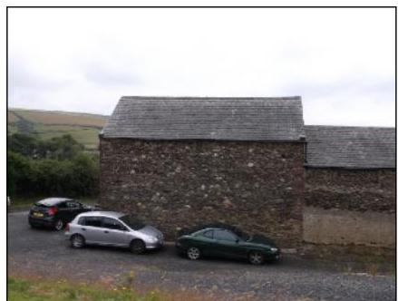
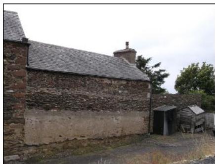
A photograph of a detached stone building with a slate roof and cars parked in front, likely the subject of a planning application for an extension.A photograph showing a stone building with a slate roof, likely a barn or outbuilding, with three cars parked on a gravel driveway in a rural setting.A photograph showing the side elevation of a stone building with a slate roof and chimney stack, alongside small wooden sheds.
The application is for a proposed single storey entrance extension located on the rear, north-east, elevation of Rearyt-Ny-Marey, together with a new external window located in the ground floor garage on the south-east elevation.
The site is the residential curtilage of Reayrt-Ny- Marrey, Ballakaighen, Peel, located north of the winding Ballabooie Road which links the Staarvey Road with the Coast Road (A4) from Peel to Kirk Michael in the west of the isle of Man. The property sits on a large plot set back from the highway which is accessed by a shared single track drive with neighbouring property Meadowcroft. The application site is bound and bordered by vegetation, this combined with the sod banks and hedgerows lining the nearby public highways it makes it difficult to see the property from the main road.
Site photographs of the rear, north-east elevation where the proposed entrance extension is to be located.
2. Planning History
A previous application was submitted in December 2016, for a larger scheme under P.A. No 16/01400/B. This application was supported by the acting Planning Officer and unanimously approved by all 7 members of the Planning Committee with the Planning Approval Notice being issued on 8th May 2017.
We attach below a copy of the submitted drawings, together with a copy of the Approval Notice issued on the 8th May 2017.
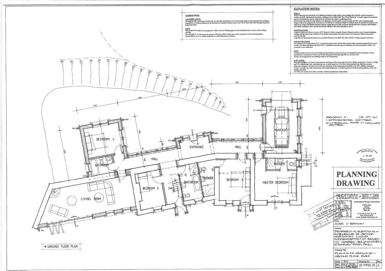
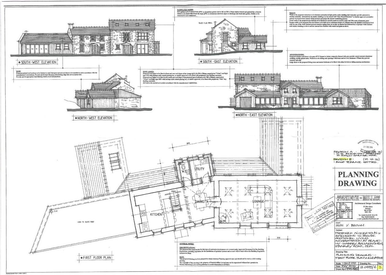
GROUND FLOOR PLAN OF PREVIOUS SCHEME FIRST FLOOR PLAN & ELEVATIONS OF PREVIOUS SCHEME
Architectural ground floor plan showing the layout of a residential property with labeled rooms including bedrooms, kitchen, and garage.This image displays a planning drawing featuring four elevations (South-West, South-East, North-West, North-East) and a first-floor plan layout for a proposed alteration to a stone dwelling.
Copyright in submitted documents remains with their authors. Request removal
Source & Provenance
Official reference
23/01227/B
Source authority
Isle of Man Government Planning & Building Control