Planning Statement For The Erection Of A Building For The Storage Of Items Associated With The Maintenance Of The Site, Riverside Barn And Adjacent Woodland, Field 534451, King Edward Road, Onchan
1.0 Introduction
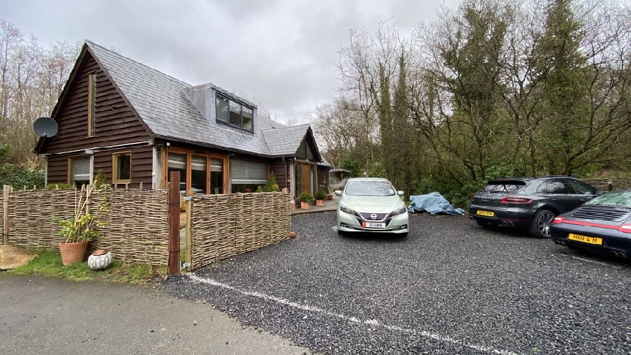
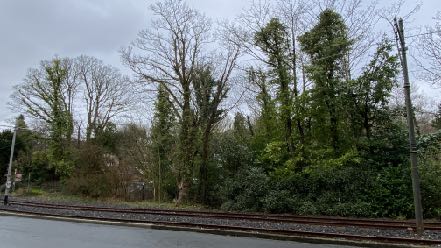
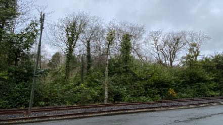
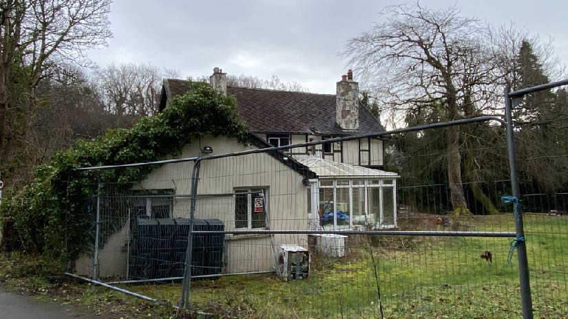
1.1 Riverside Barn is an existing detached dwelling which sits alongside Bibaloe Beg Road and whose eastern boundary abuts King Edward Road where lies the boundary between Onchan and Garff. The site is heavily treed although the area alongside Bibaloe Beg Road is open and from where the existing house is visible although the site is generally heavily screened by the existing laurel, gorse, cotoneaster, privet, holly bushes as well as the many trees along the road and riverside boundary.
1.2 The house is an interesting and attractive timber structure with a pitched roof and dormer accommodation within the roof space. There is a small garden room which has been built to the north of the house and car parking is provided as a space alongside Bible Beg Road. The building was originally not a residential unit (see Planning History). There is no covered car parking nor storage facilities within the site.
1.3 Across Bibaloe Beg Road to the south is a detached dwelling, Eskadale, which had planningapproval for replacement (see Planning History) albeit this was not implemented and the sitecurrently appears to be for sale.
A photograph showing a detached house with a conservatory, viewed through a temporary metal fence in a green, rural setting.
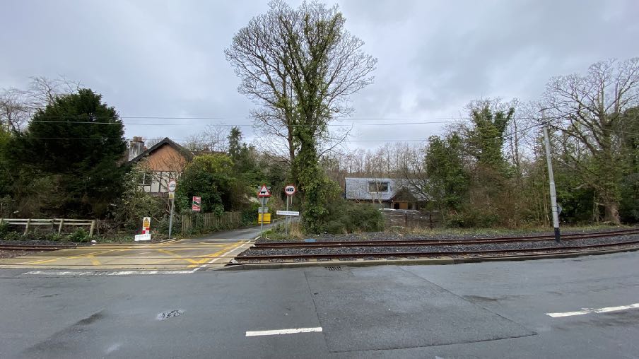
1.4 There are relatively few buildings alongside King Edward Road once it passes out of Onchan village, the exceptions being the former Groudle Public House and the houses alongside it, all of which are quite different to each other. Glimpses of Riverside Barn are available from King Edward Road through the roadside trees. Eskadale, being larger and taller, is more visible from both roads.
1.5 Bibaloe Beg Road, which is narrow and winding, has a range of different properties alongside and visible from it: there are modern and old, agricultural and residential, traditional and modern with stretches of farmland and countryside intervening between them. The closest property to the site, other than Eskadale, is Highfield to the west, whose residential curtilage is around 130m away and higher than the land owned in association with Riverside Barn.
1.6 A small watercourse runs parallel with King Edward Road within the site.
1.7 The whole site extends to 1 hectare (2.6 acres).
2.0 Planning policy
2.1 The site lies within an area not designated for development on the Area Plan for the East (2020).
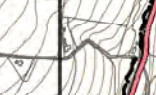
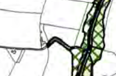
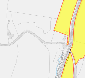
2.2 The Area Plan includes a series of constraints maps including the Environmental Constraints which identify Registered Trees within the site (see below left) although this conflicts with the information provided on the Island Environment mapping layer on the Government website (see below right). The area to the north of the house is identified as a designated Wildlife Site (below right in yellow) which is a northern extension of Groudle Glen.
2.3 There are no infrastructural or community constraints identified on the relevant maps.
2.4 The site is shown on the national flood risk maps as being at high likelihood of a risk of surface water flooding
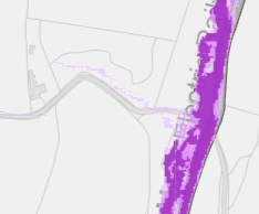
A close-up section of a topographical map displaying contour lines, property boundaries, and a red road line.A close-up view of a site location plan showing property boundaries, a road, and a green hatched area indicating land use.A planning map showing a site boundary highlighted in yellow adjacent to the Manx Electric Railway line.
2.5 The site is not within a Conservation Area. None of the buildings on the site is Registered.
2.6 Trees are generally protected under Environment Policy 3 (see Appendix One).
2.7 Ecology is protected under Environment Policies 4 and 7 particularly in the case of statutorily protected wildlife. Wildlife sites are not statutory designations, as explained in EP4 but are material considerations so there will be an expectation that development, including works that result in the loss of trees which may of ecological importance as habitat, will not adversely affect ecology. Development is generally expected to enhance biodiversity.
2.8 There is a general presumption against development in undesignated areas, as set out in General Policy 3 of the Strategic Plan (see Appendix One). This makes exceptions for development which is needed for agriculture or for forestry. Environment Policies 1 and 2 presume against development which would be harmful to the character and appearance of the countryside, EP 2 placing even more weight on the protection of the character and quality of the countryside. Environment Policy 2 refers to the areas of high landscape value and scenic significance shown on the 1982 Plan (which includes this site) although these have been replaced in the Area Plan for the East by the Landscape Character Assessment designations relating to a study in 2008, which characterises the countryside by the type of landscape rather than by its perceived quality.
2.9 Watercourses are also protected (Environment Policy 7).
2.10 This site lies within an area on the Landscape Character Assessment as part of the Conrhennyand Groudle Incised Slopes landscape area where the following guidance is provided in the Area Planfor the East. The full text in the 2008 document is provided in Appendix Two.
Landscape Strategy Conserve and enhance:
a) the character, quality and distinctiveness of this area of relatively sparse settlement;
b) its valley bottom woodland;
c) its National Glens;
d) the various archaeological features within the area.
Key Views Dramatic views to an Upland backdrop to the North and West. Dramatic, panoramic views eastwards across the ever-changing colour and nature of the sea and sky, contribute to strongly recognisable sense of place. Close and distant views to the northern edge of Onchan/ Douglas settlement, which is visually harsh in places. Channelled views along the corridor of the Groudle River, which is enclosed in places.
2.11 Whilst there is a presumption against development in this area according to General Policy 3 pfthe Strategic Plan, there is provision for extensions of existing rural properties (Housing Policies 15and 16) and also for the replacement of some rural dwellings (Housing Policies 12 and 14) as well asthe erection of buildings which are essential for forestry or agriculture (General Policy 3 andEnvironment Policy 15).
3.0 Planning history
3.1 Riverside Barn has been the subject of the following applications:
i. 00/01540/B - extension to garage - permitted
ii. 01/00929/B - erection of garage/workshop to replace existing - permitted
iii. 10/00337/B - conversion of existing workshop/barn to a dwelling - permitted
iv. 11/00030/B - conversion of existing workshop/barn to a dwelling (amendment to 10/00337/B) permitted
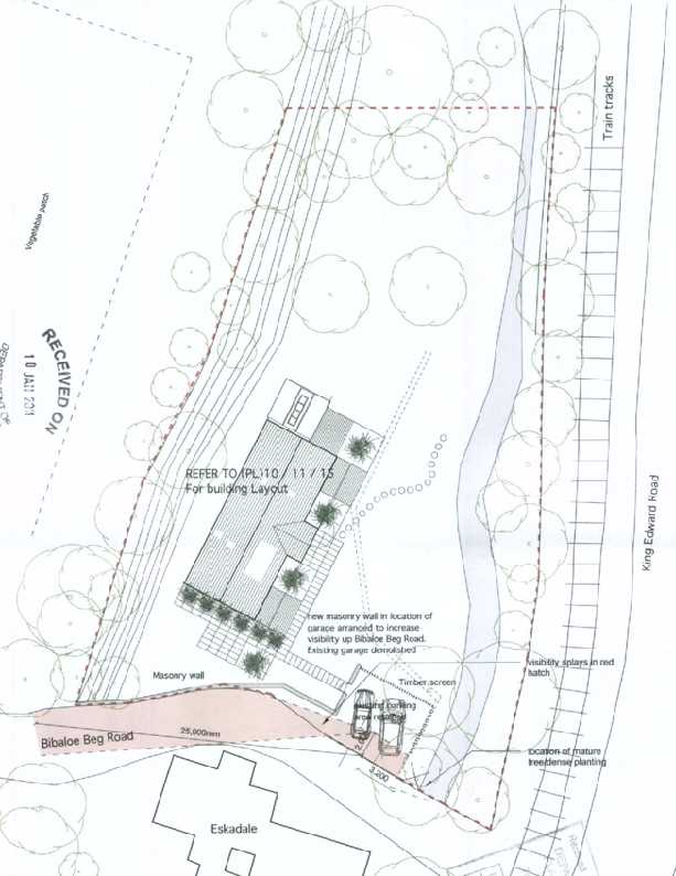
A site plan showing the proposed building layout, access driveway, and surrounding vegetation along Bibaloe Beg Road.
v. 12/00296/B - erection of garden room extension with link - refused at appeal for the reason that by virtue of its scale and massing the extension would be contrary to Housing Policy 11 (which is the policy which allows for conversion of rural buildings to dwellings) as it would be detrimental to the rural character and amenity of the countryside.
3.2 Eskadale has been the subject of a number of applications as follows:
i. 93/00091/B - erection of replacement conservatory -
ii. 09/01722/B - erection of replacement dwelling - permitted
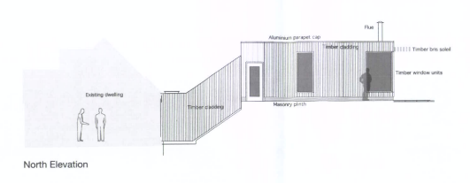
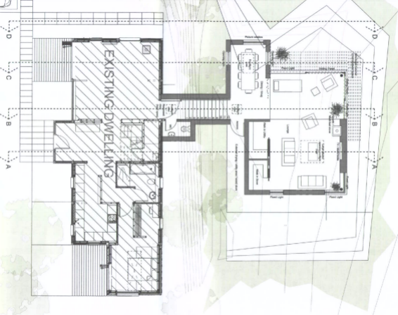
iii. 14/01187/B - erection of replacement dwelling - permitted. The proposed elevations were as follows:
Architectural elevation drawing labeled 'North Elevation' depicting a new structure with timber cladding and window units alongside an existing dwelling.Architectural floor plan showing an existing dwelling and a proposed extension with detailed room layouts and furniture.
3.2 The planning officer notes that “The existing dwelling has had a number of extensions and other alterations that have diluted the quality of its appearance.” The increase in floor area was states as amounting to approx. 63% compared with the existing.
3.3 Both sites (Eskadale and Riverside Barn when they were in the same ownership) were the subject of the following applications:
i. 94/00220/A approval in principle to create tea room and tea garden - permitted
ii. 94/01519/B - alterations and extension to provide tea room and tea garden - permitted
iii. 95/01412/D - erection of advertising sign - permitted
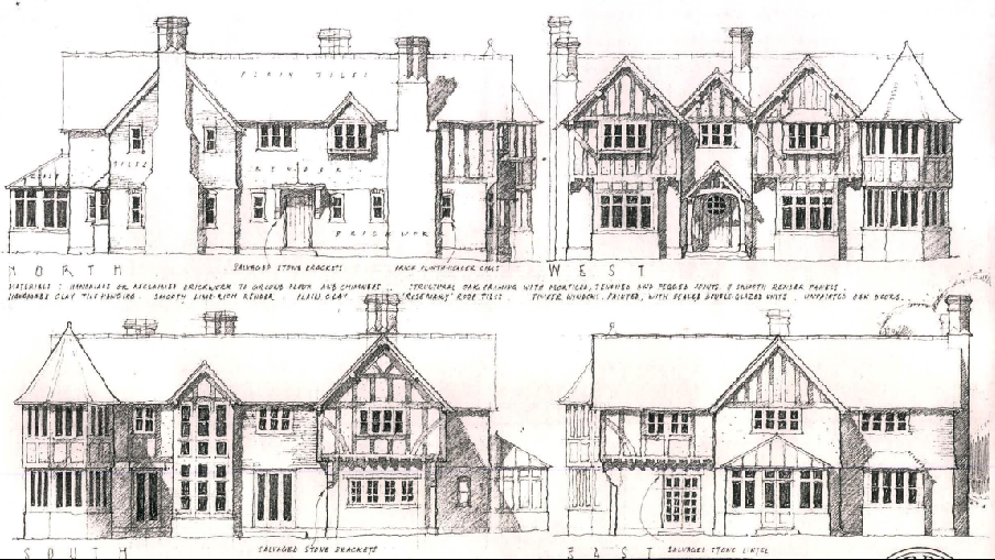
The image displays four architectural elevations (North, West, South, East) of a large, traditional-style detached house featuring timber framing and stone details.
4.0 The proposal
4.1 Proposed is the erection of a new, detached building which will be used for the storage of equipment and items associated with and required for the maintenance of the whole site which extends significantly beyond the residential curtilage. There is increasing invasion of laurel within the woodland which needs to be managed and access pathways within the woodland to manage brambles and ivy. The applicants have chainsaws, a small tractor, mini digger, chipper, dumper, axes and general maintenance tools with nowhere on site they can be securely stored under cover and they also hope to grow fruit and vegetables on the site and will need space for equipment associated with that as well as space to store produce.
4.2 The building is a timber structure to match the existing house and respect the woodland setting of the site and has a footprint of 10m by 7.5m. The building has no windows at ground floor level and a single set of double doors on the northern elevation. The eaves are 2.6m high and a roof pitched at 40 degrees with a ridge level of 6.1m and finished in natural slate.
4.3 The building is to be sited on one of the few relatively level and clear areas within the site and close to the house - approximately 8m away. In order for the new building to sit comfortably next to the house, a similar proportion and profile has been used which results in space available within the roof of the new building and an external stair and two dormer windows in the western roof plane are proposed to allow this to be usable and would be used solely in association with the occupation and management of the site and by those ordinarily associated with it.
4.4 The applicants are aware of the sensitivity of the site in respect of the existing trees and the purpose of the building is to be able to better manage the woodland for its own sake and enhance it for visual and ecological benefit. The plans include a tree protection plan which shows an exclusion zone relating to the closest trees which lie to the west and south of the proposed building. One tree is to be removed which is where the proposed building is to be erected: this tree appears to be growing out of a small drainage ditch which is to be culverted as part of the proposals.
5.0 Conclusion
5.1 The site in its entirety encompasses over a hectare most of which is natural woodland which contributes positively to the area visually and ecologically. The applicants wish to enhance this as much as possible but have nowhere to store equipment which is required for this. The policies which presume against development do acknowledge that there may be a need for development which is associated with agriculture and forestry (General Policy 3f).
5.2 The landscape context is very much a wooded scene with more prominent buildings appearing on the higher areas, some very prominent in the overall landscape. What is proposed has been designed to complement what exists in position, form and finish and will generally be screened from public view by existing trees and vegetation which will, if not hide the proposed building, then soften the impact of it. We would submit that even if seen, what is proposed will not have an adverse visual impact as the building is finished and designed to a high standard.
5.3 We believe that the proposal will not harm the landscape and thus complies with Environment Policies 1 and 2.
5.4 We do not believe that the proposal will have any adverse impact on the living conditions of those in adjacent residential properties and there is no change to vehicular access from the public highway, thus complying with General Policy 2b, c, g, h, and i).
5.5 The site has been chosen as it is outside the flood risk area, the ecologically sensitive area and generally where there are no trees: the only tree to be removed is small, growing out of a ditch and not part of the woodland. The proposal is therefore not contrary to Environment Policies 3, 4, 7, 10 or 13 or to General Policy 2d or l.
5.6 The proposal will reduce the need to bring equipment and vehicles to the site and will provide secure storage for the items, prolonging their life and thus complying with General Policy 2n.
5.7 Finally, we believe that the proposal will conserve and enhance the character, quality and distinctiveness of this area as is stated as being the landscape strategy in the Landscape Character Assessment and the Area Plan for the East.
Sarah Corlett 18.05.2023
Appendix One - policies
Strategic Plan
General Policy 2: Development which is in accordance with the land-use zoning and proposals in the appropriate Area Plan and with other policies of this Strategic Plan will normally be permitted, provided that the development:
(a) is in accordance with the design brief in the Area Plan where there is such a brief;
(b) respects the site and surroundings in terms of the siting, layout, scale, form, design and landscaping of buildings and the spaces around them;
(c) does not affect adversely the character of the surrounding landscape or townscape;
(d) does not adversely affect the protected wildlife or locally important habitats on the site or adjacent land, including water courses;
(e) does not affect adversely public views of the sea;
(f) incorporates where possible existing topography and landscape features, particularly trees and sod banks;
(g) does not affect adversely the amenity of local residents or the character of the locality;
(h) provides satisfactory amenity standards in itself, including where appropriate safe and convenient access for all highway users, together with adequate parking, servicing and manoeuvring space;
(i) does not have an unacceptable effect on road safety or traffic flows on the local highways;
(j) can be provided with all necessary services;
(k) does not prejudice the use or development of adjoining land in accordance with the appropriate Area Plan;
(l) is not on contaminated land or subject to unreasonable risk of erosion or flooding;
(m) takes account of community and personal safety and security in the design of buildings and the spaces around them; and
(n) is designed having due regard to best practice in reducing energy consumption.
General Policy 3: Development will not be permitted outside of those areas which are zoned for development on the appropriate Area Plan with the exception of:
(a) essential housing for agricultural workers who have to live close to their place of work; (Housing Policies 7, 8, 9 and 10);
(b) conversion of redundant rural buildings which are of architectural, historic, or social value and interest; (Housing Policy 11);
(c) previously developed land(1) which contains a significant amount of building; where the continued use is redundant; where redevelopment would reduce the impact of the current situation on the landscape or the wider environment; and where the development proposed would result in improvements to the landscape or wider environment;
(d) the replacement of existing rural dwellings; (Housing Policies 12, 13 and 14);
(e) location-dependent development in connection with the working of minerals or the provision of necessary services;
(f) building and engineering operations which are essential for the conduct of agriculture or forestry;
(g) development recognised to be of overriding national need in land use planning terms and for which there is no reasonable and acceptable alternative; and
(h) buildings or works required for interpretation of the countryside, its wildlife or heritage.
Environment Policy 1: The countryside and its ecology will be protected for its own sake. For the purposes of this policy, the countryside comprises all land which is outside the settlements defined in Appendix 3 at A.3.6 or which is not designated for future development on an Area Plan. Development which would adversely affect the countryside will not be permitted unless there is an over-riding national need in land use planning terms which outweighs the requirement to protect these areas and for which there is no reasonable and acceptable alternative.
Environment Policy 2: The present system of landscape classification of Areas of High Landscape or Coastal Value and Scenic Significance (AHLV’s) as shown on the 1982 Development Plan and subsequent Local and Area Plans will be used as a basis for development control until such time as it is superseded by a landscape classification which will introduce different categories of landscape and policies and guidance for control therein. Within these areas the protection of the character of the landscape will be the most important consideration unless it can be shown that:
(a) the development would not harm the character and quality of the landscape; or
(b) the location for the development is essential.
Environment Policy 3: Development will not be permitted where it would result in the unacceptable loss of or damage to woodland areas, especially ancient, natural and semi-natural woodlands, which have public amenity or conservation value.
Environment Policy 4: Development will not be permitted which would adversely affect:
(a) species and habitats of international importance:
(i) protected species of international importance or their habitats; or (ii) proposed or designated Ramsar and Emerald Sites or other internationally important sites.
(b) species and habitats of national importance:
(i) protected species of national importance or their habitats;
(ii) proposed or designated National Nature Reserves, or Areas of Special Scientific Interest; or
(iii) Marine Nature Reserves; or
(iv) National Trust Land.
(c) species and habitats of local importance such as Wildlife Sites, local nature reserves, priority habitats or species identified in any Manx Biodiversity Action Plan which do not already benefit from statutory protection, Areas of Special Protection and Bird Sanctuaries and landscape features of importance to wild flora and fauna by reason of their continuous nature or function as a corridor between habitats.
Some areas to which this policy applies are identified as Areas of Ecological Importance or Interest on extant Local or Area Plans, but others, whose importance was not evident at the time of the adoption of the relevant Local or Area Plan, are not, particularly where that plan has been in place for many years. In these circumstances, the Department will seek site specific advice from the Department of Agriculture, Fisheries and Forestry if development proposals are brought forward.
Environment Policy 7: Development which would cause demonstrable harm to a watercourse, wetland, pond or dub, and which could not be overcome by mitigation measures will not be permitted. Where development is proposed which would affect a watercourse, planning applications must comply with the following criteria:
(a) all watercourses in the vicinity of the site must be identified on plans accompanying a planning application and include an adequate risk assessment to demonstrate that works will not cause long term deterioration in water quality;
(b) details of pollution and alleviation measures must be submitted;
(c) all engineering works proposed must be phased in an appropriate manner in order to avoid a reduction in water quality in any adjacent watercourse; and
(d) development will not normally be allowed within 8 metres of any watercourse in order to protect the aquatic and bankside habitats and species.
Environment Policy 10: Where development is proposed on any site where in the opinion of the Department of Local Government and the Environment there is a potential risk of flooding, a flood risk assessment and details of proposed mitigation measures must accompany any application for planning permission. The requirements for a flood risk assessment are set out in Appendix 4.
Environment Policy 13: Development which would result in an unacceptable risk from flooding, either on or off-site, will not be permitted.
Appendix Two Landscape Character Assessment D3 CONRHENNY/GROUDLE Key Characteristics
• Gently rolling topography, which is cut by a series of rivers.
• Contain the relatively narrow corridors of the Groudle and Ballacottier Rivers.
• Patchwork of organised pasture and arable fields delineated by a combination of hedgerows, Manx banks and visible drainage ditches.
• Patches of regular coniferous woodland plantations as visible landmarks with the surrounding landscape.
• Distinctive black and white Manx milestones lining the A2 road corridor.
• Series of scattered, isolated farmsteads (several of which have associated modern farm buildings).
• Sense of enclosure provided by Uplands to the north-west.
• Open views to visually harsh red roofs of modern housing developments at the edge of Onchan dominate views southwards.
• Dramatic, panoramic views eastwards across the ever-changing colour and nature of the sea and sky, contribute to strongly recognisable sense of place.
Overall Character Description This character area encompasses gently rolling topography, which is cut by a series of small rivers and streams, including Groudle River and Ballacottier River, which flow north-south across the area. To the north of Onchan, the Groudle River has been dammed to form two triangular reservoirs, Kerrowdhoo and Clypse, which are visible on the horizon on approach to the area. Landscape within the area is covered by a patchwork of organised pasture and arable fields, which are delineated by a combination of hedgerows and Manx banks. Ditches are also characteristically visible at field boundaries in certain locations. Three regular-shaped coniferous woodland plantations are situated on sloping land to the northeast of Onchan and provide recognisable sense of place. Set against a dramatic upland backdrop, these woodlands create a sense of enclosure surrounding Conrhenny equestrian centre and provide recognisable landscape features within an otherwise predominantly open landscape. To the south, the area is served by the main A2 road, which runs along the coastline and connects Douglas in the south to Laxey in the north. A series of relatively quiet, rural roads lead northwards from this main road corridor, towards the upland backdrop. Settlement pattern consists of a series of scattered, isolated farmsteads, several of which have visually intrusive modern farm buildings in proximity to the older, traditional farmhouses. A sense of enclosure is provided by Uplands to the northwest. Overall, there is a relatively strong sense of tranquillity throughout the character area, at distance from major roads corridors and the edges of Onchan. To the north of Onchan, the geometric course of the A18 (TT course), with several viewing platforms and Marshals’
boxes, provides a recognisable transport corridor within the area. The sense of tranquillity is greatly disturbed during TT season. The meandering path of the Groudle River (which is enclosed and wooded in places) abuts the north-eastern edge of Onchan and flows eastwards to join the sea at Port Groudle. Just to the south of this river corridor, King Edward Bay golf course (situated on a prominent hill, and consisting of several areas of rough grassland and heathland) provides a distinct and recognisable landscape feature. In several places, open views to visually harsh red roofs of modern housing developments at the edge of Onchan dominate views southwards. Dramatic, panoramic views eastwards across the ever-changing colour and nature of the sea and sky, contribute to a strongly recognisable sense of place.
Key Views
• Dramatic views to an Upland backdrop to the north and west.
• Dramatic, panoramic views eastwards across the ever-changing colour and nature of the sea and sky, contribute to strongly recognisable sense of place.
• Close and distant views to the northern edge of Onchan/ Douglas settlement, which is visually harsh in places.
• Channelled views along the corridor of the Groudle River, which is enclosed in places.
Historic Features
• St. Adamnan’s/Lonan Old Church
• Standing stones and tumuli
Ecological Features
• Biodiversity value within regular patches of predominantly coniferous woodland.
• Stream corridors.
• Intact network of mature hedgerows.
Evaluation of Inherent Landscape Sensitivities
• Fragmented woodland in valley bottoms.
• Rivers and reservoirs with riparian habitats.
• Scattered settlement pattern of isolated farms and hamlets.
• Sites of archaeological importance.
• Manx Milestones by roadside.
• Well-vegetated character alongside A-roads.
• Victorian Isle of Man Steam Railway and station.
Landscape Strategy The overall strategy is to conserve and enhance the character, quality and distinctiveness of this area of relatively sparse settlement, its valley bottom woodland, its National Glens and the various archaeological features within the area.
Copyright in submitted documents remains with their authors. Request removal
Source & Provenance
Official reference
23/00640/B
Source authority
Isle of Man Government Planning & Building Control