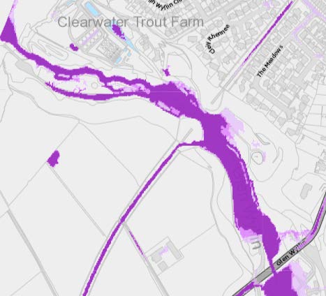
1.1 The site is an area of land which sits between the west coast of the Island - Glen Wyllin beach to the north west and the A4 coastal highway to the south east with Broogh Wyllin and Cleiy Rhennee housing to the north east and the glen and footpaths to the south west.
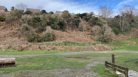
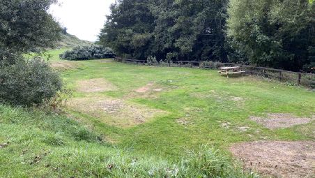
1.2 The site is lower than the land to the north and south and east. The site is generally flat, within which the Glen Wyllin river and a public highway run towards the sea with a public footpath network running up the banks to the south west of the flat area. To the north east the land rises with ferns, trees and shrubs with the housing and the domestic planted boundaries visible in some places. The former railway line bridge stone supports can still be seen.
1.3 There is an area fitted with children’s play equipment within the site and a number of timber bridges which cross the Glen Wyllin river to give access to the land on the northern side.
1.4 The site contains a building roughly in its centre which provides a cafe and administrative and storage space for the camp site which operates from the site.
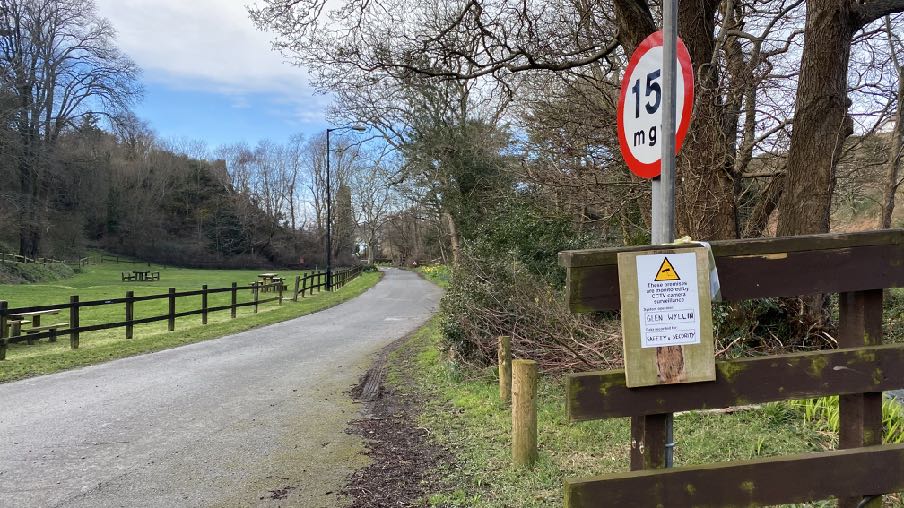
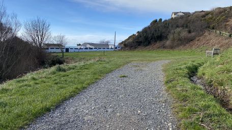
1.5 There is informal car parking at the north western end of the highway where those walking along the beach tend to park their vehicles.
1.6 The most recent application to develop the camp site at Glen Wyllin was refused by the Council of Ministers. This application, 17/00386/B sought regularisation of the use of the land as a camp site including a caravan/motorhome site (up to 46 caravans/motorhomes in total) and up to 120 camping pitches and its further development in the form of providing 2 yurts, 8 log cabins, 8 camping pods and ancillary facilities along with drainage works.
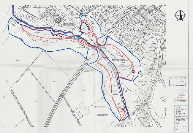
1.7 This application was refused for four reasons:
1. The proposed buildings would detract from the open character and appearance of the land, which is an important feature of the Glen Wyllin Conservation Area. This would be contrary to Environment Policy 35 of the Isle of Man Strategic Plan 2016, which provides that, in a Conservation Area, development will not be permitted unless it would preserve or enhance the character or appearance of that area, and ensure that features contributing to the area’s quality are protected.
2. No Environmental Impact Assessment (EIA) accompanies the planning application, contrary to Environment Policy 24 and paragraph A.5.2(j) of the Isle of Man Strategic Plan 2016. These provide that an EIA will be required with any application that proposes and permanent cap site or caravan site. The environmental information submitted with the application is inadequate.
3. In view of the lack of environmental information, there is uncertainty about the effect of the proposed surface water drainage arrangements on the health of trees which may be an important feature of the Glen Wyllin Conservation Area.
4. There is evidence that the application site has previously been flooded, and could be vulnerable to future flooding. However, no flood risk assessment has been submitted, contrary to Environment Policy 10 of the Isle of Man Strategic Plan 2016.
1.8 This current application seeks to address these reasons for refusal and to seek approval for a series of developments which will enhance the visitor experience at the camp site, extend the range of accommodation and the length of time people can stay on site, to manage flood risk and regularise the use of the site as a camp site.
1.9 The site is owned by Department of Environment, Food and Agriculture who also is the Government department responsible for the management and control of trees (Tree Preservation Act
1993) and ecology (Wildlife Act 1990). As the Department leases the land to the applicant, they are able at any time to control how the site is used and if there were any concern about the operation of the camp site and conflict with any of the Department’s responsibilities or legislation, the Department can vary or even terminate the agreement for the applicant’s occupancy and use of the site.
2.0 Contents of the planning statement
3 Land use status
4 Planning policy and constraints
5 Planning history
6 The proposal
7 Environmental impact:
7.1 Population and human health
7.2 Biodiversity
7.3 Land, soil, water, air and climate
7.4 Material assets, cultural heritage and the landscape
7.5 Interaction of factors
7.6 Operational effects
7.7 Vulnerability
7.8 Additional information
8 Conclusion
9 Conditions
3.0 Land use status
3.1 The status of land in planning terms may be established in a number of ways: planning approval may be granted for the use of the land, it may be designated for a particular use in an approved development plan or it may have established use through having been used for a particular use for a period of time which results in it being immune from the issue of an enforcement notice under Schedule 4 (3) of the Town and Country Planning Act 1999. This position may be certified through the granting of a Certificate of Lawful Use or Development under Section 24 of the same Act. In respect of the last provision, there needs to be sufficient evidence to demonstrate that a use has been consistent on a site for a CLAW to be issued. In respect of built development this can be relatively easy to demonstrate through the presentation of photographs and aerial photographs which may be compared with the existing situation on the ground. For uses, it is more difficult to demonstrate consistent use of a piece of land for a particular purpose and after discussions with the Department, it was concluded that whilst
there is photographic evidence over the years of the use of the site as a camp site, this is not sufficient to demonstrate that that use has been consistent over the required ten years as the images represent only a particular moment in time. For a seasonal campsite this is even more difficult to evidence.
3.2 The site in this case is part of Glen Wyllin which sits to the south of Kirk Michael and is accessed via a public highway from the A4 just south of its junction with the A3 TT Course. The site is annotated on the Isle of Man Digital Mapping as “camp site”.
3.3 There is reference to a camp site here in the Local Plan Written Statement and the Conservation Area Character Appraisal (see Planning Policy and Constraints). The inspector for the most recent application on the site refers to historic use of the site for camping and there is a planning history of applications for campsite related development (see Planning History).
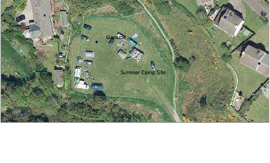
3.4 It would appear clear from all of the above that there is acceptance that the use of the site at least in some part, as a camp site, has been on-going for a considerable time. However, the precise extent of that area is not clear. Aerial photographs can provide an indication of how land is used at the time of their taking although cannot provide definitive proof of the continuation of that use throughout the periods between when these photographs were taken. In 2009 there appears to be evidence of camping on various parts of the site including alongside Glenside (annotated on the digital map as “Summer camp Site” and appears to show motorhomes parked on the lower area to the south east.
3.5 The 2018 aerial photograph shows similar evidence of camping alongside Glenside:
3.6 The most recent Google aerial images (stated as being 2021) show evidence of camping having happened on various parts of the site but with no tents or motorhomes evident at the time of that image.
3.7 The site is also noted as being “a tourist camp site which extended on either side of the River Willyn [sic]” in the inspector’s report into 21/00026/B for the construction of the pedestrian bridge across the site (see Planning History).
3.8 The Visit Isle of Man website which provides information on walking routes on the Island refers to the Road ny Foillan long distance footpath sections between Peel and Kirk Michael as starting at Fenella Beach in Peel and ending at “Glen Wyllin Campsite” (https://www.visitisleofman.com/ experience/6-peel-to-kirk-michael-raad-ny-foillan-p1301191).
3.9 The inspector considering 17/00386/B states:
“63. There has clearly been a camp site in Glen Wyllin since before 1994, as reference to this facility is made in Section 4 of the Kirk Michael Local Plan Written Statement, which dates from that year. However, as far as I am aware, no planning approval has ever been granted for this use; and no certificate of lawfulness has been issued in respect of it, under Section 24 of the Town and Country Planning Act 1999. Despite this, as a camp site has been operative here for more than 10 years, it appears to be an established use, which would be immune from enforcement action under Part 4 of the Act. Nevertheless, I am not certain that the area occupied by the established camp site is coextensive with the present application site.
The present proposal seeks planning approval for the use of the application site as a camping facility for a specified number of tents, caravans and motorhomes. If approval is granted this would give future certainty as to the authorised use of this land. However it approved is refused that would not affect the extent to which any existing established use is immune from enforcement action.”
“69 The presence of tents, caravans and motorhomes (together with campers’ cars and other camping paraphernalia) may detract from the open, unspoilt appearance of Glen Wyllin, which is a National Glen as well as a Conservation Area. However, as indicated above, use of the application site for camping is likely to continue regardless of the outcome of the present application.”
“70 The evidence suggests that the established use is for a seasonal camp site, which only operated between April and September.”
“88 …In part, the approval granted would be retrospective, since there seems already to be an established use right for camping to take place on the application site.”
3.9 In conclusion, whilst there is no definitive land use designation or planning approval which confers camp site status on all of the land which is the subject of this application, it is our position that given the evidence provided above and elsewhere within this document, the use of the majority, if not all of the camp site for these purposes has been on-going for sufficient time for this not to be a reason why the development of the site should be refused. If approved, this application would regularise the current situation for clarity for the future.
4.0 Planning policy and constraints Local Plan
4.1 The land currently being used for camping purposes at Glen Wyllin is designated on the Kirk Michael Local Plan of 1994 as “Glen Wyllin (Public Open Space)” which is consistent with the designation on the Isle of Man Planning Scheme (Development Plan) Order 1982 which was the relevant development plan for this area prior to the adoption of the local plan.
4.2 The Written Statement accompanying the local plan map contains a number of references to this site as follows:
Paragraph 4.1: “ The village of Kirk Michael and the rural area are attract in their own right and possess certain assets which are tourist related. These are:-…vii. Glen Wyllin and its camp site…”
4.2 The sum of the above attractions contributes to the economy of the village and the real are in terms of attracting visitors.
POLICY 4.5 THE PRESENT TOURIST ASSETS SHOULD BE MAINTAINED AND REINFORCED IN ORDER TO MAKE THE BEST USE OF THEIR COMBINED ATTRACTION.
A topographical site plan showing the Glen Wyllin River, railway lines, and contour lines indicating the terrain.
POLICY 4.6 THE DEPARTMENT OF AGRICULTURE, FISHERIES AND FORESTRY, DEPARTMENT OF LOCAL GOVERNMENT AND THE ENVIRONMENT, DEPARTMENT OF TOURISM AND TRANSPORT SHOUDL LIAISE WITH THE MICHAEL COMMISSIONERS WITH A VIEW TO AGREEING A PLAN FOR THE FUTURE DEVELOPMENT OF THE FACILITIES AND AMENITIES OF GLEN WYLLIN AS A MATTER OF PRIORITY. THE RIVER QUALITY AND FLOWS SHOULD BE MONITORED IN ORDER TO ENSURE THAT BOTH ARE TO AN ACCEPTABLE STANDARD.
Strategic Plan
4.3 As the site is designated as Public Open Space (POS), it is relevant to consider the Strategic Plan policies which refer to open space which is or has the potential to be amenity or recreation value to the community. The Strategic Plan generally discusses POS which is provided or required to be provided alongside residential development rather than the larger areas of POS which is held in the public domain and controlled by central or local government. Recreation and amenity space is generally protected under Recreation Policy 2 (see Appendix One).
4.4 Public Open Space is a subset of Open Space where development is generally discouraged and where the loss of open space which is or has the potential to be of recreation or amenity value without adequate mitigation, should be resisted (Recreation Policy 2). However, given the historic use of the site as a camp site with children’s play facilities in the middle of it and a public highway giving public access to footpaths within the glen and the beach, it is considered that what is proposed is not harmful to the overall area being open space available to the public whilst some areas will not be (arguably not continue to be) accessible to the general public where there are tents, motorhomes and pods.
4.5 The Strategic Plan refers to tourism in Section 9 where it explains that tourism developments are subject to the same constraints as other forms of development in undesignated areas and recommend that tourist development is sustainable.
4.6 The countryside (land which is outside settlements or which is not designated for further development) is protected for its own sake (Environment Policy 1).
4.7 Ecology is protected under Environment Policies 4 and 7.
4.8 Trees are protected under Environment Policy 3. There are no Registered Trees on the site.
4.9 Development which would be at risk of flooding is presumed against (Environment Policies 10 and
13) and where development is proposed in an area at risk of flooding, a Flood Risk Assessment is required.
4.9 Parts of the site are shown on the national flood risk maps as being at risk of flooding from surface water.
4.10 Development which would have a significant impact are required by Environment Policy 24 to be accompanied by an Environmental Impact Assessment. In the absence of specific Isle of Man EIA regulations, current practice in England and Wales is applicable (A.5.1 of the Strategic Plan). In Appendix 5 it is recommended that applications for permanent camp sites and caravan sites should be accompanied by an Environmental Impact Assessment although this is qualified in the UK to be only permanent camp sites which are more than 1ha in size) and paragraph 9.5.4 suggests that larger scale schemes may have to be the subject of an environmental impact assessment.
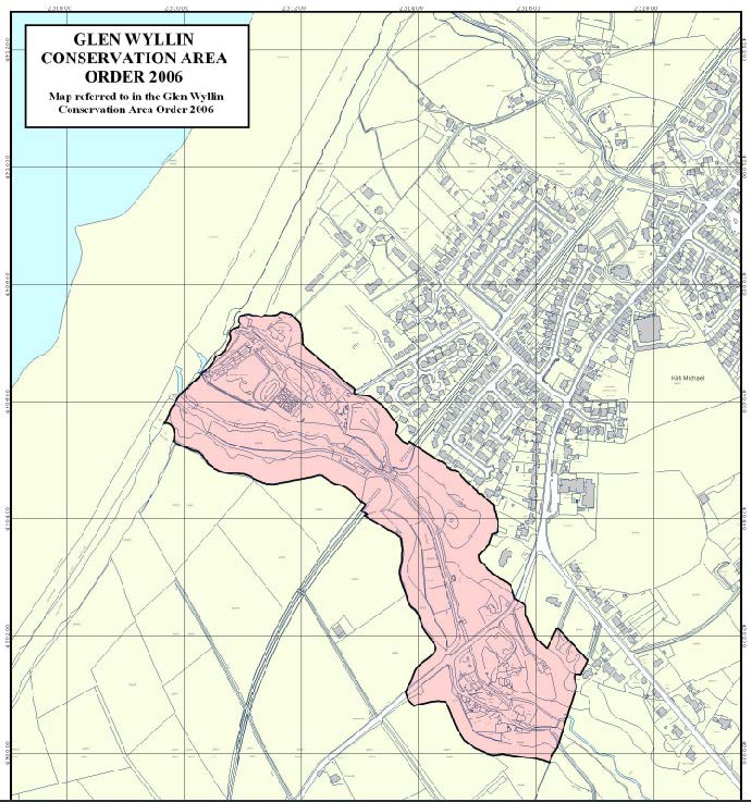
4.11 Development within a Conservation Area is required to preserve or enhance the character or appearance of the Area and where the special character of the Conservation Area must be taken into account in the determination of any application for development (Environment Policy 35 and Planning Policy Statement 1/01 - Conservation of the Historic Environment of the Isle of Man (see Appendix Two). The Conservation Area Character Appraisal is also a material consideration. There are no Registered Buildings on or near the site.
4.12 Development must have an acceptable impact on highway safety (Transport Policy 4) and the needs of pedestrians should be given similar weight to the needs of other road users (Transport Policy
6).
4.13 Vehicle parking must be provided in accordance with the Department’s current standards (Transport Policy 7 and Appendix 7: no specific standards are proposed for camping facilities).
4.14 Major development proposals must be accompanied by a Transport Assessment (Transport policy
7).
4.15 Department for Enterprise produced a Non-Serviced Accommodation Study in March 2017 which looks at the type and amount of accommodation available on the Island, potential improvements and what is currently lacking. It identified the poor quality of some camp sites, the opportunities for family and friend get togethers, all season units and communal facilities including wet weather, electric hook ups and distinctive glamping units to provide a unique, quality experience.
4.16 This has been succeeded/supplemented by the Isle of Man Visitor Economy Strategy 2022
-2032. This confirms the Government’s recognition of the role that Visitor Economy growth has to play in achieving the vision of a secure, vibrant and sustainable future for the Isle of Man and the Strategy aims to growing the visitor economy over the next ten years by improving the quality of the visitor experience which will also improve the quality of life for residents, including widening the leisure opportunities for Island residents and their enjoyment of the Island’s seas, coastline and countryside whilst aiming to eliminate its carbon footprint and supporting the conservation goals of the UNESCO Biosphere nation status of the Island and Climate Change objectives.
4.17 It identifies a deficiency in quality, choice and innovation in the Island’s tourist offer and notes that the Island is not making the most of the key Unique Selling Points of the Island - our coastline, seas, countryside, heritage, culture, arts and our food and drink. It includes objectives to:
• Triple the holiday short break market
• Grow all of the other visitor markets
• Invest in a competitive visitor destination over time
• Work to achieve a planning policy approach that can give positive consideration to proposals for well-designed, eco-friendly coastal and rural visitor accommodation, whilst protecting the natural environment and areas of high scenic value and avoiding any adverse climate change impact
• The progression of a series of Island-wide visitor accommodation development initiatives, including a cabin and bothies network around the Island to support the Raad Ny Foillan coastal path and round-island cycle, car, motorbike and kayak touring; a motorhome stopovers network around the Island; a pub accommodation development programme; a sky huts and star camps initiative; and the development of a distinctive Manx glamping offer.
• Extend the visitor season to ultimately make the Island an all year round destination
• Attract an additional 170,500 visitors per year compared to 2019 resulting in £310m total annual visitor spending, 5,000 jobs and £49m annual exchequer benefit.
5.0 Planning History Of The Site
5.1 IDO 21567 granted approval in principle for the use of the site as a holiday chalet park on 25.03.65.
5.2 IDO 23116 proposed approval in principle for the layout of 178 dwellings for tourist occupation with restaurant, public house, shops and swimming pool at Glen Wyllin. This was approved on 30.06.67 and renewed until 1974 subject to conditions which requires the standard submission of reserved matters and also that the junction of the site with the main road must be improved to the requirements of the IOM Highway and Transport Board and the Planning Committee. This approval related to a significantly larger area than is currently being used for camping.
5.3 IDO 23117 granted approval for 39 dwellings for tourists, restaurants and shops with flats over. This would appear to be a full, detailed approval and was granted on 30.07.67.
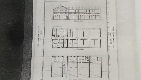
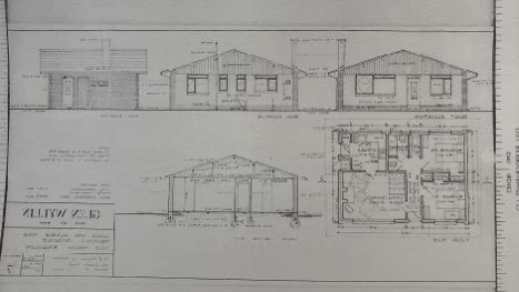
5.4 There were at least three Special Planning Committee applications (the microfiches appear to contain multiple applications and it is not clear whether all were approved and which drawings go with which application) - understood to be applications made by the Government Department (the then IOM Local Government Board).
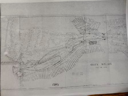
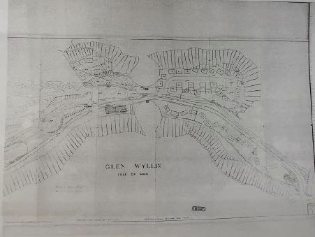
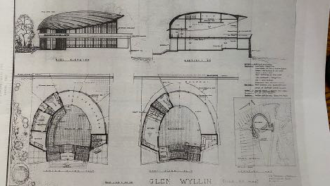
Architectural elevations and cross-sections of a curved camping pod or cabin structure, showing interior layout and exterior form.This image displays an architectural drawing featuring a floor plan and elevations for a long, narrow building structure, labeled as an office, cabin, or yurt.Architectural drawing displaying multiple elevations and a detailed floor plan of a building structure, likely a cabin or facility extension.A black and white site location map showing field boundaries, roads, and the proposed development area near Laxey.
5.5 SP 754(42) proposed approval in principle for the erection of holiday chalets, shop, manager’s office and sanitary accommodation and the use of Glen Wyllin for tented holiday accommodation with the site described as “a site in Kirk Michael bounded by the rear of the properties in Station Road and Main Road, the former railway track and the boundary with Glen Wyllin and was approved initially on 18.12.78 and confirmed on review on 31.01.79. The existing use of the site at that time was described on the application form as being “vacant land”.
5.6 SP 754 (42.1) It has not been possible to locate a separate microfiche for this application but it is referred to in the microfiche for 754(42). Herein there is a planning decision relating to 754(42.1) which is stated as being for approval in detail to the use of Glen Wyllin for tented campsite with central conveniences, ablution facilities and a small office/shop and was approved on 14th March,
This decision was subject to 18 conditions, some of which required the completion of the development within 12 months, certain facilities to be provided in accordance with the requirements of other authorities (Chief Fire Officer, Chief Public Health Inspector, Michael Village Commissioners, Isle of Man Highway and Transport Board); no camping was approved within the area shown black and unhatched and extending to the shore beyond 31st December 1979, adequate car parking is provided for campers and the public and suitable portable toilets are provided.
Also within this microfiche under the reference 754(42.1) the Special Planning Committee stated in a letter dated 12.02.80 that the Attorney General advised that:
“In my view, the Local Government Board seek a further change of use. The ‘unhatched’ area reverted to natural glen after 31st December, 1979 (save for the TT and MGP weeks). A fresh planning application should now be made for the change of use of the ‘unhatched’ area to a camp site suring [sic] the periods of the year outside TT and MGP weeks. Presumably the change of use, to be applied for, would be for a permanent change of use”.
5.6 754 (62). Again, a separate microfiche for this has not been able to be located but within 754(42) there appears an application form for the change of the site from camping site use approved during the TT and MGP periods to camping site through the season in common with other area of the Glen approved for this purpose and the application form refers to previous application 754(42.1) approved on 14.03.79). This states that “the operation of the Glen as a camp site during the 1979 season proved to be successful and it is request that use may be made of the area delineated black during the whole of the season in 1980 and in succeeding year. If approved, this would bring the approval for the whole of the Glen into line with the approval already granted in respect of the area delineated and hatched black.” It is not clarified what “the season” is.
5.7 There also appears to be an application form for “tented holiday accommodation…layout as a tented campsite with associated mobile toilet and ablution facilities” on land to the north of Glen Wyllin on land designated for residential development on both sides of the former railway line (now developed for housing) as well as an application for “self catering holiday accommodation.erection of rustic cabins and Manager’s officer with associated camp shop and public toilets…” with the accompanying map showing the manager’s office where the existing shop currently is and with the proposed chalets on the land to the south east of the former railway line to the rear of the properties which back onto Douglas Road corner.
5.8 84/00362/B proposed an extension to the ablutions buildings at the site which was defined only as the area of the building (the current office and shop). This was approved.
5.9 89/01824/B proposed engineering works to the River Wyllin by DAFF and whilst not a proposal for campsite facilities, did describe the site as “within camp site area”. This was approved.
5.10 90/04020/B proposed the replacement of the timber bridge within what was described as the “Glen Wyllin camp site”, proposed by the Forestry, Amenity and Land Division of DAFF. This was approved.
5.11 95/01165/D proposed an advertising sign, by Michael Commissioners for the “Glen Wyllin camp site” and was approved on 06.12.95.
5.12 97/01899/A was an application by Michael Commissioners for the principle of log cabins to replace existing portacabins and refurbishment of toilet/shower block approved on 17.03.98.
5.13 98/01653/B proposed the erection of warden’s accommodation, shop, office etc to replacement portacabins, by Michael Commissioners and was approved on 01.02.99.
5.14 12/00833/B proposed a footbridge within “Glen Wyllin camp site’ by Michael Commissioners.
5.15 12/01104/B proposed a BMX track by Michael Commissioners
5.16 14/00957/B was a proposal by Department of Environment, Food and Agriculture for a new bridge within “Glen Wyllin camp site motorhome area” and was approved.
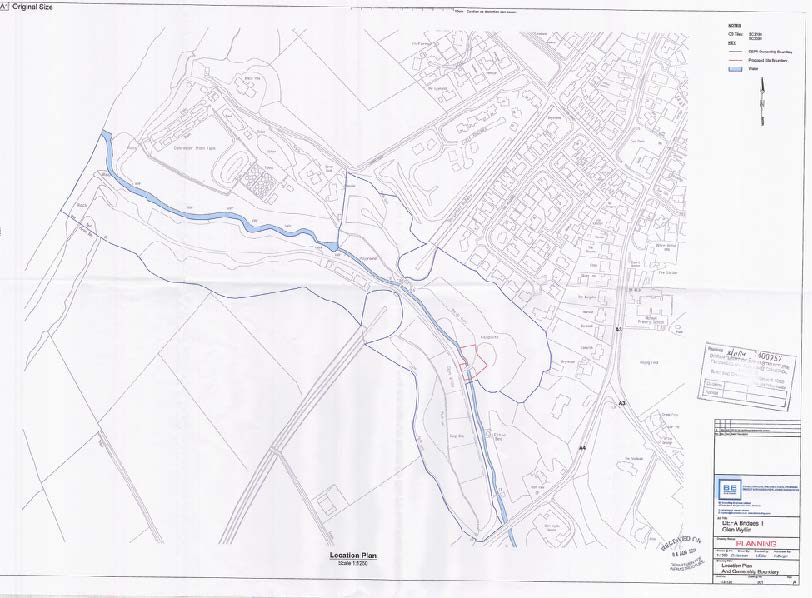
A black and white site location plan showing field boundaries, roads, and a winding watercourse with a legend and title block.
5.17 16/01278/B proposed the reinstatement of the weir mechanism at the fish farm, describing the site as Glen Wyllin camp site.
5.18 It is not believed that any of these previous applications defined the extent of the camp site and the defined sites were confined to the area where the proposed buildings were proposed rather than the overall camp site.
5.19 17/00386/B proposed the use of land for tourist purposes, comprising a caravan/motorhome site (up to 46 caravans/motorhomes in total) and a campsite comprising up to 120 tent pitches, along with the erection of 2 yurts and 8 log cabins and 8 camping pods and ancillary facilities, along with installation of land drains. This application was refused by the Council of Ministers (as the application site belongs to Department of Environment, Food and Agriculture) for four reasons:
1. The proposed buildings would detract from the open character and appearance of the land, which is an important feature of the Glen Wyllin Conservation Area. This would be contrary to Environment Policy 35 of the Isle of Man Strategic Plan 2016, which provides that, in a Conservation Area, development will not be permitted unless it would preserve or enhance the character or appearance of that area, and ensure that features contributing to the area’s quality are protected.
2. No Environmental Impact Assessment (EIA) accompanies the planning application, contrary to Environment Policy 24 and paragraph A.5.2(j) of the Isle of Man Strategic Plan 2016. These provide that an EIA will be required with any application that proposal a permanent camp site or caravan site. The environmental information submitted with the application is inadequate.
A site plan showing the proposed layout for a camping and cabin development, marked with red and blue boundary lines and existing structures.
3. In view of the lack of environmental information, there is uncertainty about the effect of the proposed surface water drainage arrangements on the health of trees which may be an important feature of the Glen Wyllin Conservation Area.
4. There is evidence that the application site has previously been flooded, and could be vulnerable to future flooding. However, no flood risk assessment has been submitted, contrary to Environment Policy 10 of the Isle of Man Strategic Plan 2016.
5.20 The inspector’s report refers a number of times to the status of the site in planning terms:
2 “… for the most part, the application site consists of open green areas, used for camping and for other recreational purposes. It contained two or three utilitarian buildings, which provide facilities for campers and other visitors…”
63 “There has clearly been camp site in Glen Wyllin since before 1994, as reference to this facility is made in Section 4 of the Kirk Michael Local Plan Written Statement, which dates from that year. However, as far as I am aware, no planning approval has ever been granted for this use; and no certificate of lawfulness has been issued in resect of it, under section 24 of the Town and Country Planning Act 1999. Despite this, as a camp site has been operative here for more than 10 years, it appears to be an established use, which would be immune from enforcement action under Part 34 of the Act. Nevertheless, I am not certain that the area occupied by the established camp site is coextensive with the present application site”.
64 “The present proposal seeks planning approval for the use of the application site as a camping facility for a specified number of tents, caravans and motorhomes If approval is granted, this would give future certainty as to the authorised use of this land. However, if approval is refused, that would not affect the extent to which any existing established use is immune from enforcement action.”
68 “In the Kirk Michael Local Plan, the application site is shown as falling within an area allocated as Public Open Space. Its present (and proposed) use does not appear to be wholly consistent with this designation, since the camp site is privately run; and members of the general public appear to have only limited access to the application site, along public rights of way. It follows that General Policy 2 of the Isle of Man Strategic Plan, which indicates that planning appeal will normally be granted for development that accords with the land-use zoning in the appropriate Area Plan, does not apply in this case. However, I know of no proposal for this land to be used as a public open space in accordance with its zoning in the Local Plan; and I attach weight to the fact that camping is an established use, which would be likely to continue whether planning approval is now granted or not. On balance, I am not persuaded that the inconsistency between the proposed us and the Local Plan zoning should tell against the present application.”
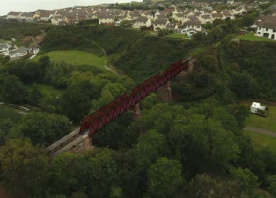
5.21 Department for Infrastructure sought and received planning approval for the construction of steel truss pedestrian bridges on the route of the former railway line (21/00026/B) so that users of the Raad ny Foillan footpath would not have to descend from the route at the top of each side of the valley to continue using the footpath.
6.0 The Proposal
6.1 The applicants are the current tenants of the site, leasing it from Department of Environment, Food and Agriculture on a 21 year basis and are about to start season 7. The applicants would like to invest in the facilities available at the site for the benefit of the remainder of their lease and potentially further extension of this in the future. They would also like to extend the period in which camping can take place on the site: currently the camp site is open from 1st April to 30th September and they would like an additional period for the 5 cabins on the upper section of the site, to be available until the end of December in any year.
6.2 The application proposes the installation of 8 moveable camping pods (drawing 105) on the area to the north west of the facilities building, with flood bund wall; the erection of 5 cabins (drawings 103 and 111 - the difference being that the one closest to Glenside has no windows in the side facing this property); on the upper area alongside Glenside and a barbecue unit (drawing 106); the installation of bollard lighting leading up to these units from the lower area alongside the children’s play area (drawing 107B); the installation of two canvas covered yurts (drawing 110) to the north of the motorhome camping area; two cabins (drawing 104) to the east of the caravan and motorhome camping area; the creation of a car parking area to the south west of the access at the southern end of the site (drawing 107B) and the creation of drainage channels to assist water flow from the camping area (drawing 102). Also proposed are alterations and extension of the main facilities building to provide additional storage space (drawing 109) including two additional sheds to the south east of the main building (drawing 102B and 113).
6.3 The proposal would result in the removal of up to 33 camping units to facilitate the new structures which occupy more space. Plan 108B illustrates how each area is currently used and how it is proposed to use the site. In the motorhome and caravan electrical area there are currently 70 spaces and there will be 60 which will remain and in addition it is proposed to add 2 yurts and 2 log cabins. In the areas on the south western side of the road there is currently 80 tented pitched and these will remain along with dedicated parking for users of the camp site. The area alongside Glenside is currently used for up to 30 pitches and will result in 5 log cabins and the area to the west of the facilities building currently accommodates 50 tent pitches and will accommodate 40 tent pitches and 8 camping pods.
6.4 The proposal also seeks permission - partly retrospective - for the installation of French drains which were introduced to make parts of the site drier. The applicant consulted a professional arboriculturist to ensure that none of the drain routes affected tree roots prior to the works commencing. Drawing 102B illustrates where the installed drains are and where it is proposed to install more.
6.5 The proposal has been redesigned following the previous refusal, reducing the height of the proposed cabins and improving their appearance and introduce different styles of unit depending on their location within the site.
6.6 The advice of the Manx Bat Group was also sought prior to the formulation of the latest application and their advice regarding the position of units and their windows and lighting has been taken into account in the design of the development.
6.7 Information was sought from the Manx Wildlife Trust in respect of the ecology of the site, despite no objections having been raised in the previous application by the Department or the inspector in this respect. Their report is included in the application.
6.8 A Flood Risk Assessment was commissioned, including liaison with the Isle of Man Flood Risk Management Team and this is included in the application.
6.9 A Transport Statement is also included which follows pre-application advice sought from and provided by the Highway Services Division of Department for Infrastructure despite no objections having been raised in this respect in the previous application.
7.1 Environmental Impact - Population and Human Health
7.1.1 The inspector for the 2017 application helpfully refers to this and does not consider this to be an issue at paragraphs 71-73.
7.1.2 The development is a significant distance from most existing dwellings with almost all higher than the application site and proposed development. It is not considered that the proposed development will have any adverse impact on the properties in Broogh Wyllin or Cleiy Rhennee.
7.1.3 The proposed cabins will sit relatively close to Glenside. The nearest cabin has been designed so as not to have any windows facing this property and there is a solid wall between that residential curtilage and the proposed cabins with the nearest cabin closest to the property’s garage rather than its living accommodation.
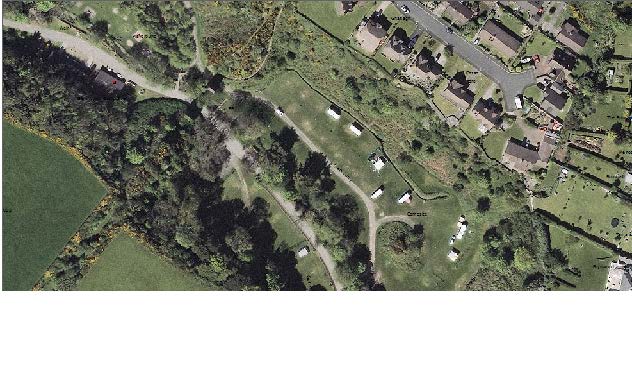
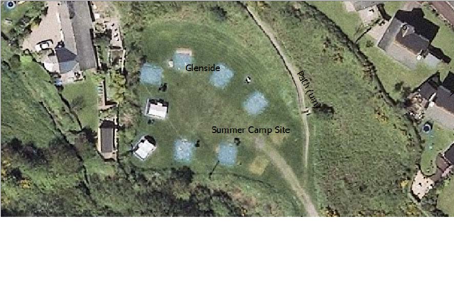
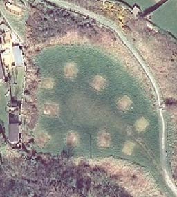
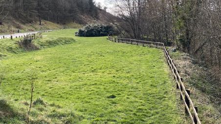
7.1.4 These cabins are to be located in an area previously occupied by tents as can be seen from the aerial photograph:
7.1.5 The Department’s Residential Design Guidance provides guidance on how impact on adjacent dwellings is measured and recommends that there are no windows looking directly towards other existing windows which will be avoided in this case.
7.1.6 The applicants have discussed the proposal with the owners of Glenside who indicated that they would much prefer permanent cabins rather than tents alongside them and had no objection to what was proposed.
7.2 Environmental Impact - Biodiversity
7.2.1 This is not raised by the inspector as a material issue nor a reason for refusal although third parties did raise the installation of concrete bases as something which could affect ecology. The Department’s Senior Biodiversity Officer commented on the 2017 application that “the grassland affected by the proposals has been classified in the 1992 phase 1 survey as amenity grassland, and therefore of little conservation interest, being regularly closely mown” and goes on to refer to the sluice area which is of greater biodiversity and discussed with the applicant, the position of the proposed septic tank for the huts and the amended proposals submitted in that application reflected that. His conclusion was that he was “content that nature conservation has been taken into account and in particular the possibility of ‘uncommon plants or vegetation’ as referred to in the Kirk Michael Local Plan (“12.6 IN THE PREPARATION OF DEVELOPMENT PROPOSALS IT IS ESSENTIAL TO ENSURE THAT ANY WORKS DO NOT HAVE A DETRIMENTAL EFFECT ON UNCOMMON PLANTS OR VEGETATION. THE MANX MUSEUM AND NATIONAL TRUST SHOULD BE CONSULTED IN THIS RESPECT”)
7.2.2 Whilst this was not raised as an issue in the previous application, the applicants commissioned a Preliminary Ecological Appraisal of the site and proposed development and in addition, sought advice from the Manx Bat Group and these reports/notes are attached.
7.2.3 The PEA, undertaken in November, 2021 concludes that use of the site by common lizard is unlikely, no common frogs were seen although the time of the year would make this unlikely and there are records of frogs on the site including evidence of breeding. Bird are plentiful on and around the site and there are three recorded species of bat in the vicinity of the site with the site being used for foraging. No scarce or rare plants were found which was not considered surprising “due to the long term use of the site for public amenity”. It refers to widespread incidence of Montbretia, a Schedule 8 species, Rhododendron and Japanese Knotweed.
7.2.4 It is their conclusion that the development will largely involve changes to the use of amenity grassland which is of low ecological value and as the site is used for camping, there is unlikely to be any additional disturbance to surrounding woodland and scrub areas. Their main concern was to impacts on the wet ditches and the stream although it is not known whether the ditches are used by breeding common frog and whether the proposed changes to the drainage will have an impact on water levels.
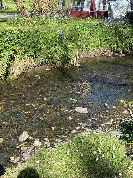
7.2.5 It should be noted that the area as a whole is subject to flood risk and at the two separate site visits, the river level and flow rates were completely different due to the varying climatic conditions at the time and are irrespective of any work undertaken on site to the natural existing drainage.
7.2.6 The report recommends the installation of bird and bat boxes and specifically refers to house Martin and house sparrow although the known nest sites for these are not thought to be within the site. We do not believe that the development will have any adverse effect on ecology but are happy to enhance the biodiversity value of the site by introducing bird and bat boxes on the proposed buildings or trees, as advised by the Department and a condition requiring details of this could be attached to any approval should this be forthcoming.
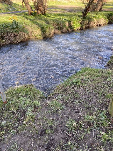
State of river flow 10.03.3022 and 11.05.22
11.09.2021
7.2.7 The report recommends the avoidance of tree removal, details of how any sediment run off into the stream will be controlled, careful timing of pruning work to trees and vegetation to avoid bird breeding and nesting seasons, cautious use of lighting which accords with BCT Guidance, examination of buildings which could accommodate birds or bats before any work is undertaken, careful timing of work to the stream to avoid harm to common frog and care not to spread Schedule
8 species.
7.2.8 They recommend the additional planting of native trees, creation of grassland margins for wildflowers and frogs and the provision of bird and bat boxes on log cabins.
7.3 Environmental Impact Land - soil, water, air and climate
7.3.1 These are not issues which were raised by the inspector either within the report or as reasons for refusal. We do consider that evidence or information needs to be provided in respect of this issue other than to confirm that the land is not of agricultural or ecological value through its continued and historic use as a camp site.
7.3.2 The development will not affect water quality: reference was made in the earlier application to discharges from hot tubs and it is not proposed to have these facilities on site. The site does not lie within an area where potable water is stored or collected. The proposal will not have any impact on air quality.
7.3.3 In terms of climate and climate change and referring to the Non Serviced Accommodation Study and the latest Visitor Economic Strategy by Department for Enterprise, the provision of additional facilities at this site will increase the range of on-Island recreation and tourist facilities for Island residents as well as off Island visitors, providing more sustainable holiday experience for residents than going off-Island as well as supporting access to natural recreation facilities (the adjacent coast and footpaths) in accordance with Chapter 10 of the Strategic Plan which acknowledges the benefits of recreation and open space.
7.4 Material assets, cultural heritage and the landscape
7.4.1 These are three distinct areas. In terms of material assets, whilst not raised as an issue by the inspector, third parties did raise as an issue the prevention of access by the public to parts of the site. The public will still have access to the children’s play facilities, the glen on the south western side of the road, and the beach and since the camp site has been operational, the public have generally not had access to the land on the north eastern side of the road. As the inspector in the previous application notes, there are no known plans to make this area functional public open space.
7.4.2 Cultural heritage is an issue which needs to be addressed as the site lies within a Conservation Area (CA) and it must be demonstrated that what is proposed will not have an adverse impact on the CA and that its special character is taken into account in the determination of development proposals.
7.4.3 The inspector makes reference to the impact of the use where “the presence of tents, caravans and motorhomes (together with campers’ vans and other camping paraphernalia) may detract from the open, unspoilt appearance of Glen Wyllin which is a National Glen as well as a Conservation Area) but considers also that, regardless of whether this proposal is approved, there will continue to be use
A map displaying the boundary of the Glen Wyllin Conservation Area Order 2006, highlighted in pink over an Ordnance Survey base map.
of the site as a camp site and as such, the additional times being sought as a camp site would have a “marginal” effect and the proposal, if approved, would allow control over the number and location of tents, caravans and motorhomes.
7.4.4 He also refers to the proposed built structures and their impact and that in some respects they would not preserve or enhance the character or appearance of the CA.
7.4.5 It is noted that the Principal Registered Buildings Officer considered the impact of the previous proposal as “negligible at best”.
7.4.6 The design of the camping cabins and pods has been changed. They are now exclusively single storey, more akin to what may be expected on a camp site and have been designed for the site rather than being ‘off the shelf’. The barbecue units are still hexagonal in plan but the other cabins and pods are rectangular and more similar to the dwellings which are also seen in the same vistas, and the main facilities building. We believe that the changes which will result from the proposed new structures will be positive - it should be remembered that if these units were not approved and installed, these areas would be likely to be used by tents and motorhomes which we consider would have a more damaging impact on the character and appearance of the Conservation Area. The camp site operates on the basis that many users bring their own tents and as such, there is often a wide variety of colours, styles, sizes of tents on the site at any one time.
7.4.7 It is important to note that the Conservation Area Character Appraisal acknowledges the presence of the camp site. It is unusual for a Conservation Area to contain so few buildings as they would usually focus on areas which are predominantly built up and whose history is portrayed in their buildings and their architecture. Indeed, the Town and Country Planning Act 1999 provides for Conservation Areas where they are of “special architectural or historic interest and talks of this special character being portrayed in the historic street patterns, variety of uses, use of materials, quality of period architecture, quality and detail of contemporary buildings, survival of building types or features, shop fronts, street furnitures, the quality of enclosures, spaces between buildings and vistas along streets, hard and soft landscaping, green open spaces and the presence of water in the landscape. It also refers to “neighbourhood”.
7.4.8 Of these characteristics, the camp site area contains relatively few: the Conservation Area was clearly not designated for its architectural quality and its history is predominantly as a public glen which provides access to the beach, which it will continue to do. Indeed, the Appraisal states “there are few buildings within the area of ay great merit and designation could not be justified purely upon the qualities of the built environment” (4.2). The area is described in the opening paragraphs as containing the camp site and trout farm and at paragraph 3.8 states: “Today, to the west of the main road the majority of the area is occupied by the campsite and its facilities…”. The area is described as having been “opened up to visitors” in 1890 with the opening of a pleasure resort and reference is made to arbours, summerhouses, sea bathing, freshwater lake, tennis courts, bowling green, croquet, swings, hobby horses and other games” and “a well appointed refreshment room”. After the War and the closure of the railway the pleasure grounds were closed and the glen subsided into dereliction and “an extensive area is used as a camp site with associated facilities, including a children’s playground”. The areas on each side of the river would have provided opportunities for amenity and leisure space, which they will continue to do in the form of camping opportunities where people can meet, stay and enjoy the rural location. The existence of the camp site is acknowledged in the Appraisal and is clearly something that forms part of its character and in some ways, what is proposed will restore the life and activity to this part of the glen that it would have had when the
“pleasure park” was created. The reinstatement of the bridge, albeit in pedestrian form only will continue this reinstatement of original character.
7.4.9 The Appraisal specifically discusses the camp site, having two buildings, the cafe building being considered to “harmonise well with its surroundings” and the ablution block which is described as “ugly” and not harmonising with its surroundings.
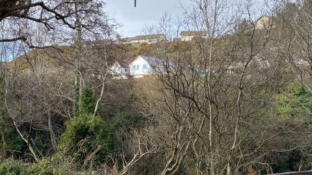
7.4.9 At the time of the Conservation Area designation there was significant intrusion into the vistas from within the glen from the residential developments visible at the top of the northern banks - Cleiy Rhennee, Broogh Wyllin (which is not shown on the Conservation Area map) and The Meadows.
7.4.10 The Appraisal discusses vistas into and within the Conservation Area and other than the trout farm, the intrusion of the two storey houses overlooking the glen and the poor appearance of the ablutions block, there are no adverse vistas noted. The few signs relating to the camp site and the children’s playground are considered neutral features.
7.4.11 The Appraisal discusses the camp site specifically, noting its appearance in the winter months when the site is devoid of tents and is uncluttered, but describing the summer months as when the “glen comes alive, as a variety of tents and motor homes take up sites so that their occupants can enjoy the natural beauty of the glen”. This is not described as a negative feature at all so perpetuating the lively nature of the glen at other times of the year, through the extension of the camping period, should surely not be considered detrimental to the character or appearance of the Conservation Area.
A photograph showing a hillside with several white houses visible through bare trees and vegetation.
7.4.12 The proposal will not significantly change the appearance of the camp site with the main areas where motorhomes and tents are pitched remaining as is and the location of the cabins largely screened from the principal views along the public highway by trees, topography or the motorhomes. In any case, the proposed structures are considered to be appropriate designed for their location and not to have an adverse impact on the character or appearance of the area and are arguably more attractive than the motorhomes and tents.
7.4.13 The camping pods which are to be located to the west of the ablutions block will be visible from the public highway although set lower than the road and flood bund is to be constructed alongside the road which will provide further screening.
10.03.2022 11.09.2021 showing where tents have been pitched
7.4.14 The units are appropriately designed for their location and will be more sympathetic than tents and will have some resemblance to the main facilities building in terms of their form and finish.
7.4.15 It is not believed that there are any archaeological issues in this case and information on this is not required for the EIA. Manx National Heritage were consulted in the 2017 application but made no comment and it is not believed that there are any archaeological features within the site. The Conservation Area Appraisal identifies features of present or past significance, none of which is believed to be within the application site.
7.4.16 Landscape impact is an issue which needs to be addressed albeit that some of this is dealt above in the section on impact on the Conservation Area. There are potentially further potential issues in respect of the impact of engineering operations on trees and indeed in the previous application concern was raised about the impact on trees of the creation of drainage channels. Since that decision, the applicants have sought advice and have dug trial holes to ascertain whether the drainage channels would impact any roots and none was found in these areas. The 10cm diameter pipes were laid in channels 400mm deep and discharge into the river, some via existing ditches and keeping the camping areas drier and their location has no effect on existing trees.
7.5 Interaction of factors
7.5.1 The various proposals in the application are not considered to have any significant change to the existing situation on site and further investigation into this element of the EIA is not considered necessary.
7.6 Operational effects
7.6.1 These are considered to be the impact of the use of the site as a camp site on the residential amenities on those in neighbouring dwellings as explained above, on the character and appearance of the area, on ecology and access. Access, highway safety and parking
7.6.2 Access, car parking and highway safety do not appear explicitly in the UK Regulations but are matters in the Strategic Plan (Transport Policies 4 and 7) so need to be assessed. These were not raised as an issue to a reason for refusal in the 2017 application and there was then no objection from Highway Services to the 2017 proposal. The submitted drawings show where vehicles will be parked and the visibility available at the entrance. It should be remembered that this is a public Glen which gives access to the beach and regardless of the camp site, is a popular destination by local people and visitors.
7.6.3 It was not envisaged that a Transport Assessment was required for the EIA or the application as the proposal is not considered to be “major development in accordance with Transport Policy 8 of the Strategic Plan insofar as what is proposed is not considered to significantly alter the traffic movements and parking requirement over and above how the site is and may currently be used and this is not a significant traffic generator given that there is at least established use of some parts of the site as a camp site and it is a National Glen open to the public and providing public access to Glen Wyllin beach. This position was confirmed by the Highway Services Division of Department for Infrastructure on 17.08.2021 provided that the application resembled the previous application which was not considered by them at that point to be a high traffic generator and the the car park was and is seen as beneficial to better cater for non—camp site visitors and events.
7.6.4 They advised that a Transport Statement covering the following matters would be helpful to identify existing and proposed facilities for and usage by pedestrians and vehicles for day to day activities when open. A transport statement reflecting this is provided.
7.7 Vulnerability
7.7.1 Parts of the site lie within areas of high risk of surface water flooding on the national flood risk maps. A Flood Risk Assessment is required and provided as part of the application under Environment Policies 10 and 13. The guidance of Department for Infrastructure’s Flood Risk Management Committee was sought prior to submitting the application and discussions with them on and off site were undertaken which have informed the application and the information provided with it.
7.7.2 The application includes a Flood Risk Assessment and additional Appendix which was formulated in discussion with the Flood Risk Management Committee’s direction and requirements. It identifies that only one area of proposed accommodation falls below estimated flood levels and to address this, it is proposed to add a flood bund, 0.5m high along the road to defend this area against flood water flow and details of this are shown in the FRA and on the proposed site plan.
7.7.3 The FRA also identifies the need for a flood evacuation plan specific to the campsite and provides an outline for this document which can be duly developed if and when planning approval is granted.
7.7.4 The 2017 application also identified a potential risk of land slip and the application included a submission from a Civil Engineering consultant who was instructed by the land owner, Department of Environment, Food and Agriculture who concluded that where there had previously been a land slip, this area was now considered to be stable and he saw no reason why camping could not continue on the site provided that there was no changes in condition of this slope.
7.7.5 The Department confirmed on 31.08.2021 that there has been no further slippage and that they continue to inspect the area at the start of each season, and as such, no further information is considered necessary in respect of this aspect of vulnerability.
8.0 Conclusion
8.1 A significant starting point is the most recent planning application for the development of the site as a camp site. That application is very similar to what is proposed and a number of conclusions were reached in that instance which are equally applicable to this proposal:
“In the Kirk Michael Local Plan, the application site is shown as falling within an area allocated as Public Open Space. Its present (and proposed) use does not seem to be wholly consistent with this designation since the camp site is privately run; and members of the general public appear to have only limited access to the application site, along public rights of way. It follows that General Policy 2 of the Isle of Man Strategic Plan, which indicates that planning approval will normally be granted for development that accords with the land-use zoning in the appropriate Area Plan, does not apply in this case. However, I know of no proposal for this land to be used as a public open space in accordance with its zoning on the Local Plan; and I attach weight to the fact that camping is an established use, which would be likely to continue whether planning approval is not granted or not. On balance, I am not persuaded that the inconsistency between the proposed use and the Local Plan zoning should tell against the present application.”
“73 I do not consider that the proposed development would affe the privacy of neighbouring residents, who live on higher land to the north of the Glen.”
“74 I attach weight to the conclusions of the civil engineering consultant instructed by Department of Environment, Food and Agriculture with respect to land stability. In his opinion, the slope where there was previously a landslip can now be considered stable. Subject to annual inspection of any changes in the condition of this slope, he sees no reason why camping cannot continue on the application site.”
“75 I cannot see why the proposed development should affect any public right of access.”
“77 The use of this land for motorhomes and touring caravans (as well as tents) clearly contributes to the Isle of Man’s tourism offer. The Designation Management Plan indicates potential grown in selfcatering holidays including camping. The Non-serviced Accommodation Futures Study says that camper vans and motorhomes are welcome and actively encouraged on the Island…The proposed extension of the camping season, to run from February to November inclusive, would wider the scope for self-catering holidays of this sort. In my view, these considerations tell strongly in favour of the proposed use.”
“78 I consider that the advantages of using the application site as a campsite for tents, caravans and motorhomes in the manner described, and the probation of the proposed parking area, would strongly outweigh the disadvantages.”
“84 The proposed pods, cabins and yurts would be serviceable in all weather, and would offer a relatively luxurious form of camping holiday. There would provide an extra dimension to the selfcatering accommodation available in Glen Wyllin. I have no doubt that this would add to the attraction of the Isle of Man as a tourist destination, with beneficial economic consequences. Paragraph 9.5.4 of the Strategic Plan refers to the need to broaden the range of tourist accommodation,. I have no doubt the proposed development would contribute to this objective. I attach weight to the DfE’s support for this scheme.”
“85 The installation of effective land drains should help reduce the number of occasions on which parts of the campsite become saturated and unusable, Provide that the proposed drainage system
would have no adverse effect on trees, I consider that it would be unexceptionable. Similarly, I consider that the installation of a geotextile mesh in the proposed parking area, and the erection of a screening fence around the area in which the catering van and the storage container would be kept, would be beneficial.”
8.2 The issues which were raised were the perceived adverse impact on the Conservation Area through the detraction from the open character and appearance and as it would neither preserve or enhance its character or appearance; the lack of an EIA, the lack of information about the effect of the works for surface water drainage and the lack of a Flood Risk Assessment.
8.3 We would submit that these issues have been satisfactorily addressed by the submission of the evidence and information that was previously lacking and have demonstrated by further information and amendments to the previous scheme, that the proposal will not have an adverse impact on the Conservation Area in accordance with the relevant policy.
8.4 Since the previous application, Government has published its strategy for the development of tourism on the Island and this aims to increase visitor numbers and making the most of the key Unique Selling Points of the Island - our coastline, seas, countryside, heritage. What is proposed will reduce the overall number of camping units on this site but will significantly improve the quality and visual impact of what is there, enhancing car parking provision, mitigating flood risk and addressing areas of the site which were prone to water-logging, making better use of it and all retaining the tourism use of the site with its cafe and play area which are available for public use. The development would enhance the attractiveness of the beach and coastline through presentation of a better looking camp site as one passes through the site en route for the beach as well as providing facilities on the Raad ny Foillan, enhancing the enjoyment of that and supporting the establishment of a route of Island-wide tourist facilities. We would suggest that the proposal is in accordance with and will help Government achieve the aims in its recently published strategy.
8.5 The development will reduce the impact of the camp site on those in the closest houses to it through the provision of better car parking facilities and the replacement of tents with a reduced number of solid walled units, the nearest of which to Glenside will not have any windows in the elevating facing it.
8.6 We would suggest that the current application addresses all of the previous reasons for refusal and complies with all of the relevant planning policies.
9.0 Conditions
9.1 The applicants would be happy to accept conditions which restrict the operating times of the site to 1st April to 30th September in any year with the 5 cabins adjacent to Glenside being available between 1st April and 31st December in any year.
9.2 A condition may be appropriate to require details to be provided to and approved by the Department prior to the erection of any of the proposed buildings, of the location and type of bird and bat boxes to be installed, possibly on existing trees which may be more suitable that the proposed cabins which are relatively low in height.
9.3 A condition may be considered to require the details of the Evacuation Plan in relation to mitigating flood risk.
Sarah Corlett 20th June, 2022
Appendix One Strategic Plan policies
Recreation Policy 2: Development which would adversely affect, or result in the loss of Open Space or a recreation facility that is or has the potential to be, of recreational or amenity value to the community will not be permitted except in the following circumstances: (a) where alternative provision of equivalent community benefit and of equivalent or better accessibility is made available; and (b) where there would be an overall community gain from the development, and the particular loss of the open space or recreation facility would have no significant unacceptable effect on local open space or recreation provision or on the character or amenity of the area.
Business Policy 11: Tourism development must be in accordance with the sustainable development objectives of this plan; policies and designations which seek to protect the countryside from development will be applied to tourist development with as much weight as they are to other types of development. Within the rural areas there may be (1) Tourism Strategy 2004 – 2008 Fit for the Future Department of Tourism and Leisure April 2004 87 situations where existing rural buildings could be used for tourist use and Environment Policy 16 sets out the circumstances where this may be permitted.
Business Policy 14: Tourism development may be permitted in rural areas provided that it complies with the policies in the Plan. Farmhouse accommodation or quality self catering units in barn conversions and making use of rural activities will be encouraged but must comply with General Policy
3 and Business Policies 11 and 12. Other forms of quality accommodation in rural areas will be considered, including the provision of hostels and similar accommodation suitable for walkers but must comply with General Policy 3 and Business Policies 11 and 12.
Environment Policy 1: The countryside and its ecology will be protected for its own sake. For the purposes of this policy, the countryside comprises all land which is outside the settlements defined in Appendix 3 at A.3.6 or which is not designated for future development on an Area Plan. Development which would adversely affect the countryside will not be permitted unless there is an over-riding national need in land use planning terms which outweighs the requirement to protect these areas and for which there is no reasonable and acceptable alternative.
Environment Policy 3: Development will not be permitted where it would result in the unacceptable loss of or damage to woodland areas, especially ancient, natural and semi-natural woodlands, which have public amenity or conservation value.
Environment Policy 4: Development will not be permitted which would adversely affect:
(a) species and habitats of international importance:
(i) protected species of international importance or their habitats; or
(ii) proposed or designated Ramsar and Emerald Sites or other internationally important sites.
(b) species and habitats of national importance:
(i) protected species of national importance or their habitats; (1) Wildlife Sites are defined in Appendix 1 41
(ii) proposed or designated National Nature Reserves, or Areas of Special Scientific Interest; or
(iii) Marine Nature Reserves; or
(iv) National Trust Land.
(c) species and habitats of local importance such as Wildlife Sites, local nature reserves, priority habitats or species identified in any Manx Biodiversity Action Plan which do not already benefit from statutory protection, Areas of Special Protection and Bird Sanctuaries and landscape features of importance to wild flora and fauna by reason of their continuous nature or function as a corridor between habitats.
Some areas to which this policy applies are identified as Areas of Ecological Importance or Interest on extant Local or Area Plans, but others, whose importance was not evident at the time of the adoption of the relevant Local or Area Plan, are not, particularly where that plan has been in place for many years. In these circumstances, the Department will seek site specific advice from the Department of Agriculture, Fisheries and Forestry if development proposals are brought forward.
Environment Policy 7: Development which would cause demonstrable harm to a watercourse, wetland, pond or dub, and which could not be overcome by mitigation measures will not be permitted. Where development is proposed which would affect a watercourse, planning applications must comply with the following criteria:
(a) all watercourses in the vicinity of the site must be identified on plans accompanying a planning application and include an adequate risk assessment to demonstrate that works will not cause long term deterioration in water quality;
(b) details of pollution and alleviation measures must be submitted;
(c) all engineering works proposed must be phased in an appropriate manner in order to avoid a reduction in water quality in any adjacent watercourse; and
(d) development will not normally be allowed within 8 metres of any watercourse in order to protect the aquatic and bankside habitats and species.
Environment Policy 10: Where development is proposed on any site where in the opinion of the Department of Local Government and the Environment there is a potential risk of flooding, a flood risk assessment and details of proposed mitigation measures must accompany any application for planning permission. The requirements for a flood risk assessment are set out in Appendix 4.
Environment Policy 13: Development which would result in an unacceptable risk from flooding, either on or off-site, will not be permitted.
Environment Policy 22: Development will not be permitted where it would unacceptably harm the environment and/or the amenity of nearby properties in terms of: i) pollution of sea, surface water or groundwater; ii) emissions of airborne pollutants; and iii) vibration, odour, noise or light pollution.
Environment Policy 23: When considering alterations and improvements to existing facilities the Department will require that consideration be given to the potential adverse impact of the proposed changes to existing neighbours.
Environment Policy 24: Development which is likely to have a significant effect on the environment will be required: i) to be accompanied by an Environmental Impact Assessment in certain cases; and ii) to be accompanied by suitable supporting environmental information in all other cases.
Environment Policy 35: Within Conservation Areas, the Department will permit only development which would preserve or enhance the character or appearance of the Area, and will ensure that the special features contributing to the character and quality are protected against inappropriate development.
Recreation Policy 2: Development which would adversely affect, or result in the loss of Open Space or a recreation facility that is or has the potential to be, of recreational or amenity value to the community will not be permitted except in the following circumstances: (a) where alternative provision of equivalent community benefit and of equivalent or better accessibility is made available; and (b) where there would be an overall community gain from the development, and the particular loss of the open space or recreation facility would have no significant unacceptable effect on local open space or recreation provision or on the character or amenity of the area.
Transport Policy 4: The new and existing highways which serve any new development must be designed so as to be capable of accommodating the vehicle and pedestrian journeys generated by that development in a safe and appropriate manner, and in accordance with the environmental objectives of this plan.
Transport Policy 6: In the design of new development and transport facilities the needs of pedestrians will be given similar weight to the needs of other road users.
Transport Policy 7: The Department will require that in all new development, parking provision must be in accordance with the Department’s current standards.
Appendix Two Planning Policy Statement 1/01 - Conservation of the Historic Environment of the Isle of Man
POLICY CA/2 SPECIAL PLANNING CONSIDERATIONS When considering proposals for the possible development of any land or buildings which fall within the conservation area, the impact of such proposals upon the special character of the area, will be a material consideration when assessing the application. Where a development is proposed for land which, although not within the boundaries of the conservation area, would affect its context or setting, or views into or out of the area; such issues should be given special consideration where the character or appearance of a conservation area may be affected.
Appendix Three UK Town and Country Planing (Environmental Impact Assessment) Regulations 2017
4.—(1) The environmental impact assessment (“ EIA”) is a process consisting of:
(a) the preparation of an environmental statement;
(b) any consultation, publication and notification required by, or by virtue of, these Regulations or
any other enactment in respect of EIA development; and
(c) the steps required under regulation 26.
(2) The EIA must identify, describe and assess in an appropriate manner, in light of each individual case, the direct and indirect significant effects of the proposed development on the following factors
—
(a) population and human health;
(b) biodiversity, with particular attention to species and habitats protected under Directive 92/43/
EEC(30) and Directive 2009/147/EC(31);
(c) land, soil, water, air and climate;
(d) material assets, cultural heritage and the landscape;
(e) the interaction between the factors referred to in sub-paragraphs (a) to (d).
(3) The effects referred to in paragraph (2) on the factors set out in that paragraph must include
the operational effects of the proposed development, where the proposed development will have operational effects.
(4) The significant effects to be identified, described and assessed under paragraph (2) include the
expected significant effects arising from the vulnerability of the proposed development to major accidents or disasters that are relevant to that development.
Copyright in submitted documents remains with their authors. Request removal
Source & Provenance
Official reference
22/00789/B
Source authority
Isle of Man Government Planning & Building Control