Planning Statement In Support Of Alterations To The Existing Dwelling To Create First Floor Roof Terrace, Ballavale Farmhouse, Ballavale Road, Santon Im4 1Eh
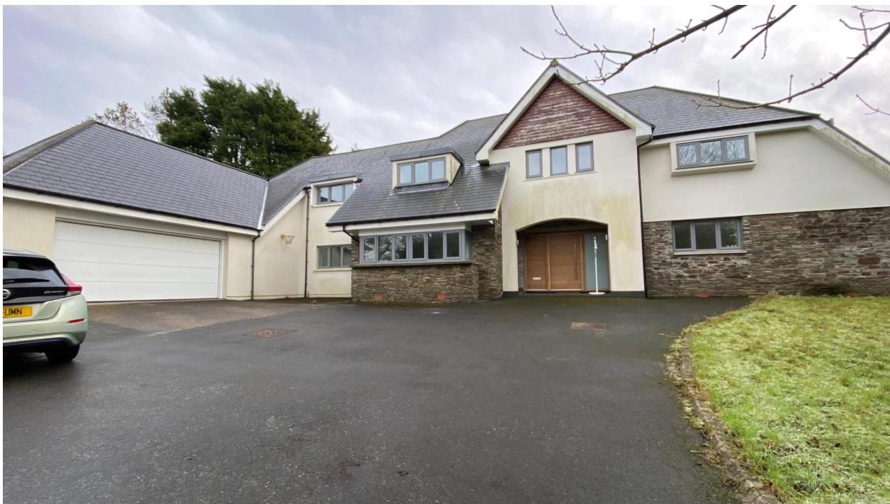
A photograph showing the front exterior of a large detached house with an attached garage and paved driveway.
1.0 Introduction
1.1 Ballavale Farmhouse is a single residential property situated off a lane which runs to the east of Ballavale Road (B26). The dwelling sits to the south of the lane and comprises a detached dwelling with attached garage and with a detached residential outbuilding situated to the north east (see Planning History).
1.2 Access is available into the site from the lane via an existing driveway which leads to a hard surfaced parking and manoeuvring area.
1.3 To the immediate south west of the site is a group of partly former agricultural barns and some new build structures, arranged around a square courtyard which now form a single residential property which is the subject of a current application for additional use as meeting and office space. The complex is mostly renovated stone barns with the only completely new building on previously undeveloped space being the garage which backs onto the lane. This is a rendered structure with three garage doors and a large pedestrian door giving access to a gym area to the east of the garaging. This property is also owned by the applicant.
1.4 The dwelling sits in an area bounded by the lane to the north, the railway line to the south, a hedge and stream to the west. All of the surrounding area is in the same ownership as the application site as shown on the location plan including Ballavale across the lane to the south west, Mallards to the south west and Ashdowne House across the Ballavale Road together with significant land surrounding these properties and land of the approved scheme for the creation of a botanic garden (see 2.9 Planning History below).
2.0 Planning history Ballavale Farmhouse
2.1 Ballavale Farmhouse was originally approved as an agricultural dwelling but after a period of non compliance with the occupancy condition, a Certificate of Lawfulness was sought and issued (06/00299/LAW) in respect of the use of the property as a private dwelling as it has been used ever since.
2.2 The site was then the subject of applications for extensions which were refused (06/01878/B - refused as the garage was deemed to be tantamount to a new self contained dwelling) but later permitted (07/01422/B and 08/00948/B the latter of which was implemented and reflects what exists on site today see photograph on the title page and below).
2.3 A wooden outbuilding, 13/00328/B was permitted with a further extension of this approved outbuilding under 15/00115/B also approved.
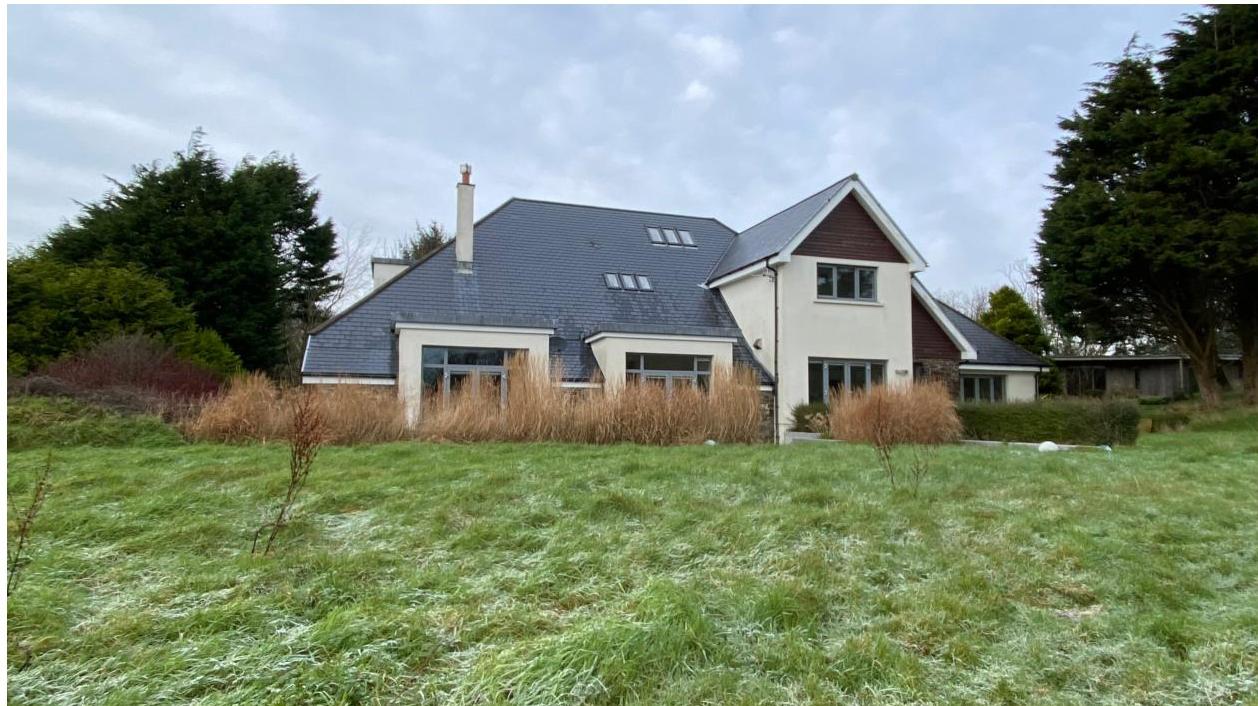
A photograph showing the exterior of a large detached house with a slate roof, situated in a grassy, rural setting with mature trees.
Ballavale Barns
2.4 The site was the subject of a number of applications for the conversion of the building to a dwelling (01/01130/A, 02/01228/B, 04/00624/B and 05/01006/B).
2.5 In 2006 applications were submitted for the “necessary demolition of further limited areas of the existing structure” and modifications to regularise additional demolition over and above what had been permitted in the conversion in the previous application. These applications, 06/00205/B and 06/02243/B were permitted.
2.6 An application to erect an annex for additional living accommodation was refused under 08/02324/B.
2.7 10/00041/B proposed the erection of the replacement building to provide the gym, boat store and garage and was permitted.
2.8 13/91380/B - conversion of the existing gym, garage and boat store to tourist accommodation - permitted.
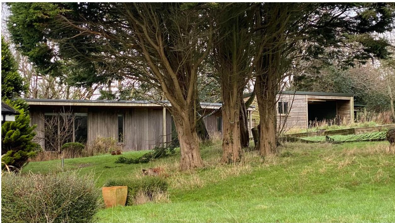
A photograph showing a single-story wooden building, likely a bungalow, partially hidden by large trees. To the right, a separate wooden outbuilding or garage stands in a grassy, rural setting.
2.9 An application has recently been submitted but has not yet been validated for theadditional use of this property as meeting rooms.
Ballavale Farm Old Farmhouse
2.10 Ballavale Farm Old Farmhouse across the lane from the application site was permittedfor replacement under 02/00686/A and 04/00531/B and for a conservatory under 04/02233/B. This property is now within the ownership of the applicant.
Land alongside Ballavale Road
2.11 The applicant’s ownership extends significantly in all directions from the application siteas shown on the submitted plans and importantly includes land which was the subject offour applications which cumulatively proposed to create a botanic garden. Theseapplications were:
13/00830/B - creation of a production house and walled garden (amended under 16/00358/ B
13/00831/B - creation of a water cascade and amphitheatre
13/00832/B - creation of meadow orchard, meadow, lake, wetlands, boglands and glen 13/00834/B - creation of gardener’s compound and sensory garden: this incorporated new buildings for vehicle and machinery storage as well as a more formal building for education, changing facilities, office facilities, archive library and kitchen facilities. These new buildings have not been implemented 13/00365/B - erection of temporary greenhouse
Ashdowne House
2.12 This property sits alongside the access to the Santon Railway Station, on the westernside of Ballavale Road and has permission for the creation of a new house through theredevelopment of the former dwelling, under 12/00355/B, 15/00902/B, 16/00160/B,18/00040/B and 23/00244/B. This property is within the ownership of and is the residenceof the applicant.
Ballachrink Farm
2.13 This farm sits alongside the A25 Old Castletown Road and comprises two dwellings anda range of new and older agricultural buildings. This farm is now in the ownership of theapplicant and recently planning approval was granted for the alterations and extension tothe old farmhouse to provide facilities for those working within the estate and also living
space for visiting consultants (21/00299/B). These visiting consultants are associated with the botanic garden project.
2.12 The planning officer notes in his report:
2.6 ...The land which was formerly agricultural is now being developed as a botanic garden which requires more intensive hands-on management, both from local resident staff and from visiting experts. Whilst previously there would have been daily care and physical management of the land and its stock, the management now involves botanical planting, and maintenance of trees, waterways and meadows. The land in question used to employ one permanent farm worker, but now employs nine permanent horticultural and botanical staff, with a commensurate increase in need for welfare facilities. The botanic garden also requires the intervention and involvement of visiting specialists - botanists and landscapers from different regions - whose permanent presence on the land is not required. It is still proposed for the farmhouse to be residential for those associated with the running of the botanical garden.
3.0 Planning policy context
Area Plan for the East
3.1 The site lies within an area designated on the Area Plan for the East as not for a particular purpose - essentially countryside as defined in Environment Policy 1 of the Strategic Plan.
3.2 On the Environmental Constraints Map which accompanies the Area Plan, the land to the west of the adjacent former barns and to the north thereof, but not immediately alongside the application site, is identified as being of ecological interest (draft) and the land to the north of the adjacent former barns and the application site is identified as accommodating Registered Trees.
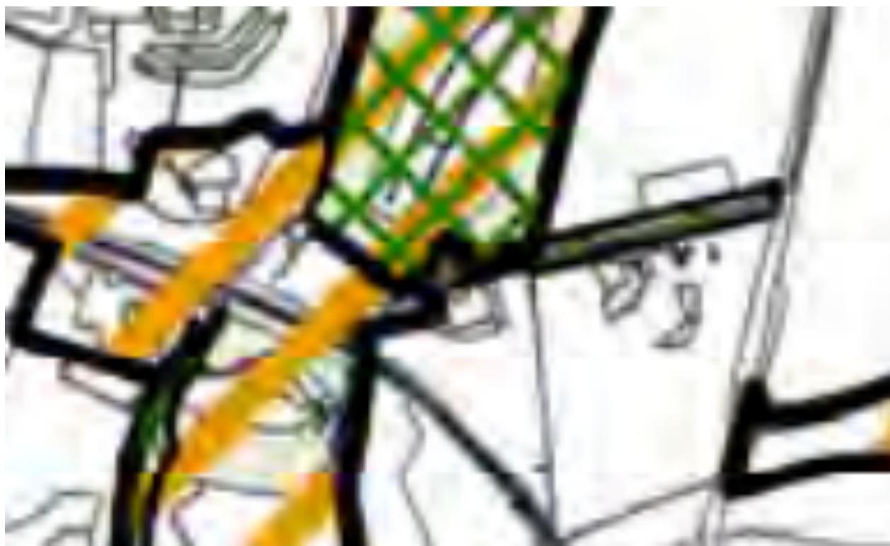
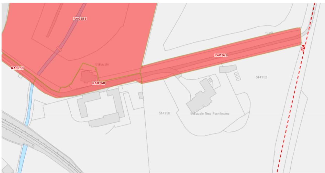
3.3 The Registered Tree area is shown more clearly on the Island Environment Map shown below where there are no sites of ecological significance highlighted. The footpath 314 is also shown on this map running to the east of the application site from Brown Cow Hill on the A5, across the railway line and meeting the A25 Old Castletown Road to the south.
A close-up view of a site plan or map showing thick black boundary lines and colored overlays including green cross-hatching and yellow markings.
3.4 The only constraint shown on the Infrastructural Constraints Map is the existing overhead high tension line running to the east of the house parallel with the lane, and the site lies outside of the area where there are building height restrictions due to the proximity to the Isle of Man Airport.
3.5 There are no Community Constraints shown on the relevant map accompanying the Area Plan.
3.6 In 2008 the Department commissioned a Landscape Character Assessment of the Island, intending to replace the areas of High Landscape or Coastal Value and Scenic Significance on the Isle of Man Planning Scheme (Development Plan) Order 1982. The site falls into an area so designated in 1982. Rather than qualitative designations, the Landscape Character Assessment divides the Island into character types. The application site falls within the D13 Incised Inland Slopes area and the full assessment (which is provided at Appendix One) is set out in the Area Plan as follows:
A site plan map showing the location of Ballavale New Farmhouse with red shaded zones indicating specific areas or constraints.
Landscape Character Area Santon (D13) Landscape Strategy Conserve and enhance:
a) the character, quality and distinctiveness of the area, with its wooded valley bottoms and wooded horizons;
b) its scattered settlement pattern;
c) its Victorian garden and the railway.
Key Views Open and expansive views from the higher areas along the rugged coast in the east and inland towards the upland areas over Braaid. Incinerator chimney forms a notable landmark in the immediate area. Glimpsed views framed by vegetation in the valley bottoms and along the main roads where they follow the wooded valley bottoms. Views in the northern part of the area up to the Transmitting Masts on top of Douglas Head hill top. Views from Isle of Man Steam Railway
3.7 This is followed by a proposal:
Landscape Proposal 7 (Santon) In cases where new development is proposed, applications must demonstrate that it can be suitably integrated into the surrounding landscape setting through reasonable mitigation measures and considering siting, colours, materials, finishes and the general scale.
3.8 The Area Plan also contains policies protecting the steam railway and views therefrom:
Landscape Proposal 10 (for the Manx Electric Railway, the Mountain Railway and the Isle of Man Steam Railway).
This is applicable to those linear corridors for the named railway forms, the linesof-sight required for their safe and continued operation and also as a consideration to sites proximate to those corridors and where the predominant view is of those corridors.
For the Isle of Man Steam Railway - Views as seen from Isle of Man Steam Railway are to be preserved; development which would significantly intrude on such views will generally not be supported. Safety and continued operability will require some clear line-of-sight corridors, and these shall be maintained.
For the Manx Electric Railway (including the Mountain Railway) - Views as seen from the Manx Electric Railway are to be preserved; development which would significantly intrude on such views will generally not be supported. Safety and continued operability will require some clear line-of-sight corridors, and these shall be maintained.
Prospective Applicants wishing to develop along these routes (which includes sites located adjacent to the boundary of the railway line or within close proximity to the transport corridors) should engage with the Department of Infrastructure 33 for advice ahead of the submission of any planning application. Prior to any decision on a planning application for which Landscape Proposal 10 is relevant, advice will normally be sought from the Department of Infrastructure.
3.9 Environment Policy 2 confirms that the areas of an area of High Landscape or Coastal Value and Scenic Significance will be replaced by a landscape classification which will introduce different categories of landscape and policies and guidance for control therein. The Landscape Character Assessment introduces such a classification although cannot introduce policies which are the sole domain of the Strategic Plan or Planning Policy Statement (PPS): Area Plans may only introduce proposals, not policies. Whilst there is a draft PPS in the role of Landscape Character in Development which encompasses the landscape classification types in the original 2008 Assessment and the East and South Area Plans, it is not yet adopted. There are therefore no policies related to the Landscape Character Assessment so it is relevant to still make reference to Environment Policy 2 of the Strategic Plan where development is proposed in areas of an area of High Landscape or Coastal Value and Scenic Significance: this states that within these areas the protection of the character of the landscape will be the most important consideration unless it can be shown that: (a) the development would not harm the character and quality of the landscape; or (b) the location for the development is essential.
Isle of Man Strategic Plan 2016
3.10 The Strategic Plan provides planning guidance which applies to all of the Island. Here, development is generally directed towards settlements (Strategic Policies 1, 2 and 10, Spatial Policy 5 and Transport Policy 1). The countryside is protected for its own sake (Environment Policy 1) and development which is harmful to the countryside is presumed against.
3.11 There is, however, provision for the extension of existing dwellings in the countryside. There are two policies which guide this form of development - one relating to existing traditional dwellings (Housing Policy 15) and the other to all other forms of dwelling, described as either non traditional or of poor form (Housing Policy 16). The existing dwelling is not considered to be traditional and as such, it is this policy which is considered the more appropriate in this case. It states:
The extension of non-traditional dwellings or those of poor or inappropriate form will not generally be permitted where this would increase the impact of the building as viewed by the public.
3.12 Development is expected to comply with the general standards set out in General Policy 2 and in the assessment of the impact on the living conditions of those in adjacent properties (General Policy 2g), the provisions of the Residential Design Guide are also considered relevant. In terms of new balconies and terraces, the Guide suggests that:
4.11.1 These can add a welcome amenity to a dwelling, as long as the scale, design, and materials complement the character of the property, whether it is traditional or modern.
4.11.2 In most instances, roof terraces on terraced or semi-detached properties are unlikely to be acceptable.
4.11.3 For detached properties they can be acceptable where they are carefully designed to avoid unreasonable overlooking of neighbouring properties (including gardens). Large separation distances to neighbouring boundaries and habitable room windows will help to avoid such issues.
4.11.5 Balconies should not result in views into the rear windows of neighbouring properties at a distance of less than 20 metres.
4.11.6 Additional consideration should also be given to the potential visual impact upon the streetscene and the individual dwelling.
4.11.7 A projecting balcony can result in an alien and top heavy feature, particularly at first floor level or above. Thought should be given to minimising the visual impact of such an addition with regard to the size, projection, and materials.
4.11.8 Balconies should be designed to complement the proportions and character of the property and should be in line with windows on the original house.
4.11.11 These areas should be designed sensibly in order to avoid dominance at the front boundary of a property. Large areas of decking are unlikely to be supported at the side or front of a property.
4.0 The proposal
4.1 Proposed is the introduction of a first floor balcony area at the rear of the dwelling. This will be accessed from the existing bedroom alongside through a new sliding door opening.
4.2 On the ground floor the walling on the rear elevation will be refinished in smooth painted render and a new platform constructed above, surrounded by glazed balustrades. Two new projections will be constructed, taking the form of zinc finished flat roofed dormers and will accommodate the new door opening onto the balcony and a new glazed projection serving the existing en suite bathroom alongside.
4.3 An existing chimney at the rear of the property will be removed to facilitate the development.
4.4 The rest of the dwelling will remain generally as existing internally and externally.
5.0 Conclusion
5.1 The proposed works are not publicly visible other than potentially from the railway line which is over 100m away. In any case, the proposed works do not change the already modern character of the property and would not look out of place or detrimental in any way.
5.2 The proposed changes do not result in the overlooking of any other property, the orientation of the existing house in relation to Ballavale Barns resulting in no view being available of this adjacent property from the application site proposals: Ballavale Farm house’s southern elevation looks towards the south east whereas the southern elevation of Ballavale Barns looks south and is set slightly further back than is the application property.
5.3 The proposed works would not result in a top heavy appearance of the property as the existing roof is significant and the balcony taking up less than one third of the overall rear elevation and with the adjacent two storey projecting annex rising taller than it and the proposed dormers. What is proposed remains subservient to the remaining elevation all in accordance with the advice in the Residential Design Guide.
5.4 The proposed works will add useful external space to the property, enhancing its accommodation without any adverse or significant environmental impact. The works follow
the advice provided in the Residential Design Guide and accord fully with General Policy 2 and Housing Policy 16 of the Isle of Man Strategic Plan 2016, Area Plan for the East and the Landscape Character Assessment.
Sarah Corlett 13.01.25
APPENDIX ONE EXCERPT FROM THE LANDSCAPE CHARACTER ASSESSMENT, 2008
D13 - SANTON Key Characteristics
• A predominantly rural landscape, dissected by A5 and A25 roads.
• Densely wooded valley bottoms amongst undulating rolling land with large rectilinear arable and pastoral fields on the gently sloping hill sides and rounded tops.
• Steep sided densely wooded Victorian pleasure Glens of Glen Grenaugh and Port Soderick Glen lead down to the coast.
• Victorian electric railway line and stations runs through the area at the bottom of Crogga Glen.
• Fragmented woodland along field boundaries and along tracks that access the scattered farm houses centred around Quine’s Hill (along the A25) and small settlements of Santon and Ballaveare.
• Sea-facing hill slopes with large open fields running along the cliff tops with gorse, heather and bracken along the cliff top periphery.
• Incinerator chimney forms notable landmark in the immediate area.
• Presence of Manx Milestones.
• Abrupt linear southern built edge to Douglas, comprising residential and industrial development with minor localised extension of industrial character into character area south of Cooil Road.
• Pulrose Golf Course on edge of Douglas
Overall Character Description Numerous gentle to steeply sided river valleys cut down into the landform to form an undulating and rolling character with pronounced incised valleys. Glen Grenaugh and Port Soderick Glen are steepsided densely wooded valleys, the latter appropriated during the Victorian period as pleasure Glens with walkways and features such as bandstands and bridges. Linear fragmented woodland runs along the valley bottoms of these National Glens and along Crogga River. Hedgerow trees and woodland blocks surround the numerous farms in the area, which are predominantly located in the north of the area around Quine’s Hill.
Medium sized rectilinear arable and pastoral fields delineated predominantly by Manx hedges and some post and wire fences form a strong geometric field pattern on the gently sloping hill sides and rounded tops in the south of the area. Smaller rectilinear fields enclosed by
Manx hedgerows, containing large hedgerow trees, cover the more settled north-eastern area where farmsteads such as Hampton Court and Cronkbane are concentrated. This field pattern stops abruptly in the north of the area where it meets the A24 and the linear builtup edge of Douglas. The far north-eastern part of the area comprises the Pulrose Golf Course, which extends in towards the centre of Douglas. Patches of gorse and heather grow in areas on the more exposed hill tops and along the eastern edges of the fields of the coastal facing slopes, along which the cliff top coastal path runs and forms the area’s seaward boundary.
The busy A25 runs along the lower valley sides with small, often steep and winding tracks branching off perpendicular from the main road to provide farm access, while smaller predominantly straight B roads, enclosed by tall hedgerow vegetation, which follow the grain of the rectilinear field pattern and link the small and wooded settlements within the area such as Santon and Seafield. The Victorian Electric Railway runs through the area along Crogga Glen with stations at Santon and Port Soderick before skirting around the bottom of Douglas Head which forms the north eastern boundary. Moderate sense of tranquillity away from Douglas and the major roads.
Key Views
• Open and expansive views from the higher areas along the rugged coast in the east and inland towards the upland areas over Braaid.
• Incinerator chimney forms a notable landmark in the immediate area.
• Glimpsed views framed by vegetation in the valley bottoms and along the main roads where they follow the wooded valley bottoms.
• Views in the northern part of the area up to the Transmitting Masts on top of Douglas Head hill top.
• Views from Isle of Man Steam Railway
Historic Features
• Victorian Isle of Man Steam Railway and stations, including Port Soderick (Registered Building) and the Old Toll Booth (Registered Building).
Ecological Features
• Farmland grassland habitats.
• Mature network of hedgerows containing deciduous trees in field boundaries.
• Aquatic and waterside habitats along river courses.
• Dense riparian woodland in Valley bottom with deciduous woodland along valley sides.
• Exposed heathland on steeper sea facing slopes.
Key Issues and landscape sensitivities
• Wooded horizons and skyline seen from valley bottoms.
• Ecological value of the aquatic and waterside habitats.
• Various sized pastoral and arable fields with Manx hedges.
• Wooded valley bottom with fragmented woodland along substantial field boundaries.
• Scattered farmsteads fringed by trees.
• Wooded Victorian Pleasure Glen at Port Soderick.
• Victorian Isle of Man Steam Railway and stations.
• Presence of Manx Milestones.
Landscape Strategy The overall strategy should be to conserve and enhance the character, quality and distinctiveness of the area, with its wooded valley bottoms and wooded horizons, its scattered settlement pattern, its Victorian pleasure glen and the railway.
APPENDIX TWO
Strategic Plan policies
Strategic Policy 1: Development should make the best use of resources by: (a) optimising the use of previously developed land, redundant buildings, unused and under-used land and buildings, and reusing scarce indigenous building materials; (b) ensuring efficient use of sites, taking into account the needs for access, landscaping, open space(1) and amenity standards; and (c) being located so as to utilise existing and planned infrastructure, facilities and services.
Strategic Policy 2: New development will be located primarily within our existing towns and villages, or, where appropriate, in sustainable urban extensions(2) of these towns and villages. Development will be permitted in the countryside only in the exceptional circumstances identified in paragraph 6.3.
Strategic Policy 4: Proposals for development must: (a) Protect or enhance the fabric and setting of Ancient Monuments, Registered Buildings(1), Conservation Areas(2) , buildings and structures within National Heritage Areas and sites of archaeological interest; (b) protect or enhance the landscape quality and nature conservation value of urban as well as rural areas but especially in respect to development adjacent to Areas of Special Scientific Interest and other designations; and (c) not cause or lead to unacceptable environmental pollution or disturbance.
Strategic Policy 9: All new retail development (excepting neighbourhood shops and those instances identified in Business Policy 5) and all new office development (excepting corporate headquarters suitable for a business park(1) location) must be sited within the town and village centres on land zoned for these purposes in Area Plans, whilst taking into consideration Business Policies 7 and 8.
Strategic Policy 10: New development should be located and designed such as to promote a more integrated transport network with the aim to: (a) minimise journeys, especially by private car; (b) make best use of public transport; (c) not adversely affect highway safety for all users, and (d) encourage pedestrian movement
General Policy 2: Development which is in accordance with the land-use zoning and proposals in the appropriate Area Plan and with other policies of this Strategic Plan will normally be permitted, provided that the development:
(a) is in accordance with the design brief in the Area Plan where there is such a brief;
(b) respects the site and surroundings in terms of the siting, layout, scale, form, design and landscaping of buildings and the spaces around them;
(c) does not affect adversely the character of the surrounding landscape or townscape;
(d) does not adversely affect the protected wildlife or locally important habitats on the site or adjacent land, including water courses;
(e) does not affect adversely public views of the sea;
(f) incorporates where possible existing topography and landscape features, particularly trees and sod banks;
(g) does not affect adversely the amenity of local residents or the character of the locality;
(h) provides satisfactory amenity standards in itself, including where appropriate safe and convenient access for all highway users, together with adequate parking, servicing and manoeuvring space;
(i) does not have an unacceptable effect on road safety or traffic flows on the local highways; (j) can be provided with all necessary services;
(k) does not prejudice the use or development of adjoining land in accordance with the appropriate Area Plan;
(l) is not on contaminated land or subject to unreasonable risk of erosion or flooding;
(m) takes account of community and personal safety and security in the design of buildings and the spaces around them; and
(n) is designed having due regard to best practice in reducing energy consumption.
Environment Policy 16: The use of existing rural buildings for new purposes such as tourist, or small-scale industrial/commercial use may be permitted where:
a) it is demonstrated that the building is no longer required for its original purpose and where the building is substantially intact and structurally capable of renovation;
b) the reuse of the building will result in the preservation of fabric which is of historic, architectural, or social interest or is otherwise of visual attraction;
c) it is demonstrated that the building could accommodate the new use without requiring extension or adverse change to appearance or character;
d) there would not be unacceptable implications in terms of traffic generation;
e) conversion does not lead to dispersal of activity on such a scale as to prejudice the vitality and viability of existing town and village services; and
f) the use of existing buildings involves significant levels of redevelopment to accommodate the new use, the benefits secured by the proposal in terms of impact on the environment and the rural economy shall outweigh the continued impact of retaining the existing buildings on site.
Proposals to convert rural buildings to residential accommodation will be considered along with the advice given at Section 8.10 of this document.
Business Policy 7: New office floor space should be located within town and village centres on land which is zoned for the purpose on the appropriate area plan; exceptionally, permission may be given for new office space (a) on approved Business Parks for Corporate Headquarters which do not involve day to day callers; or (b) in buildings of acknowledged architectural or historic interest for which office use represents the only or most appropriate practicable and economic way of securing future use, renovation and maintenance.
Transport Policy 4: The new and existing highways which serve any new development must be designed so as to be capable of accommodating the vehicle and pedestrian journeys generated by that development in a safe and appropriate manner, and in accordance with the environmental objectives of this plan.
Transport Policy 7: The Department will require that in all new development, parking provision must be in accordance with the Department’s current standards.
Copyright in submitted documents remains with their authors. Request removal
Source & Provenance
Official reference
25/90048/B
Source authority
Isle of Man Government Planning & Building Control