Loading document...
Proposed Change of Use from Agricultural/Equestrian Land to Residential Curtilage (Private Garden), Langdale, Gansey, Port St Mary
Proposed Change of Use from Agricultural/Equestrian Land to Residential Curtilage (Private Garden), Langdale, Gansey, Port St Mary
This Planning Statement is submitted in support of a full planning application seeking consent to change the use of a strip of agricultural/equestrian land adjacent to the property known as "Langdale", Gansey, Port St Mary, into domestic garden land (residential curtilage). The proposal involves a relatively modest extension of the existing garden boundary to incorporate an adjacent area of improved grassland currently used for grazing, riding and jumping of horses.
The change of use is required to provide a garden area more proportionate to the scale of the existing dwelling, which is a large family residence with limited usable outdoor amenity space. The extended curtilage would support typical residential use. The proposal includes minor boundary works to integrate the new area within the existing property layout, and, importantly, to provide privacy from the apartments now being built at the Bay Queen development which overlook the applicant’s existing amenity space.
This document presents a detailed assessment of the proposal, referring to relevant Isle of Man Strategic Plan 2016 policies and comparable planning applications. The supporting information demonstrates that the proposal will not result in harm to the character, appearance or function of the countryside and is consistent with past decisions on the Island.
The application site comprises an area of improved agricultural and equestrian land situated immediately adjacent to the residential property known as "Langdale", located in Gansey, Port St Mary. The existing dwelling is a well-established, two-storey detached house set within a defined residential curtilage that includes a domestic garden, vehicular access, and a brick boundary wall to the rear. The land proposed for inclusion within the curtilage forms a logical and direct continuation of the existing garden space and is clearly delineated on the submitted location and site plans.
The parcel of land in question is relatively flat, regularly maintained, and exhibits characteristics consistent with low-intensity equestrian use, including informal riding and jumping activities. It is free from any built structures, permanent service infrastructure, or significant natural features such as mature trees. The land is not subject to any statutory environmental or landscape designations, nor are there any identified planning constraints that affect its current use or future management.
Geographically, the site lies outside the defined settlement boundary, within a rural character area as identified in the relevant planning policy framework. Despite its rural setting, the site benefits from proximity to the main dwelling and is visually and functionally associated with the residential property. Access is via a lightly trafficked rural lane, and the location enjoys a high degree of visual enclosure. The proposed extension area is not visible from any public vantage points and is screened effectively by existing topography, surrounding vegetation, and the built form of Langdale itself. Consequently, the proposed change would not result in any material visual or landscape impact, nor would it alter the prevailing rural character of the area.
The images above, taken from the adjacent public road (Gansey Road), clearly demonstrate that only the upper storey of the residential property is visible above a substantial and continuous belt of gorse and vegetation.
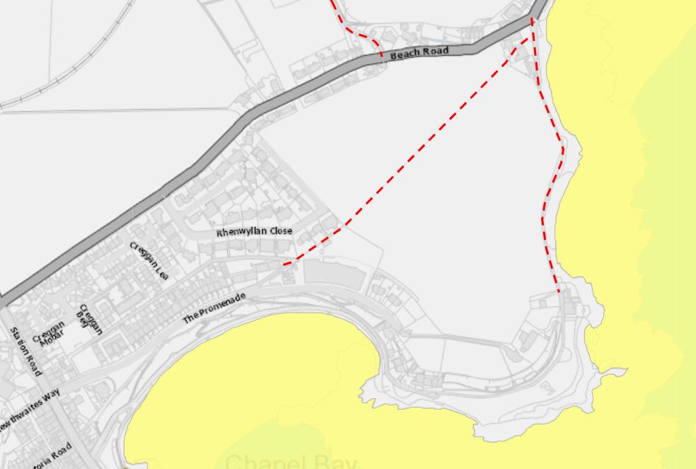
This natural screening, combined with the rising topography and existing landscaping, entirely obscures views of the property's grounds as well as the parcel of land proposed for incorporation into the residential curtilage. As such, the site is not visible from public vantage points, and the proposed curtilage extension would not result in any discernible change to the visual character or appearance of the area when viewed from the surrounding public realm. The map excerpt below shows that the nearest Public Right of Way is a significant distance from the site and would not provide any obvious views of the land.
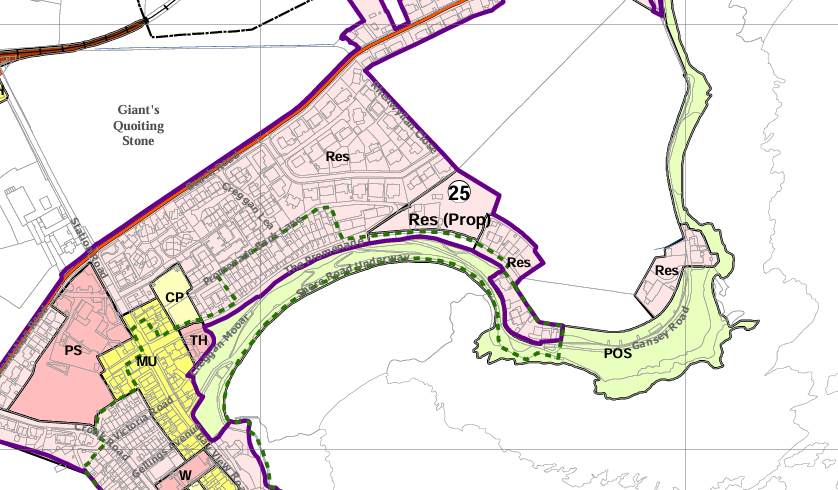
The Area Plan for the South identifies the existing dwelling and its curtilage as falling within an area zoned as Predominantly Residential, with the land proposed to be incorporated into the curtilage classified as 'white land' -that is, land which is not subject to any specific zoning designation for development purposes.
Area Plan for the South – Map 7 Port Erin/Port St Mary
The application seeks permission for a change of use of approximately 418 sq.m of agricultural/equestrian land to domestic garden. The works proposed are limited to:
The land will be laid to lawn or planted with low-level domestic vegetation and used as informal amenity space for the household. The extension creates a natural continuation of the existing residential plot.
It is not considered necessary to remove Permitted Development provisions as part of any approval of this application. The area of land is relatively modest, would be bounded by an in-keeping boundary treatment and there would be no harm arising from the types of small-scale development that are permissible under the Permitted Development Order.
The application is assessed against the Isle of Man Strategic Plan 2016, which sets out the spatial planning framework for development decisions across the Island.
Environment Policy 1 (EP1): Protects the countryside and its character from unnecessary or intrusive development. Proposals must demonstrate that they do not cause material harm or detract from rural landscapes.
Environment Policy 14 (EP14): Seeks to retain the best and most versatile agricultural land (Classes 1 and 2) in productive use. The application site is understood to be Class 3 / 4, and therefore not afforded the stronger policy protection established under EP14.
Supporting considerations include:
The proposed extension arises from a genuine need to enhance the quality and usability of outdoor residential space associated with a large dwelling. The existing garden area is modest in scale relative to the footprint and occupancy potential of the property following expansive approved development works conducted during 2019 to 2021. The extended land will be used in a traditional garden setting and will enhance the liveability of the home.
The curtilage extension is modest in extent and forms a natural continuation of the existing boundary. The proposed wall and fence treatments are visually consistent with the rural character of the area and will be visually unobtrusive. The site is well screened from public roads and footpaths. The layout reflects a rational and logical boundary realignment and avoids fragmentation of the surrounding fieldscape.
The land is not high-value agricultural land (the document Agricultural Soils of the Isle of Man seems to show this area as being Class 3 / 4) and is not in active productive use beyond grazing (in fact the land has been used for equestrian/horse-jumping purposes for a significant period of time). Its small size, peripheral location and limited quality support its release to domestic use without conflict with Policy EP14.
The proposal does not represent encroachment, ribbon development or inappropriate subdivision of land. It does not include any urbanising features or landscaping that would erode rural character. The low impact, coupled with containment by built form and proposed boundary treatment, preserves the countryside character of this location in line with EP1.
A number of applications have been approved across the Island for the extension of residential curtilage into adjoining land, typically where the scale is modest, there is no adverse impact on the landscape, and the land is logically related to the host dwelling. These include:
These cases collectively demonstrate that where the proposed change of use:
planning permission has routinely been granted. The current application is materially similar and should be supported on a consistent policy basis.
The proposal represents a well-justified and proportionate change of use of adjoining land to form a more functional and appropriate garden setting for an established residential property. The scheme is:
There are no overriding planning objections. The land has low agricultural or ecological value, and its change of use will result in no demonstrable harm. The introduction of clear and sensitive boundary treatments will ensure visual cohesion and safeguard the setting.
It is not considered necessary to remove Permitted Development provisions, as the land involved is small-scale, enclosed, and would not give rise to harmful impacts through the types of development ordinarily allowed under the PDO.
On this basis, planning permission is respectfully sought for the proposed change of use and construction of a wall to delineate the revised curtilage.
Copyright in submitted documents remains with their authors. Request removal