Planning Statement For The Erection Of A Covered Equestrian Arena, Field 214282, Goldies Loughan, Jurby East Im7 3Ez
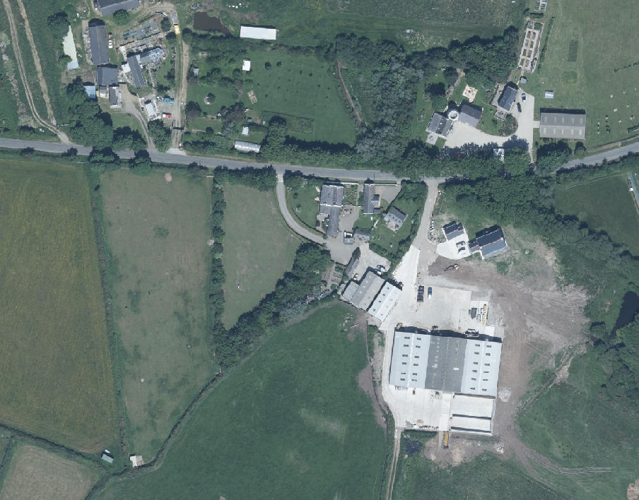
Aerial view of a rural site showing agricultural fields, a road, and existing buildings including large agricultural structures.
1.0 Introduction
1.1 The site is the curtilage of, and land associated with the holding known as Goldie’s Loughan which lies on the southern side of the Bretney Road (B3) which runs west to east between the Jurby Coast Road (A10) and Jurby East and continues east to join the Andreas Road (A17) just south west of Andreas Village.
1.2 The site includes a dwelling, Goldie’s Loughan, which is a traditional Manx cottage which has its gable to the road, and a range of additional outbuildings including a former byre which sits to the east of the cottage and which has been renovated to form holiday accommodation and which recently had permission for use as a residential property, a former stable which has permission for conversion to a home office and a more modern agricultural building which has additional permission for equestrian use.
1.3 The group takes the form of a generally traditional arrangement of buildings other than the agricultural/equestrian building. There are three means of access into the farm yard area from the B3, together with a field access to the west which provides access to the fields associated with the holding.
1.4 The holding extends to approximately 3.7 acres.
1.5 The holding is currently managed to accommodate horses. The applicants presently have one horse in foal and one pony. The horses are not put on permanent grazing but are fed twice a day in addition to grazing and are provided with hay or haylage for the 12-14 hours when they are not out grazing. The fields have been fenced and are managed so that the grazing is rotated and the fields allowed to rest and recover whilst the horses are grazing in another area. The applicants also have access to a further 40 acres of grassland should additional grazing land be required.
1.6 The applicants’ family are learning carriage driving in addition to normal riding activities.
2.0 Planning policy
2.1 The starting point for the determination of any planning application is the land use designation in the relevant adopted development plan. In this case this is the Isle of Man Planning Scheme (Development Plan) Order 1982 although this is in the process of being updated by the Area Plan for the North and West. On the 1982 Plan (below) the site is within an area not designated for a particular purpose and not part of an area of an area of High Landscape or Coastal Value and Scenic Significance with an area of Woodland centred on the house and farmyard.
2.2 In this part of the Island, the Isle of Man Planning Scheme (Development Plan) Order 1982 is being replaced by a new Area Plan (for the North and West). This was the subject of Preliminary Publicity in 2021 and has passed through a draft Plan stage and is to be the subject of a public inquiry in July 2024. The latest documents published in respect of the draft Area Plan confirms the designation of the site as not for a particular purpose.
2.3 This draft Plan also has maps which show specific constraints, including the Environmental Constraints (right) where the area of Woodland (and Registered Trees) is shown in a slightly different position to that of the 1982 Plan above and now outwith the site and with no other Environmental Constraints shown applying to the site.
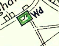
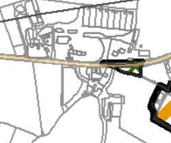
A close-up section of a site location map showing road lines, field boundaries, and a green highlighted square marker.A cropped site location plan showing the application site boundaries highlighted in black and orange near a main road.
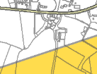
2.4 The site has no Infrastructural Constraints shown on the relevant map accompanying the draft Plan with the site lying outwith the Jurby Aerodrome Transition Surface (marked yellow below).
2.5 Trees are generally protected under the Isle of Man Strategic Plan Environment Policy 3 although there are no Registered Trees on the holding and only trees around the boundaries of the fields.
2.6 Ecology is protected under Environment Policies 4 and 7. The site is not shown as being of an ecological interest or sensitivity.
2.7 The highest quality agricultural land (Class 1, 2, 3/2 and 2/3) should be protected from loss. In this case the land is Class 3 (Environment Policy 14).
2.8 There is a general presumption against development in undesignated areas, as set out in General Policy 3 of the Strategic Plan (see Appendix One). Environment Policy 1 presumes against development which would be harmful to the character and appearance of the countryside.
2.9 This site lies within an area on the Landscape Character Assessment as part of a large area of Undulating Lowland Plain (F3). The full advice on this type of area is set out in Appendix Two with the most relevant parts highlighted. The draft Area Plan summarises this as follows with a relevant Landscape Proposal:
6.4.3 The Undulating Lowland Plain of Andreas and Jurby (F3) encompasses a swathe of farmland underlain by the predominantly flat topography of the northern plain. To the west, the narrow course of the Lhen trench meanders through the landscape. The main A19 and A17 roads cross the area interlinking with a network of minor roads often lined with tall Manx sod banks. Settlement pattern is scattered and relatively isolated with the Andreas and Jurby Industrial Estates and IOM prison providing the largest groups of buildings within the area. Overall, there is a strong sense of tranquillity and openness. A strong recognisable sense of place is provided by views to the dramatic backdrop of the
A map extract showing land parcels with a yellow highlighted area indicating the application site boundaries.
Uplands to the south, views of St. Patrick’s Church and distant views to the sea at the eastern and western edges of the area.
Landscape Strategy To conserve and enhance: a) the character, quality and distinctiveness of this rural area including the scattered settlement pattern, relatively strong field pattern delineated by a mixture of stone walls and relatively tall Manx hedge-banks and its network of enclosed minor rural roads
Key Views - Glimpsed views to the sea from the eastern and western edges of the area. Panoramic open views southwards towards a dramatic upland backdrop. Open views to landmark church towers (particularly St. Patrick’s Church) to the west of Jurby.
2.10 Whilst there is a presumption against development in this area according to General Policy 3 pf the Strategic Plan, there is provision for the erection of buildings for agriculture or equestrian pursuits (General Policy 3f and Environment Policies 15, 19, 20 and 21) with the following applying solely to equestrian developments:
Environment Policy 19: Development of equestrian activities and buildings will only be accepted in the countryside where there will be as a result of such development no loss in local amenity, no loss of high quality agricultural land (Classes 1 and 2) and where the local highway network can satisfactorily accommodate any increase in traffic (see Environment Policy 14 for interpretation of Class 1 and 2).
Environment Policy 20: There will be a presumption against large scale equestrian developments, which includes new buildings and external arenas, in areas with High Landscape or Coastal Value and Scenic Significance unless there are exceptional circumstances to override such a policy.
Environment Policy 21: Buildings for the stabling, shelter or care of horses or other animals will not be permitted in the countryside if they would be detrimental to the character and appearance of the countryside in terms of siting, design, size or finish. Any new buildings must be designed in form and materials to reflect their specific purpose; in particular, cavity-wall construction should not be used.
3.0 Planning history
3.1 The site has been the subject of a number of previous applications for the extension and alteration of the main house, the conversion of outbuildings to other purposes, new accesses and for new agricultural/equestrian buildings with the following two considered the most relevant:
00/02037/B - erection of agricultural building, approved subject to use for either agricultural or equestrian purposes - permitted on review
23/00431/B - conversion of stable to home office - permitted
3.2 It is notable that large equestrian developments have been permitted in the surrounding area as follows:
15/00929/B - East Bretney Farm - 40m x 20m sand arena, stables and new field gate access 21/00182/B - Ellan Farm - 40m x 20m outdoor arena
19/01426/B - Sunnycroft - 60m x 20m indoor arena
And also that the adjacent farm has a large array of modern agricultural buildings approved under the following applications:
87/00417/B
20/00832/B 20/01406/B
4.0 The proposal and assessment
4.1 The site lies within an area which is not designated for development but the Strategic Plan makes it clear that development associated with equestrian facilities can be acceptable if there is no adverse impact on the environment, citing local amenity and highway safety as well as the impact on the character and appearance of the countryside in terms of siting, design, size or finish. The buildings must also be appropriate in size, form and finish, to their function.
4.2 The site extends to approximately 3.7 acres and currently accommodates horses with the applicants engaging in carriage driving as well as normal riding activities. The application proposes the erection of a covered arena which has a footprint of 20m by 40m with one side enclosed with blockwork and vertical cladding and the other three sides being open. The structure will have to its north and south new trees planted as a screen, incorporating native trees which are listed on drawing 24 1816 04.
4.3 The building is proposed to be sited at the furthest point in the field from the road, reducing its visual impact. The site is not within an area of an area of High Landscape or Coastal Value and Scenic Significance and there are within the vicinity many large equestrian and agricultural buildings, some of which are noted in the Planning History section above.
4.4 The applicants are aware of increasing levels of traffic on the adjacent roads, which will only increase once the developing residential estate to the west is completed and occupied. As such, trekking on the adjacent roads is becoming less safe and carriage driving even less so. Exercising the horses in the applicant site fields is also becoming more difficult as the ground becomes boggy and is potentially dangerous as the surface becomes slippery and wet. A covered arena would resolve all of these issues.
4.5 The backing and breaking of the applicants’ foal will require a quiet and protected area where the foal can be safely contained and the proposed arena will provide such a space. The foal's sire is a Grand Prix level dressage horse and the applicants’ hope is that the foal will attain similar standards so that eventually either their family or a friend on island who competes at international level can compete on it. To attain this goal, without an arena, would be impossible.
4.6 The location of the arena has been chosen to deal with the fact that the wind blows predominantly from the west and provides the smallest profile in respect of the wind direction and means that more of the arena can be left open sided. In addition, having the building this way with the sides open reduces the visual impact of the building - it is possible to see through the building rather than looking at a solid end.
4.7 Accessibility within the end field will remain as there is provision for a wide corridor (wider than a car/pick up truck towing a trailer) to access it from the existing road access gate all along the eastern edge of the field.
4.8 There will be no loss of valuable agricultural land from the erection of the arena as the land is not rated particularly highly on the Agricultural Soils Map and in any case, this part of the field is used for exercising the horses when the ground is suitably dry and stable (Environment Policy 14).
4.9 The application incorporates renewable energy generation in the form of solar panels within the south facing roof plane and additional tree planting is proposed on both long sides of the building, to complement the existing tree planting already on the other two sides. Full details of the proposed landscaping is provided in drawing 24 1816 04 along with details of the position of the new soakaway.
4.10 We believe that the proposal will provide a much needed facility for the animals which presently use the site and will enable the applicants to exercise their horses and train them in carriage driving safely and at all times throughout the year. The facility is proposed for use solely by the applicants and their friends and tutors with no public or commercial use of the site or the proposed building.
4.11 The building is positioned some distance from the road where there are established hedges which provide significant visual screening. In addition, the application proposes to introduce significant new tree and shrub planting which will not only visually screen the building but will also provide an enhancement to the already established biodiversity in the area thus satisfying Environment Policies 1 and 4.
4.12 The proposal will not result in any loss in local amenity, any loss of high quality agricultural land (Classes 1 and 2) and there will not be any increase in traffic in the local highway network - there will actually be a reduction if the horses can be exercised within the site rather than using the local roads. The proposal therefore complies with Environment Policy 19.
4.13 The proposal is not within an area of High Landscape or Coastal Value and Scenic Significance and as such the proposal satisfies Environment Policy 20.
4.14 We do not believe that the proposed development would be detrimental to the character and appearance of the countryside in terms of siting, design, size or finish and the new building is designed and finished to reflect their specific purpose; cavity-wall construction is not to be used. As such, the proposal satisfies Environment Policy 21. Furthermore, the proposed planting will enhance the visual and ecological environment.
Sarah Corlett 21.05.2024
Appendix One - policies
Strategic Plan
General Policy 3: Development will not be permitted outside of those areas which are zoned for development on the appropriate Area Plan with the exception of:
(a) essential housing for agricultural workers who have to live close to their place of work; (Housing Policies 7, 8, 9 and 10);
(b) conversion of redundant rural buildings which are of architectural, historic, or social value and interest; (Housing Policy 11);
(c) previously developed land(1) which contains a significant amount of building; where the continued use is redundant; where redevelopment would reduce the impact of the current situation on the landscape or the wider environment; and where the development proposed would result in improvements to the landscape or wider environment;
(d) the replacement of existing rural dwellings; (Housing Policies 12, 13 and 14);
(e) location-dependent development in connection with the working of minerals or the provision of necessary services;
(f) building and engineering operations which are essential for the conduct of agriculture or forestry;
(g) development recognised to be of overriding national need in land use planning terms and for which there is no reasonable and acceptable alternative; and
(h) buildings or works required for interpretation of the countryside, its wildlife or heritage.
Environment Policy 1: The countryside and its ecology will be protected for its own sake. For the purposes of this policy, the countryside comprises all land which is outside the settlements defined in Appendix 3 at A.3.6 or which is not designated for future development on an Area Plan. Development which would adversely affect the countryside will not be permitted unless there is an over-riding national need in land use planning terms which outweighs the requirement to protect these areas and for which there is no reasonable and acceptable alternative.
Environment Policy 3: Development will not be permitted where it would result in the unacceptable loss of or damage to woodland areas, especially ancient, natural and semi-natural woodlands, which have public amenity or conservation value.
Environment Policy 4: Development will not be permitted which would adversely affect:
(a) species and habitats of international importance:
(i) protected species of international importance or their habitats; or (ii) proposed or designated Ramsar and Emerald Sites or other internationally important sites.
(b) species and habitats of national importance:
(i) protected species of national importance or their habitats;
(ii) proposed or designated National Nature Reserves, or Areas of Special Scientific Interest; or
(iii) Marine Nature Reserves; or
(iv) National Trust Land.
(c) species and habitats of local importance such as Wildlife Sites, local nature reserves, priority habitats or species identified in any Manx Biodiversity Action Plan which do not already benefit from statutory protection, Areas of Special Protection and Bird Sanctuaries and landscape features of importance to wild flora and fauna by reason of their continuous nature or function as a corridor between habitats.
Some areas to which this policy applies are identified as Areas of Ecological Importance or Interest on extant Local or Area Plans, but others, whose importance was not evident at the time of the adoption of the relevant Local or Area Plan, are not, particularly where that plan has been in place for many years. In these circumstances, the Department will seek site specific advice from the Department of Agriculture, Fisheries and Forestry if development proposals are brought forward.
Environment Policy 14: Development which would result in the permanent loss of important and versatile agricultural land (Classes 1-2) will not be permitted except where there is an overriding need for the development, and land of a lower quality is not available and other policies in this plan are complied with. This policy will be applied to
(a) land annotated as Classes 1/2 on the Agricultural Land Use Capability Map; and
(b) Class 2 soils falling within areas annotated as Class 2/3 and Class 3/2 on the Agricultural Land Use Capability Map.
Environment Policy 15: Where the Department is satisfied that there is agricultural or horticultural need for a new building (including a dwelling), sufficient to outweigh the general policy against development in the countryside, and that the impact of this development including buildings, accesses, servicing etc. is acceptable, such development must be sited as close as is practically possible to existing building groups and be appropriate in terms of scale, materials, colour, siting and form to ensure that all new developments are sympathetic to the landscape and built environment of which they will form a part. Only in exceptional circumstances will buildings be permitted in exposed or isolated areas or close to public highways and in all such cases will be subject to appropriate landscaping. The nature and materials of construction must also be appropriate to the purposes for which it is intended. Where new agricultural buildings are proposed next to or close to existing residential properties, care must be taken to ensure that there is no unacceptable adverse impact through any activity, although it must be borne in mind that many farming activities require buildings which are best sited, in landscape terms, close to existing building groups in the rural landscape.
Environment Policy 19: Development of equestrian activities and buildings will only be accepted in the countryside where there will be as a result of such development no loss in local amenity, no loss
of high quality agricultural land (Classes 1 and 2) and where the local highway network can satisfactorily accommodate any increase in traffic (see Environment Policy 14 for interpretation of Class 1 and 2).
Environment Policy 20: There will be a presumption against large scale equestrian developments, which includes new buildings and external arenas, in areas with High Landscape or Coastal Value and Scenic Significance unless there are exceptional circumstances to override such a policy.
Environment Policy 21: Buildings for the stabling, shelter or care of horses or other animals will not be permitted in the countryside if they would be detrimental to the character and appearance of the countryside in terms of siting, design, size or finish. Any new buildings must be designed in form and materials to reflect their specific purpose; in particular, cavity-wall construction should not be used.
Appendix Two
Landscape Character Assessment
F3 ANDREAS AND JURBY Key Characteristics
• Swathe of farmland (covering the breadth of the Island).
• Irregular pattern of medium-sized arable and pasture fields.
• Field boundaries demarcated by traditional Manx hedges and simple post and wire fences.
• Inter-linking network of minor rural roads serve the area, together with the A10, A17 and A19.
• Generally few vertical elements, other than occasional telegraph poles.
• Scattered and relatively isolated settlement pattern.
• Traditional farm buildings (characteristically white, with grey roofs).
• Key settlements include the small town of Andreas and the villages of Bride, Jurby and Sandygate.
• The Isle of Man Government Industrial Estate and adjacent Jurby Aerodrome
• Disused airfield at Andreas
• Churches provide prominent landmarks within views.
• Views to dramatic upland backdrop to the south provide strong sense of place.
• Strong sense of openness and tranquillity (at distance from main A19 and A17 roads).
• Slightly marked sinuous valley of Lhen Trench.
• Sandpit at Cronk-y-Scotty
Overall Character Description Situated to the north of the Island, this landscape character area encompasses a swathe of farmland underlain by the predominantly flat topography of the northern plain. To the west, the relatively narrow course of the Lhen trench meanders through the landscape, which exhibits an irregular pattern of medium-sized arable fields and rough grassland/pasture. A variety of different forms of hedgerows and simple post and wire fences demarcate field boundaries. To the west, mature, intact low, trimmed hedges dominate the hedgerow network. Several single mature deciduous trees within Manx hedgerows and fields also contribute to a mature recognisable landscape structure. The main A19 and A17 roads (a source of noise and visual intrusion) cross the area and an inter-linking network of minor roads, often lined with species-rich verges, help to provide access to farms and settlements. Generally, few vertical elements punctuate the skyline of the area. However, telegraph poles and the telecommunications mast at Jurby Industrial Estate are a visible human influence. Settlement pattern is scattered and relatively isolated, with the Andreas and Jurby Industrial Estates providing the largest groups of buildings within the area. Several isolated farmsteads and individual houses also pepper the landscape. Traditional farm buildings characteristically exhibit white walls (which often provide a bright contrast to the muted upland backdrop to the north) and grey roofs. Alongside these traditional buildings, modern agricultural sheds and warehouses are sometimes visually intrusive. In addition, the distinctive churches of St. Andrews Church at Andreas (built predominantly from Sulby Glen stone) and St. Patrick’s Church to the west of Jurby and their associated medieval crosses are landmark features landscapes within the area. St. Patrick’s Church is
particularly prominent within views across the surrounding open, flat landscape. The prefabricated buildings on an old air force base and disused runway at Jurby (now housing several small businesses and shops, including Jurby Junk) exhibit a strong human influence over the character of this part of the area. Construction of the new prison development is also associated with this part of the area. Overall, there is a strong sense of tranquillity and openness throughout the area. A strong recognisable sense of place is provided by views to the dramatic backdrop of the Uplands to the south, views of St. Patrick’s Church and distant views to the sea at the eastern and western edges of the area.
Key Views
• Glimpsed views to the sea from the eastern and western edges of the area.
• Panoramic open views southwards towards a dramatic upland backdrop.
• Open views to landmark church towers (particularly St. Patrick’s Church) to the west of Jurby.
Historic Features
• St. Patrick’s Church and medieval crosses.
• St. Andrew’s Church and medieval crosses.
• Old airfields at Jurby and to the east of Andreas.
Ecological Features
• Species-rich verges.
• Mature hedgerows and single mature deciduous trees.
• Patches of rough grassland
• Area of Special Scientific Interest at Ballacrye
Evaluation of Inherent Landscape Sensitivities
• Strong sense of tranquillity.
• Scattered isolated settlement pattern.
• Enclosed minor rural roads.
• Vernacular character of buildings and churches.
• Presence of Manx Mile stones.
• Few tall vertical elements.
• Dramatic views south to Uplands.
• Field pattern delineated by a mixture of stone walls, relatively tall Manx hedge-banks and post and wire fences.
Landscape Strategy The overall strategy should be to conserve and enhance the character, quality and distinctiveness of this rural area including the scattered settlement pattern, relatively strong field pattern delineated by a mixture of stone walls and relatively tall Manx hedge-banks and its network of enclosed minor rural roads.
Copyright in submitted documents remains with their authors. Request removal
Source & Provenance
Official reference
24/00634/B
Source authority
Isle of Man Government Planning & Building Control