A: 7 Creggan Lea Port St. Mary Isle of Man IM9 5BD E:[email protected]T: (0)7624 463585 Job number – 2024-017Client – Mr George MoorePlanning Statement – Field no. 324368, Top Road, CrosbyPrepared by Mark Blair {{image:236784}}
The site is situated north of the Glen Vine back road up a single lane towards Slieau Ruy.
The planning proposal is a retrospective application for new position and oreination of previously approved agricultural buildings.
History
Planning permission has previously been applied for on the site in the applications below:
Planning Application No. 21/00174/B - 9 February 2021 a planning application was permitted for "the erection of two agricultural buildings and creation of new field access". Planning Application No. 23/00899/B - 9 November 2023 a planning application was permitted for "drill a borehole for a viable potable water supply to new agricultural shed". Planning Application No. 23/01443/B/B - 16 January 2024 a planning application is pending consideration for "creation of new agricultural access into field 324368 ".
Current Form
The agricultural building was built as per the approved drawings however located in a new position and rotated . The position and the orientation was amended due to the ground that was removed from the initial cut excavation. The agricultural shed was moved closer to the bank created by the excavation works and rotated to give the cattle more protection and shelter.
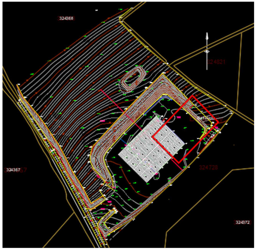
Below shows the approved location (red outline) of the agricultural shed and the position in which the shed was constructed.
A technical CAD site plan displaying topographical contour lines, site boundaries, and a building footprint on a black background.
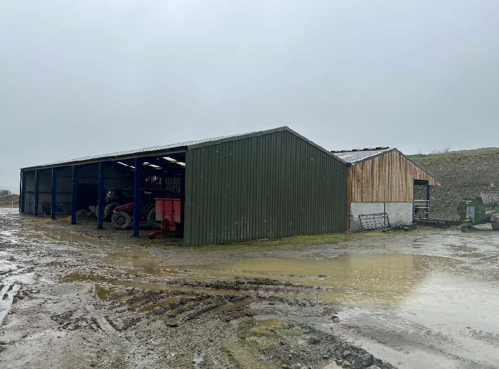
Photograph 1
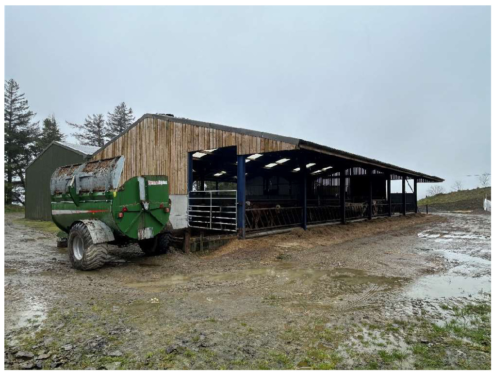
Photograph 2
A photograph showing two agricultural buildings on a muddy farmyard site, including a large open-sided metal shed with machinery and a smaller wooden structure.A photograph showing two agricultural buildings situated on a muddy, wet farmyard. The larger structure is a green metal shed with blue supports containing farm machinery, adjacent to a smaller wooden and concrete building.
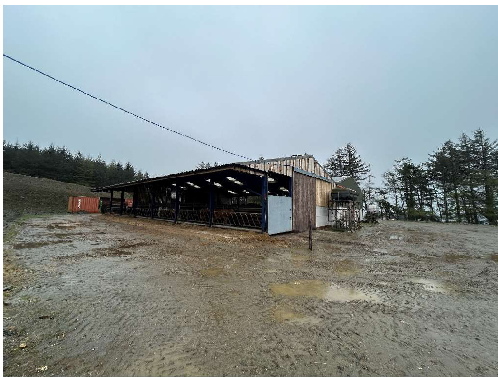
Photograph 3
Photograph 4
Photograph 1 shows the northwest and southeast elevations with the agricultural machinery spaces to the south west elevation.
Photograph 2 shows the southwest and southwest elevation that shows access into the loose cattle housing pens and the excavated bank in the background.
Photograph 3 shows the northwest elevation and the cattle loose housing pens.
Photograph 4 shows the northeast and northwest elevations.
A photograph showing a large agricultural barn with wooden cladding and an open-sided feeding area housing cattle. A green agricultural wagon is parked on the muddy ground in the foreground.A photograph showing a large open-sided agricultural shed with blue steel supports and an adjacent wooden structure situated in a muddy farmyard.
Materials and Specification
The design was constructed as per the approved application (23/00899/B). Two number steel portal frames with a central valley. The gable ends have been finished with a mixture of precast concrete panels, Yorkshire boarding and plastic-coated steel sheets.
Copyright in submitted documents remains with their authors. Request removal
Source & Provenance
Official reference
24/00440/B
Source authority
Isle of Man Government Planning & Building Control