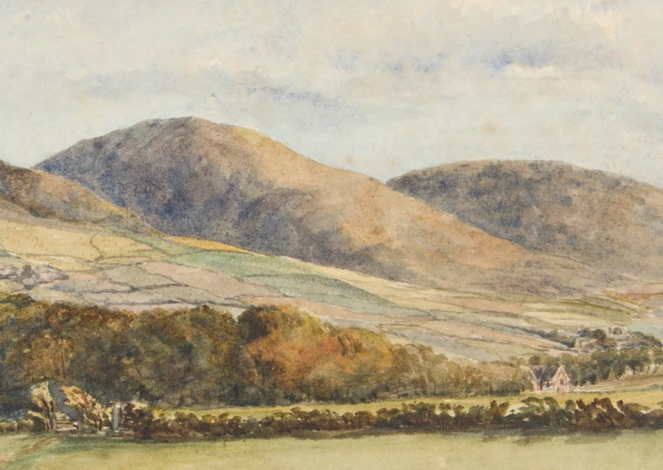
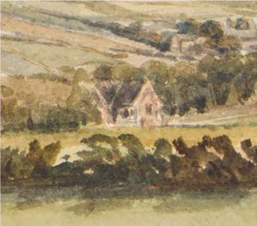
Figure 1. Kirk Michael Hills from Bishopscourt, 1864, by Georgina Gore Currie, showing the School (later theological college Refectory) which she seemingly built four years before. Her watercolour may explain the origin of the wall remnant which has necessitated this amendment to a previous planning application.
RK/6296 December 2023
A watercolor painting depicting a rural landscape with rolling hills, fields, and a small cottage in the distance.
Planning History
On the 15th of June 2023 planning approval was granted for major alterations to the Refectory at Bishopscourt as part of applications 22/01295/GB and 22/01310/CON. An extensive planning statement was submitted with that application, detailing the history of the building as it was then understood. New information and research led to the submission of an application amendment on the 29th of November 2023, with alterations to the approved internal plan of the Refectory in order to better reinstate its original form. An amendment is here sought to applications 22/01295/GB and 22/01310/CON in which the approved line of the new driveway is altered to avoid and preserve a remnant of possibly historic garden wall or rockery which has been discovered during work on site.
The Refectory is a Registered Building (NGC/MB RB No. 23, 26th September 1983) and the chronology of its development is still understood as having been built with the Bishopscourt Chapel as part of a broad programme of alterations at Bishopscourt from 1854 to 1860. The Refectory’s gothic language, stone masonry and window details are comparable to those on the Chapel and West Wing, making use of shallow, rustic tudor arches and trefoil lancet windows. Pale granite - hammered ashlar - was used for the quoins, the buttress and gable copings, plinth moulding and door and window surrounds. The majority of the masonry is dark grey Manx mudstone of a rough but ordered appearance: split-faced stone is laid in courses, each course a different height to its neighbours and the length of the stones irregular. Manx stone was also used to form rough arches above the ashlar window surrounds and gable vents.
Evidence in the Lambeth Palace Library has shown that the Refectory was built as a model school from 1856-1857, seemingly under the guidance of Bishop Powys’ niece Georgina Gore Currie, who would have been about twenty-five years old when the project started. (She was thirty years old at the time of the 1861 census and is likely to have been born in 1831.) She was the niece of the bishop’s wife Percy Gore Currie and the daughter of Blackwood Gore Currie (1803-1836) and Laura Gossett. The Curries of East Horsley Park, Surrey, were a London banking family. Georgina Currie’s patronage is attested by Mrs Barron in an interview lodged with the Manx Museum. Mrs Barron lived in the Lodge (now Cottage) at the turn of the 20th century and cooked for the ordinands whom her husband, as butler, served in the Refectory.
The school opened and closed several times between the 1870s and the 1882, as noted in the Isle of Man Times. From 1874 to 1943 the Bishop Wilson Theological College was housed in the west wing at Bishopscourt. Under Bishop Bardsley (1887-1891) the Refectory was used as a lecture room for the college, as well as a Sunday School, a place for public meetings and lectures and occasionally for services of evening prayer. Details of these different uses are found in the Manx Church Magazine of the time. In 1891 the ordinands began to dine at the school (alleviating the bishop’s wife and her staff of an onerous responsibility) whence the building came to be known as the Refectory instead of the School. In 1943 the College closed, and the Refectory was sold and radically altered to make it into a private house, later to be re-named Holly Lodge. This application forms part of a broad scheme of conservation and re-instatement of lost features at Bishopscourt, its outbuildings and grounds.
Proposal
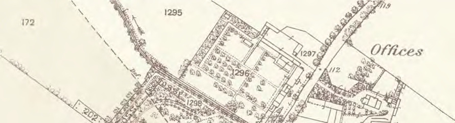
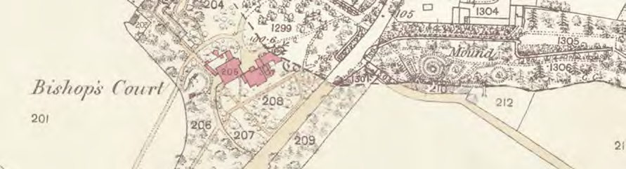
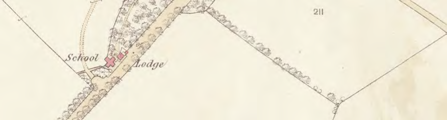
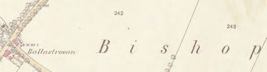
A black and white map extract showing property boundaries, vegetation, and a road, with plot numbers and a building labeled 'Offices'.A cropped section of a historical map showing property boundaries, trees, and buildings, with specific plots highlighted in red.A vintage map extract showing a road junction with labels for 'School' and 'Lodge' and red crosses indicating specific sites.A cropped section of a historical map showing place names like 'Ballastrooan' and 'Bishop' along with property boundaries and small building footprints.
A gravel driveway was approved as part of the original application to restore and alter the Refectory and neighbouring Cottage. The entrance of this new driveway is a reinstatement of an old carriage entrance in roughly the same place, which led to the West Carriage Drive which crossed the field (No. 201) behind the Refectory and which led to the North front of Bishopscourt. The re-instatement of the full route of the carriage drive is not possible, because that field is now owned separately from Bishopscourt. To reconnect the Refectory and the episcopal palace without the West Drive, a new drive was approved between the Refectory and the Refectory Walk.
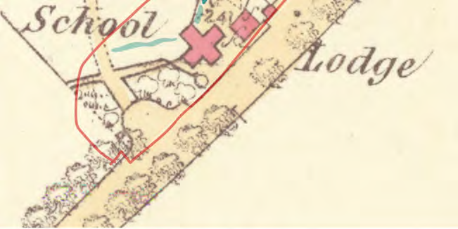
Figure 2. 1870 Ordnance Survey map of Bishopscourt. The Refectory is marked School, for it still was. The Cottage is marked as Lodge, seemingly its name in relation to the lost West Carriage Drive which ran up through Field 201 to the North entrance of Bishopscourt. The way from both the Refectory and Cottage through the grounds to the episcopal palace survives as the Refectory Walk.
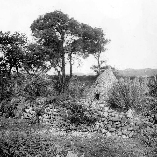
As preparation for work at the Refectory commenced in June 2023 it was found that the new section of drive approved to run around the back of the Refectory to the Cottage and the new garage was going to run through a line of rough stones which had been misunderstood as a late 20th century garden feature but which members of the archaeological and historical team working at Bishopscourt have identified as sandstone crag typical of the shore below Bishopscourt and possibly quarried from nearby Glen Balleira. The same stone has been found in the interior of the half-sunken garden structure long known as the Ice House. This type of stone was used in the 19th century to form rockeries and to clad structures and grottoes to make them more rustic or picturesque. The remnant at the Refectory could be a garden rockery – there is evidence that the ordinands were set to work in the Refectory garden – of the same size as found or originally larger and paired with the surviving, large rockery at the West Wing of Bishopscourt. It could also be the partial remnant of a low boundary wall. The stones may have been taken and re-used from elsewhere in the gardens at Bishopscourt or in the Glen at a time unknown to us.
Figure 3. From left to right: The Cottage, Refectory, large sycamore no. 1417 and crag stone remnant in June 2023, seen from the North, at the end of the Refectory path leading from the Palace. The crag stone runs up to and engulfs the base of the sycamore and seemingly lies between the edge of the path and the wire fence marking the field boundary.
Figure 4. Detail of the crag stone wall, June 2023.
Figure 5. Detail of the crag stone wall, June 2023.
Figure 6. A detail of the 1864 watercolour Figure 1. It is difficult to discern whether the white highlight either side of the refectory’s gable facing the field is nothing in particular or whether it might be a pale wall, its two separate sections abutting the sides Refectory.
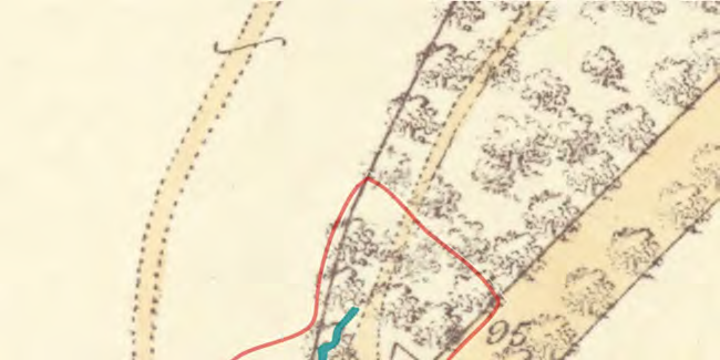
Figure 7. The 1870 Ordnance Survey map marked up: the current legal boundary in red; the surviving crag stone remnant in dark blue, and the possible missing sections indicated in the 1864 watercolour shown tentatively in light blue. The crag stone does not correspond with the current or 1870s boundary lines, but does mark a rough edge between the Refectory Walk and the boundary.
A watercolor sketch depicting a detached cottage nestled in a rural landscape with fields and trees.A close-up view of a vintage topographical map showing a plot of land outlined in red, featuring trees, roads, and a small water feature.A cropped section of a vintage map showing a red boundary line outlining a property near a 'School' and 'Lodge'.
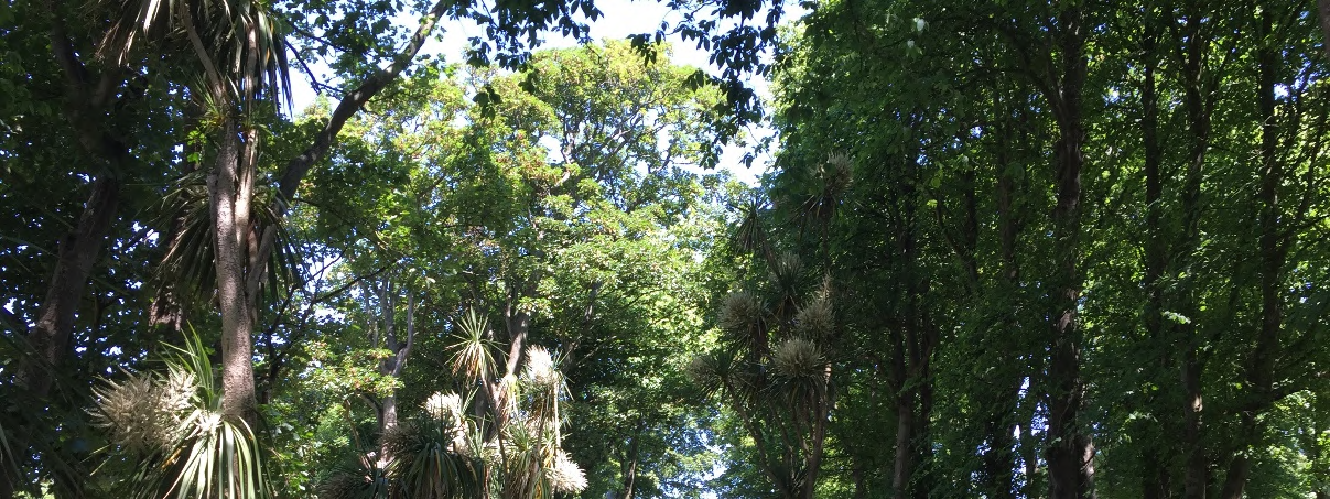
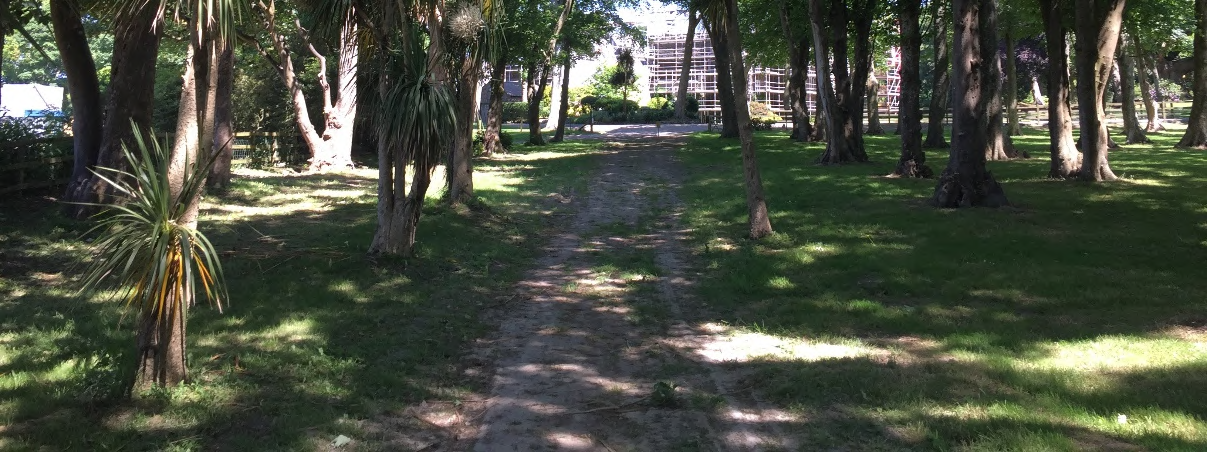
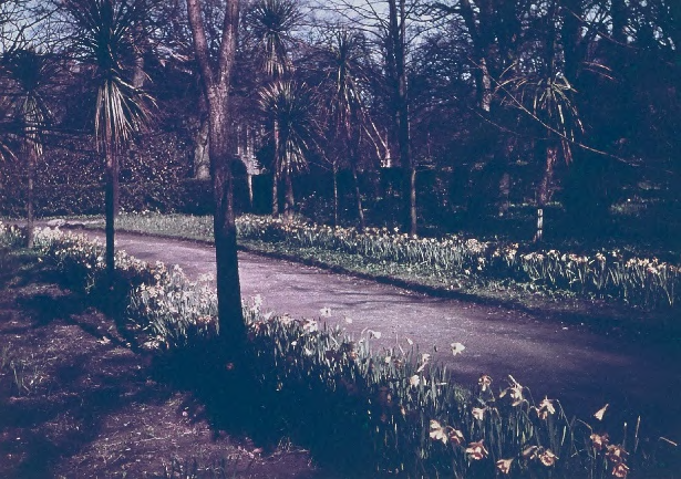
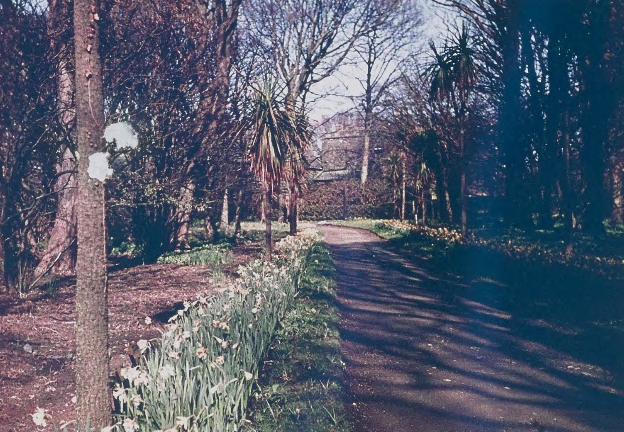
Figure 8. The Refectory Walk over time, seen looking away from the Refectory towards the Palace. From the top, in June 2023; in the middle, a pair of views from the 1940s, when Ezra Rimmer was head gardener and the theological college was closing and its Refectory to be sold, making this bordered walk between the West Wing hostel and the Refectory redundant. Edging stones can be made out at the corner of the Refectory Walk and the East Drive. These have since disappeared.
A low-angle photograph showing the dense canopy of mature trees and green foliage against a bright sky.A photograph showing a grassy, tree-lined dirt path or driveway leading towards a building covered in scaffolding in the background.A photograph showing an existing paved or gravel driveway curving through a garden area lined with trees and a bed of white flowers.A photograph showing a paved driveway winding through a wooded garden area with daffodils and trees.A grainy, low-resolution photograph showing a vegetated area with trees and a path or driveway running horizontally through the scene.
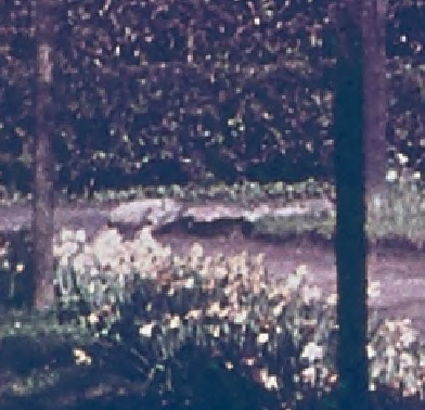
Figure 9. The Old Rockery dividing the East Drive from the garden on the south front of the Palace. Stones from lost edgings or garden features may have been added to this over time. It is at least extant in 1911 photographs in the Theological College photographs held at the Manx Museum, and in the 1870 Ordnance Survey map is marked as an area distinct from the lawn, with neighbouring shrubbery running up towards the Ballaugh-Kirk Michael road. Lady Sarah Murray was credited with the creation of a rockery which survived into the 1850s, but which feature this may be at Bishopscourt is unknown.
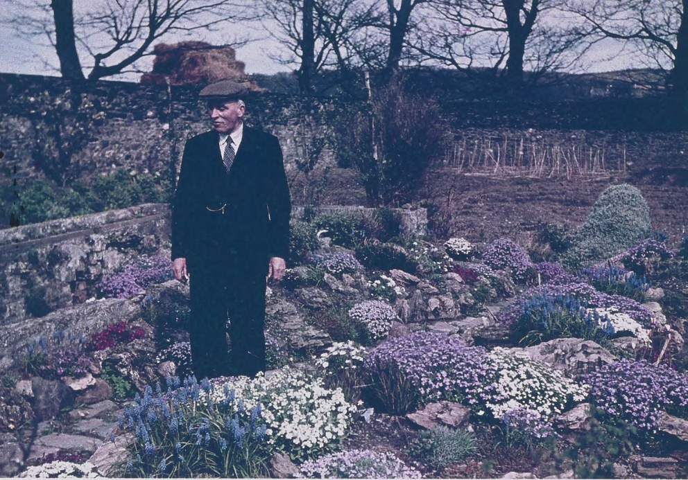
Figure 10. Head Gardener Ezra Rimmer in the rockery he created in the ruin of one of the glasshouses in the Kitchen Garden. c1940.
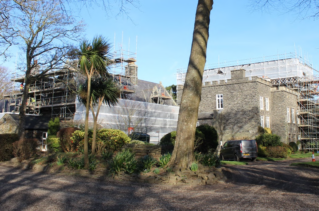
A photograph showing a large stone building covered in scaffolding and protective sheeting, viewed from a gravel driveway with landscaping in the foreground.A vintage photograph showing an elderly man in a suit and flat cap standing in a terraced garden with stone walls and flowers.
Figure 11. Vernacular Manx boundary walls of different stone types, partially gardened and photographed at unknown island locations in the early 20th century and kept by the Manx Museum. The crag stone wall at the Refectory forms part of a network of rough stonework across Bishopscourt, including the stone-revetted wall and ruined structure on the north side of the Palace, the boundary walls to the main road, retaining walls to some of the beds in the gardens and the embanked stream.
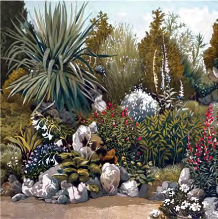
Figure 12. Victorian ideals of the rockery within picturesque gardens, richly planted with alpines and other plants imported to Britain from overseas and connected to the rest of the gardens by gravel paths. The rockery and rustic summerhouse at Riverhill House in Kent was made for plant hunter John Rogers for his collection of Himalayan plants. These flourished in the milder Kent climate as they have at Bishopscourt since at least the time of Bishop and Lady Sarah Murray, who also created an American garden.
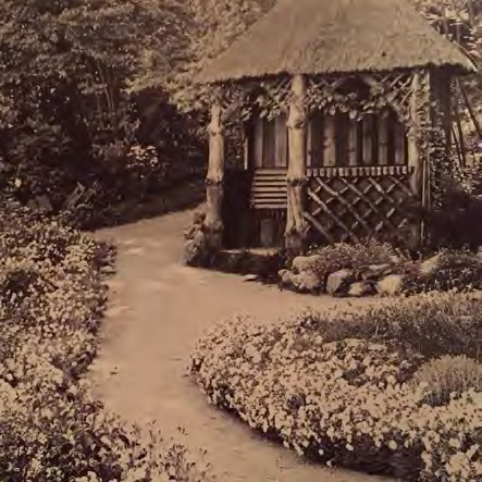
A sepia-toned photograph depicting a rural scene with stone walls, a small water feature with a bucket, and a dense wooded background.Black and white photograph of a rural plot featuring a dry stone wall, dense vegetation, trees, and a thatched structure.A landscape drawing or rendering depicting a garden area with a driveway edge, rocks, and diverse vegetation including agave and flowering plants.A sepia-toned photograph showing a paved garden path leading towards a small structure with a thatched roof and wooden lattice, surrounded by flower beds.
Considering the survival of the crag-stone wall and its possible links to other lost or surviving garden features at Bishopscourt and the Glen, it is proposed to alter the route of the proposed new drive running behind the Refectory to the new Cottage garage so as to leave this feature in place, and to incorporate it into the developing plans for the gardens around the Refectory.
The alteration of the route of the drive will see it pass closer to some of the trees on the field boundary, and an arboricultural method statement has been submitted with this application in order to explain how the effect this will have on those trees will be mitigated by root protection measures.
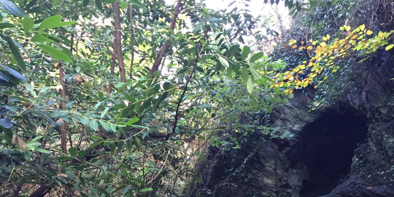
Figure 13. One of the earlier picturesque garden structures at Bishopscourt, the Cave of the Winds beside Mount Aeolus in the Bishopscourt Glen, its name – and that of the mound and its now lost canons – commemorating the British victory over the French off the coast below Bishopscourt in 1760.
A photograph showing a rocky outcrop with a dark cave-like opening surrounded by dense green trees and foliage.
Copyright in submitted documents remains with their authors. Request removal
Source & Provenance
Official reference
24/00103/B
Source authority
Isle of Man Government Planning & Building Control