Loading document...
Crown Copyright
Chapter 1 - Previous Planning History Page No 1.1 Submissions ..... 4 Chapter 2 - Background 2.1 Purpose ..... 4 2.2 Background Information ..... 4 2.3 Existing Highway Layout and Geometry ..... 4 Chapter 3 - Why The Improvement is Needed 3.1 Junction Geometry ..... 5 3.2 Vehicle Survey Data ..... 5 3.3 Pedestrian Facilities ..... 6 3.4 Accident History ..... 6 Chapter 4 - Scheme Proposals 4.1 Junction Improvements ..... 7 4.2 Provision of access and off road parking ..... 7 Summary ..... 8 Appendix A Photographs ..... $9-12$ Appendix B Drawings ..... 13 Appendix C Existing and proposed visual images ..... 14
November 2013 PA 13/90943/B - demolition of Bridge House December 2010 PA 10/01602/B - junction improvement scheme
The purpose of this document is to demonstrate the necessity for improvement work to be carried out to the A3/A24 Mines Road junction in Higher Foxdale.
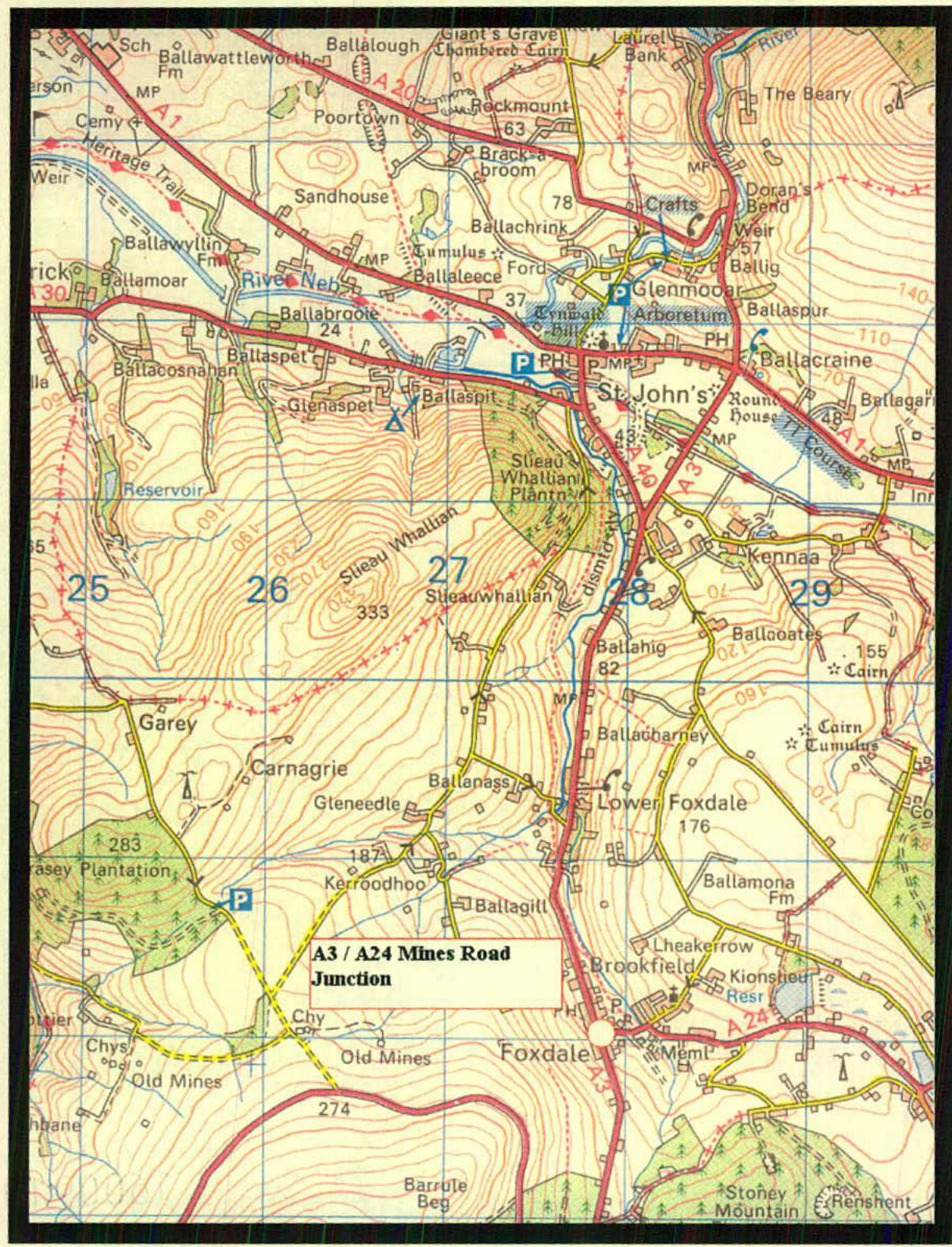
Mines Road junction is located within a 30 mph speed limit and currently operates as a simple T-junction. The A3 is the main route for traffic travelling between Castletown in the South and Ramsey in the North. The A24 provides local access and onwards to Douglas. The junction is bounded by residential properties on all sides. In 2014, the property adjacent to the junction was demolished. The footprint from this former dwelling (Bridge House) has been temporarily 'landscaped' with tarmac, timber planters, and a post and chain fence until a more aesthetically pleasing permanent solution is found.
A detailed topographical survey of the junction indicates the following:-
Average road width 7.4 m Single footway to the east on the north side of the junction, average width 1.2 m Single footway to the west on the south side of the junction, average width 1.3 m Speed limit 30 mph
Average road width 4.8 m Footway to the north, average width 1.3 m Footway to the south, average width 0.9 m Speed limit 30 mph
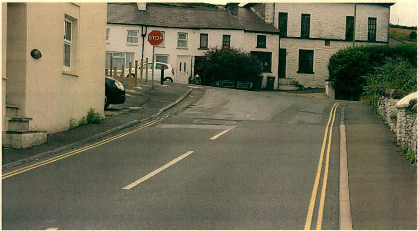
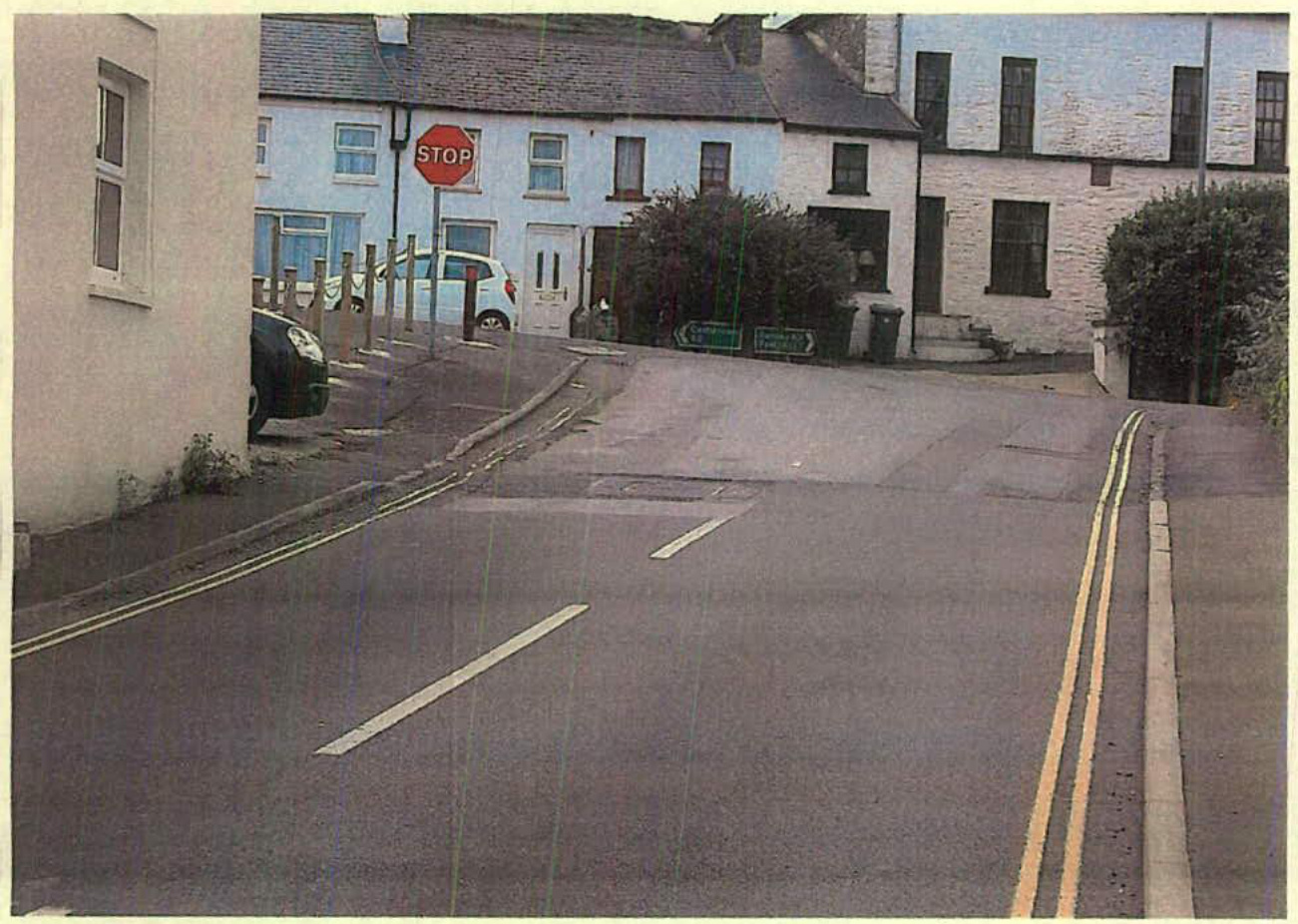
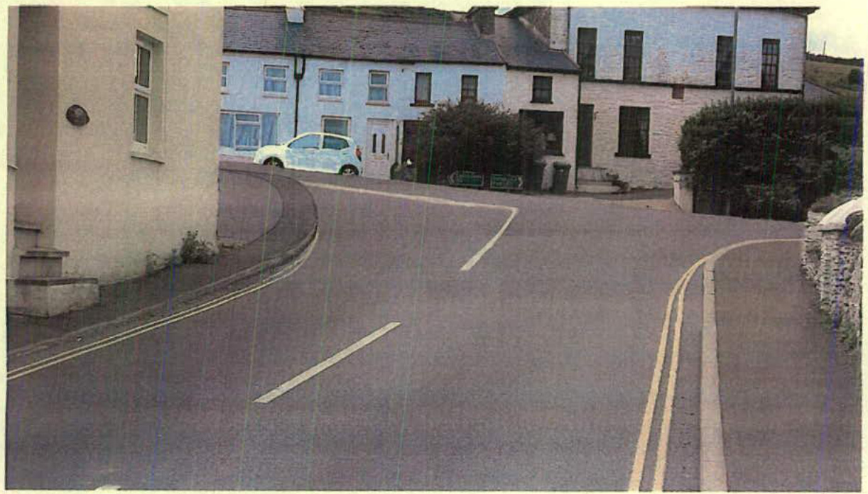
The incline on the approach from Mines Road towards the junction is approximately 11%. The A3 Main Road gradient through the junction is approximately 7%. The desirable minimum sight stopping distance of 90m is achieved in advance of the junction on all approaches. However junction visibility is well below the desired standard. From a point taken 2.4m back from the STOP line on Mines Road looking south towards Castletown, only 60m is achieved (see Appendix A – Plate 1). Looking north towards St Johns the visibility is restricted to just 35m, but much less when the vegetation behind the wall is growing (see Appendix A – Plate 2).
The geometry of the junction is sub-standard both horizontally and vertically. The manoeuvring of large goods vehicles and buses is onerous and vehicles regularly encroach onto opposing traffic lanes when negotiating the junction. Also the steep uphill approach gradient is undesirable since it is difficult for drivers to appreciate the layout of the junction from this uphill approach (see Appendix A – Plate 3).
Traffic survey data has been sourced and provided at two locations on the A3 Main Road and at one location on the A24 Mines Road. This data was collected between 19th and 26th March 2012. The measured traffic volumes and speeds are summarised below:-
| Location | Average Daily Traffic | Speed Summary 85th%ile | ||
|---|---|---|---|---|
| Northbound | Southbound | Northbound | Southbound | |
| A3 North of Mines Rd | 1670 | 1676 | 31 | 32 |
| A3 South of Mines Rd | 1473 | 1501 | 29 | 32 |
As indicated above, traffic volumes range from around 1,500 to 1,700 on the A3 and 840 to 850 on the A24. Peak hour flows represent around 10% of the daily volumes (i.e. 150 to 170 and 84 to 85 respectively). This level of traffic does not represent any link capacity
| Location | Average Daily Traffic | Speed Summary 85th%ile | ||
|---|---|---|---|---|
| Westbound | Eastbound | Westbound | Eastbound | |
| A24 Mines Rd | 838 | 847 | 29 | 29 |
issues. The 85th percentile speeds range from 29mph to 32mph on the A3 and 29mph on Mines Road.
This indicates that vehicle speeds are around the 30mph posted speed limit at all three locations. From the above results it is evident that excessive vehicle speed is not an issue.
Mines Road has a footway on both sides leading to the junction but the footway towards the south terminates abruptly at No 2 Bridge Row on Main Road. The A3 has a single footway leading to the junction on the southern approach. The footway on the northern approach is on the opposite side of the road and there are no dedicated crossing points at the junction.
Accident data has been sourced for the period January 2012 to May 2016. During this period there were a total of 7 reported accidents on the A3 through Upper Foxdale. These accidents along with the severity are summarised in the table below:-
Around 72% of accidents reported during the identified period are damage only while the cause of 100% of accidents was driver error generally as a result of misjudgement of clearance, distance or speed or inattentive or attention diverted. Only three accidents occurred at Mines Road junction. One accident was a heavy motorcycle toppling over onto the rider and pillion at the junction, and the other two were as a result of misjudgement of distance and clearance.
The above results would indicate that there is not a significant accident problem on the Mines Road junction in terms of severity.
| Year | Fatal | Serious | Slight | Damage | Total |
|---|---|---|---|---|---|
| 2012 | 2 | 2 | |||
| 2013 | 3 | 3 | |||
| 2014 | 1 | 1 | |||
| 2015 | |||||
| 2016 | 1 | 1 |
The Department's proposed improvements to the existing T-junction arrangement will address several areas of concern. The proposed layout will remove the requirement for large goods vehicles and buses to encroach onto opposing traffic lanes when negotiating the junction. Junction visibility will increase significantly in both directions as a result of realigning and reducing the height of adjacent boundary features and repositioning the stop line west of its current position.
The introduction of diagonal hatched road markings will increase the prominence of the junction and give a more defined impression of the road layout ahead causing vehicles to slow down when approaching the junction on the A3 Main Road.
Due to the proximity of adjacent residential properties and topography of the land, the steep approach gradient cannot be significantly amended to meet recommended standards. However the proposal does introduce minor gradient improvements which will improve the current situation.
The land at the southern corner of the junction will be terraced and landscaped with low level and low maintenance shrubs and plants.
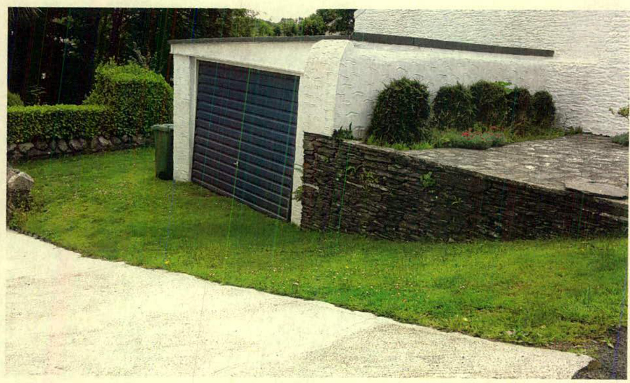
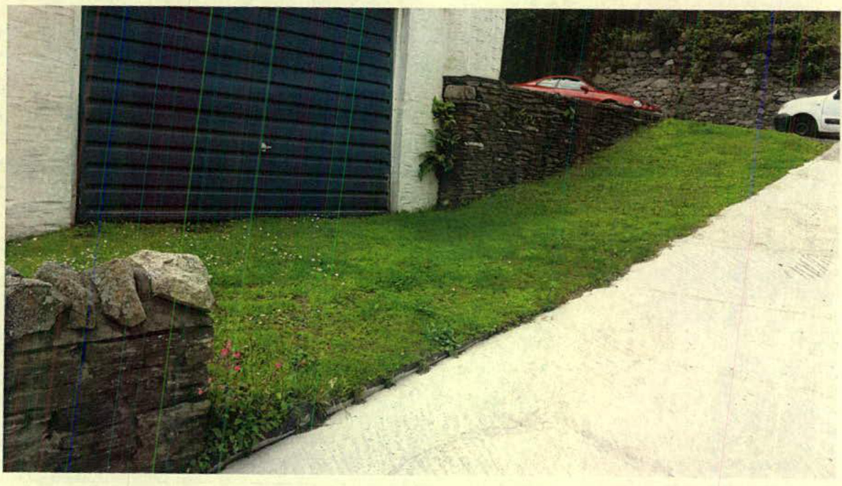
To provide the necessary improvements to the northern corner of the junction, third party land is required from the property known as Dingle Nook. The landowner has given the Department permission to proceed with the planning application subject to the inclusion of minor improvements to the driveway of Dingle Nook as part of the Department's intended accommodation work. Currently the property's double garage is inaccessible because the driveway from the highway is grass (see Appendix A - Plates 7 \& 8). It is proposed to reconstruct and re-profile the driveway in concrete to match the adjacent driveway to Chapel House. This will allow the property owner to park his cars off the highway in the vicinity of the junction and to access his garage.
To overcome all the identified problems, the Department proposes to undertake the alterations shown on the attached plan (see Appendix B ref: HW2868/P011). These improvements will increase capacity and make the junction safer as a result of improved visibility, with the landscaped area improving the surrounding aesthetics. These works would be done at the same time as the major reconstruction works planned for the main road through the village.
Plate 1 - Sub-standard visibility looking south from Mines Road Plate 2 - Sub-standard visibility looking north from Mines Road
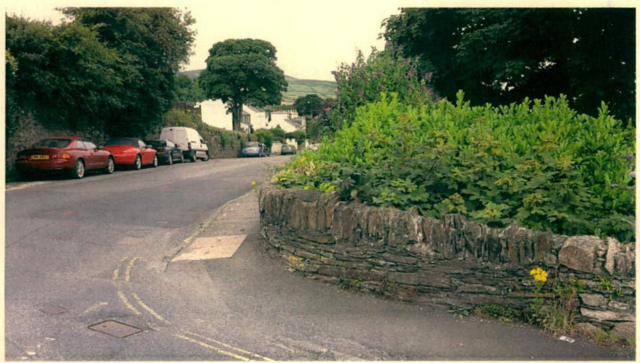
Plate 3 - Steep approach gradient on Mines Road
Plate 4 - A3 Southern Approach
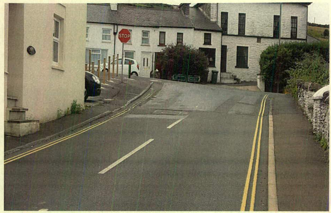
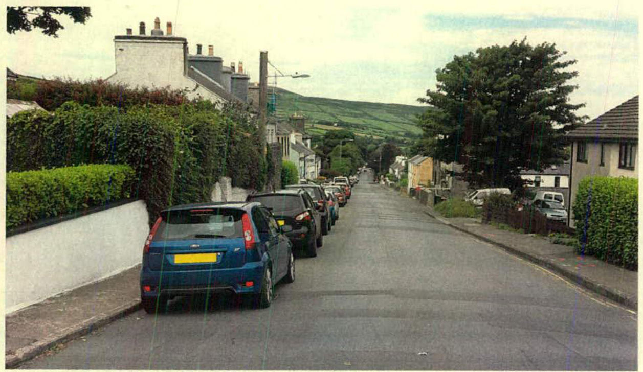
Plate 5 - A3 Northern Approach
Plate 6 - Existing landscaped area at Mines Road junction
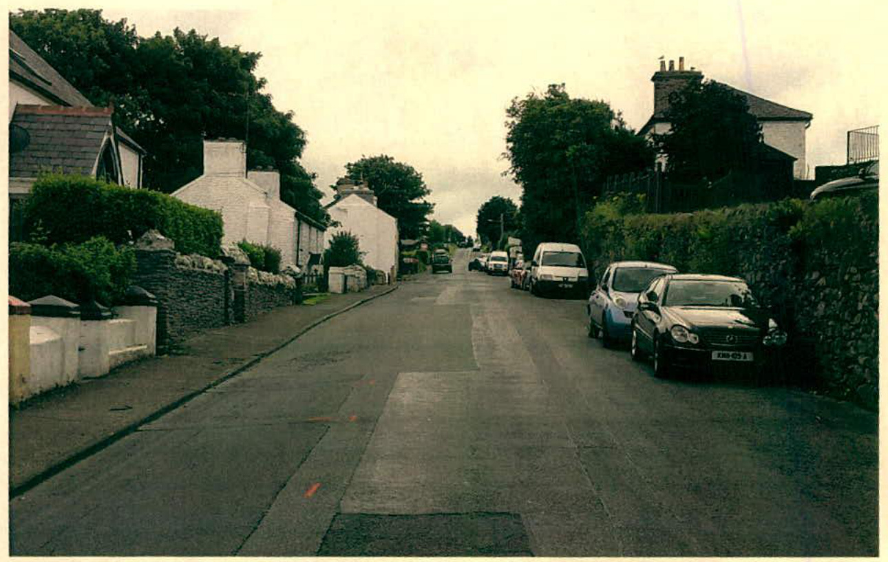
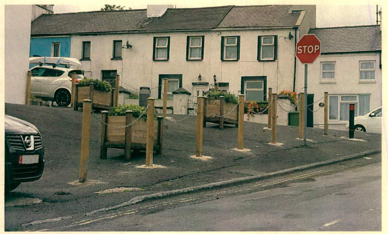
Plate 7 - Existing access to garage at Dingle Nook (grass driveway)
Plate 8 - Existing access to garage at Dingle Nook (grass driveway)
APPENDIX B - DRAWINGS
Existing Junction Layout Visual impression of Junction Layout after improvement works
Copyright in submitted documents remains with their authors. Request removal