Loading document...
This document is to be read in conjunction with the Planning Application dated 5th Feb 2019.
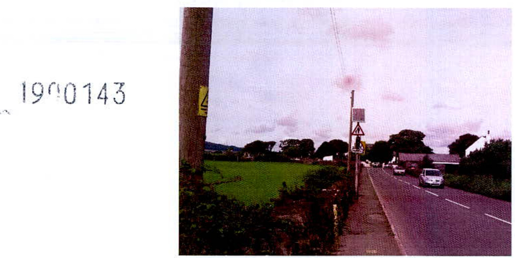
1900143
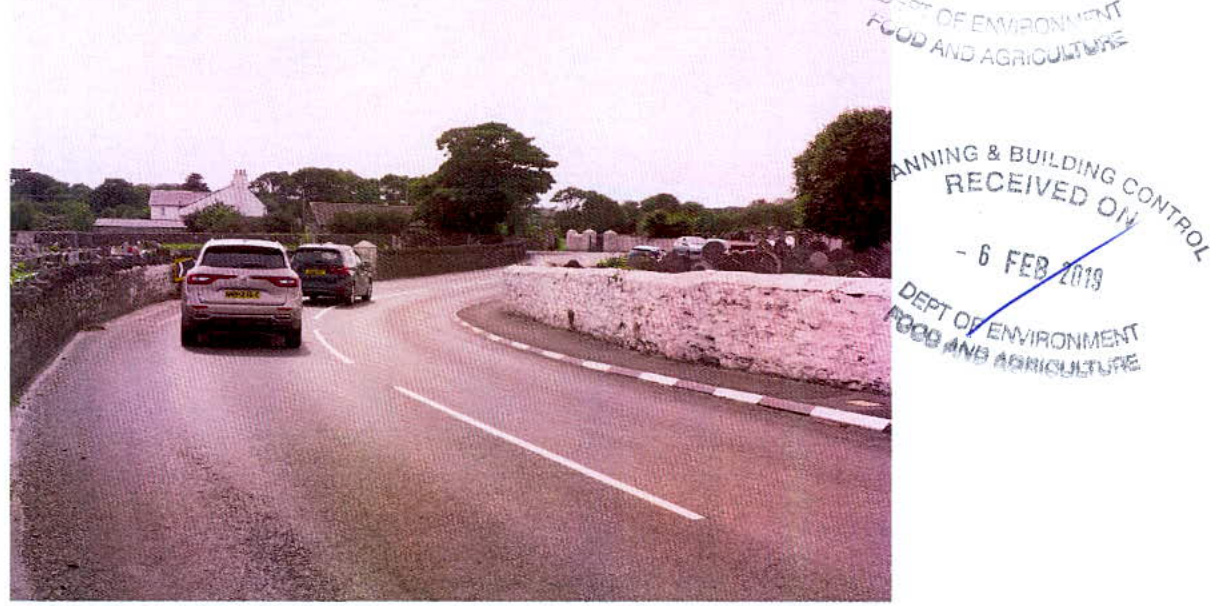
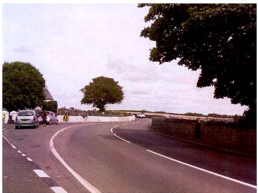
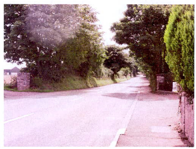
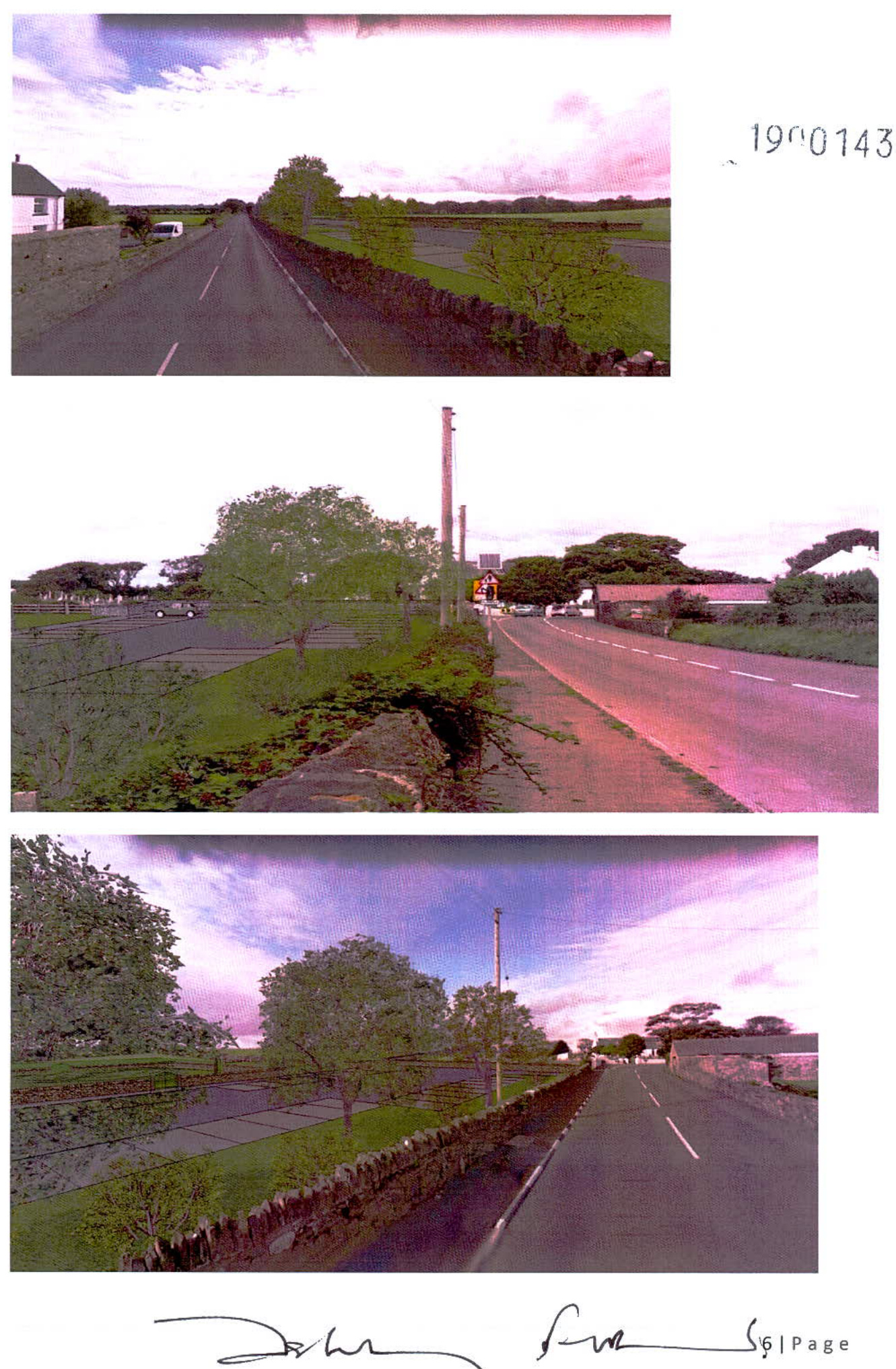
The following photographs are referred to on the site location plan 18-MC-716 01/SP dated Nov 2018
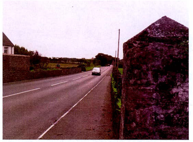
The speed through these bends is considerably below the 50mph average for the road. The existing field entrance is visible beyond the two white pillars in the middle distance. This photograph is taken some 94m from the existing entrance. This entrance is necessary for farm vehicles accessing Sidbrick Hill and is adjacent to the present Church Car Park.
Photograph 3 : taken from proposed car park entrance towards Malew bends.
Photograph 4 : taken from proposed entrance towards Castletown
Additional Photograph showing view from farm entrance towards Castletown.
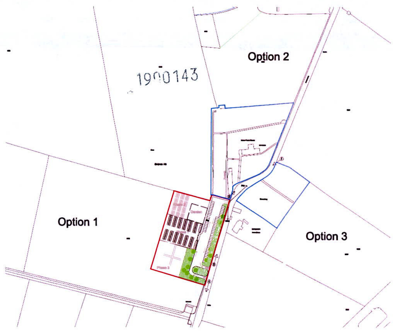
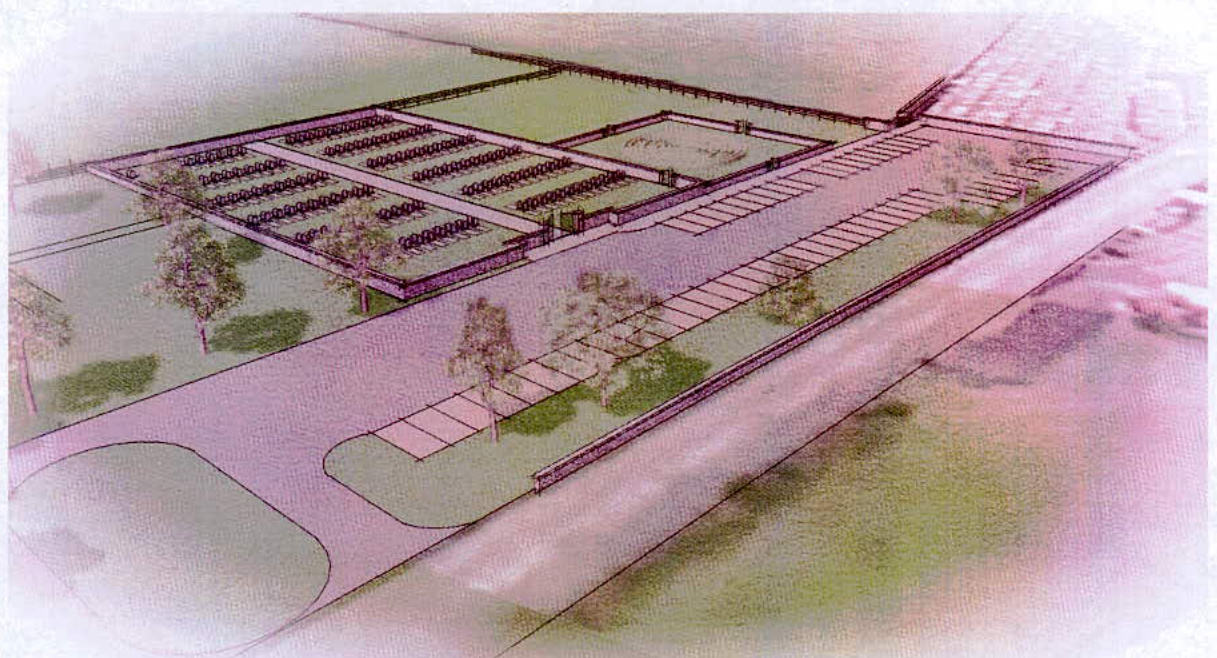
The site plan 18-MC-716 01/SP showed three options; Option 1 is the preferred option. It is adjacent to the present parking area and has reasonable access to the other Malew burial grounds. There is a toilet available at the church and the church is open during daylight hours for the families to use if they wish to. There have been discussions regarding the purchase of this site for 10 years with the present owners.
Option 2: would extend the older burial ground behind Malew Church towards Cross Four Ways. There is a sharp change in level between the older cemetery and the field making it difficult to use the facilities in the Church and the sight lines are more restricted than at option 1. This is particularly true for vehicles approaching from the church bends.
Option 3: extending the present burial ground. This would not be possible without moving some of the existing burials. The present practice of crossing the road is not ideal and access for the hearse is very restricted. Getting a new access through adjoining farmland would be complicated.
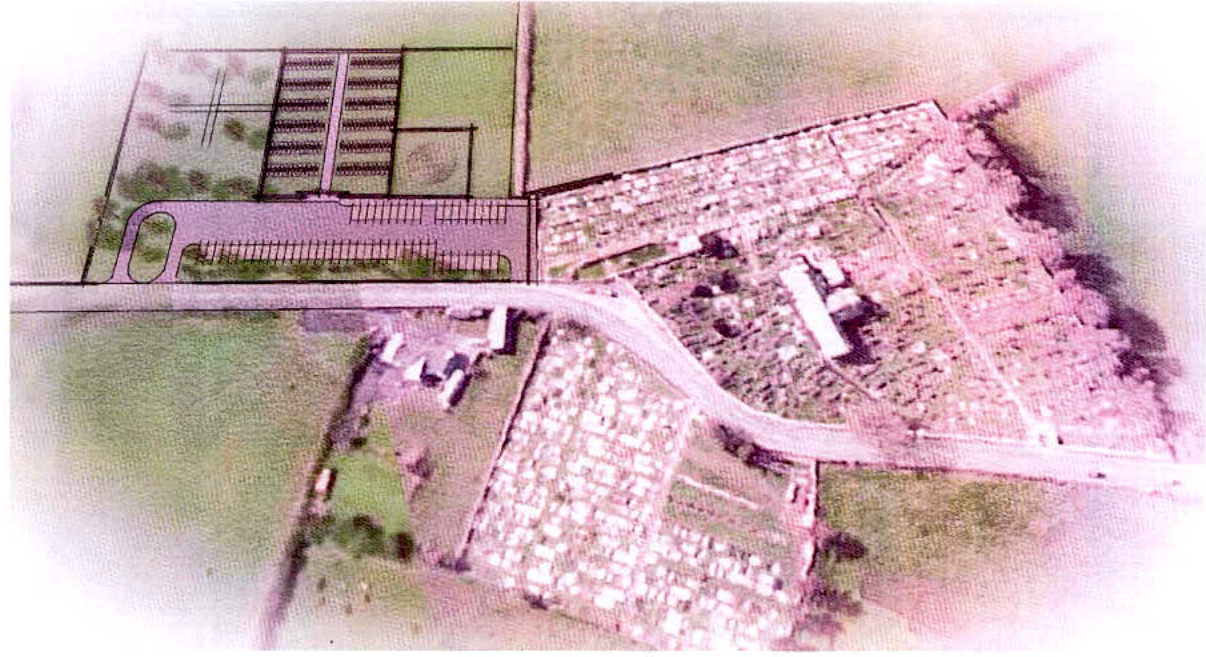
The following images are based on drawing 18-MC-716 / 02 dated Nov 2018
The road layout with a separate entrance and exit was discussed at an early stage with highways and reduces the possibility of a car being stationary in the main highway waiting to get access to the car park. There is a reasonably long drive where cars can queue. The area adjacent to the cemetery entrance will be kept clear for hearse and family cars and there is ample parking. The parking nearest the church will also be available during services at Malew Church.
The new cemetery will serve Malew and Castletown and may also be available on request to the Church Wardens of Malew and Santon, who run the service on behalf of the Malew Burial Authority. The only municipal cemetery is in Douglas and all the other Parishes run similar operations. The Cemetery at Rushen has recently been extended. Currently there are 10-12 burials a year in the existing cemetery which has started in 1935 and has spaces for 1000 burials. The present cemetery has about 5 years left and the demand may increase as Castletown grows. Burials are still a popular alternative to cremation.
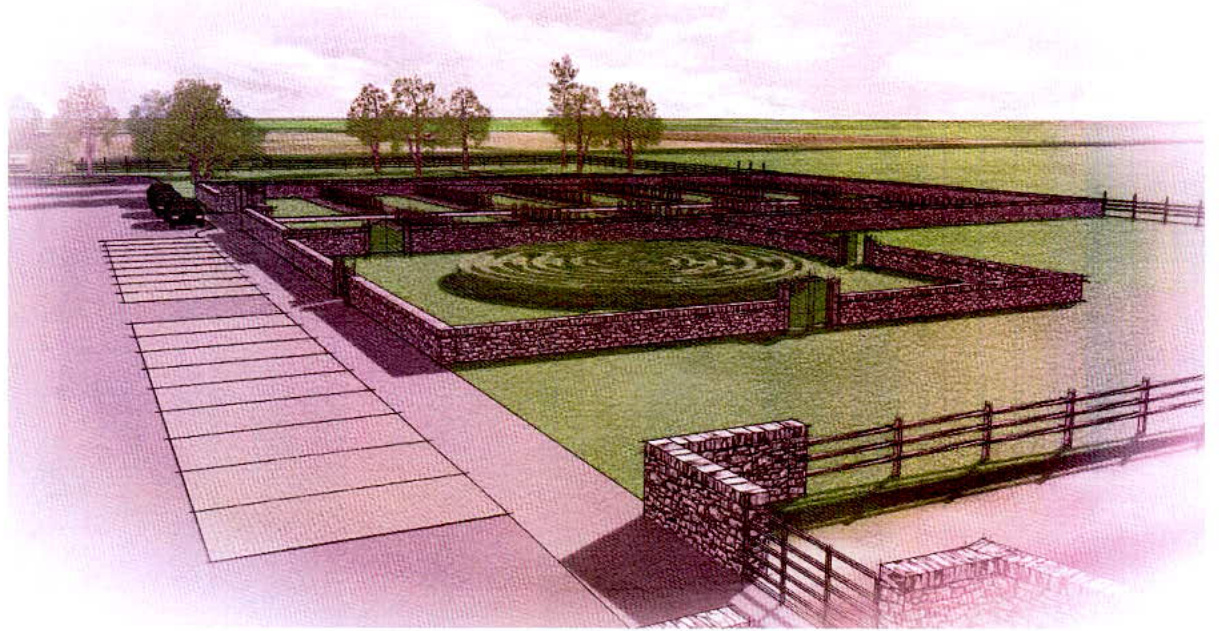
It was decided that the first phase of the cemetery extension would be in the centre of the site proposed in the application with a small formal remembrance garden to the North nearest the church. The land rises slightly nearer Skibrick Hill and could also be planted as a feature. The existing cemeteries are regularly visited and the parking nearest the church will give access to those older parts.
The new cemetery will have a stone wall 1.5 m high surrounding it offering some privacy and there will be a similar wall to the garden. The remaining site is simply planted with native trees and grass which will be maintained on a regular basis. The whole site will be secured by a stock proof fence.
It is hoped that an option can be taken to purchase the remaining field which in time could be planted and become a Woodland Burial Site - this type of burial site where the graves are arranged in clearings within a landscaped area with simple markers is becoming more popular and may be offered as an option in the future. This option is not included in the present application.
The existing roadside wall will be reduced in height to 1 m in accordance with the guidelines for visibility splays and the new entrance and exit are designed to give a full 120 m visibility splay from 2.4 m back from the kerb line.
Copyright in submitted documents remains with their authors. Request removal