Planning Statement In Support Of The Erection Of A Garage, Phoenix Cottage, Ballacorey Road, Bride Im7 4Aw
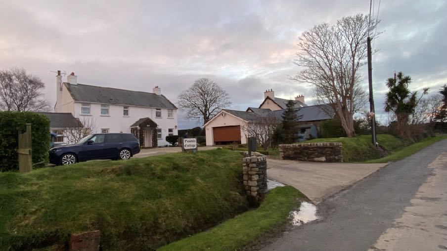
A street-level photograph showing a white detached house named Poorna Cottage and a separate garage building with a brown door, situated on a grassy slope next to a road.
1.0 Introduction
1.1 Phoenix Cottage is an existing two storey dwelling with detached garage and small garden sheds which sits between Curlew Cottage and Ballachrink Croft. Ballachrink Croft is the author’s property. Phoenix Cottage sits in 0.3 acres of residential curtilage with spacious gardens at the front and rear.
1.2 Phoenix Cottage was built in the 2000s (see Planning History) and is traditionally styled with rendered walls, vertically proportioned windows, slated roof and chimneys at each end of the roof. The garage sits in front of the house, as do the garages serving the adjacent properties. It should be noted that the garage for Ballachrink Croft is to be finished in timber cladding and is not yet complete.
1.3 Curlew Cottage is the oldest property in the trio and appearing on the 1860s maps. There was an original house on Ballachrink Croft which sat alongside the road:
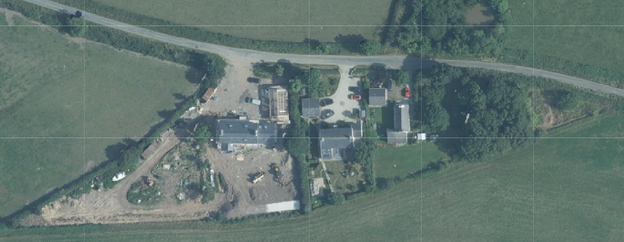
Aerial site location map showing a rural property with buildings under construction surrounded by fields.
1.4 Phoenix Cottage has a number of trees in the front garden, mostly fruit trees and also one willowoak which sits close to the boundary with Ballachrink Croft.
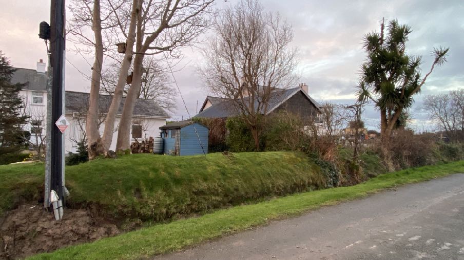
A street-level photograph showing a blue wooden outbuilding or shed situated on a grassy bank next to a road, with residential houses and trees in the background.
2.0 The proposal
2.1 Proposed is the alterations and creation of a larger garage incorporating the existing footprint. The footprint will resemble the garage constructed at Ballachrink Croft but incorporate materials included in the existing Phoenix Cottage - render and stonework.
2.2 The existing garage has a footprint of 6.2m by just over 6m and is just over 4m to the ridge. The proposed garage will have an overall footprint of 7.2m by 11.4m and be 5.7m to the ridge. The roof will be finished in dark slates and the walls in smooth render with a stone faced plinth to reflect the stone porch on the house. There will be three sectional garage doors and an upstairs which will be used for a home office and/or purposes ancillary to the main dwelling including shower and toilet facilities.
2.3 The small fruit trees between the existing garage and the road may be removed or relocated: the existing hedge between the two properties and the large willow oak in the corner will not be affected by the proposal.
2.4 The surface water from the proposed building will be drained into the existing perforated pipework which discharges into the existing roadside ditch.
2.5 There will be no change in the access into the property and only a marginal change in the space available for manoeuvring and parking, which remains substantial.
2.6 The existing garage has limited space length and widthways and the applicant would wish his vehicles to be kept under cover and securely.
3.0 Planning policy
3.1 The site lies within an area designated on the Isle of Man Planning Scheme (Development Plan) Order 1982 as not for a particular purpose and outside of the area of an area of High Landscape or Coastal Value and Scenic Significance.
3.2 The 2008 Landscape Character Assessment (see Appendix One) identifies the area in which the site lies as Undulating Lowland Plain - Andreas and Jurby and is summarised in the draft Area Plan for the North and West as follows:
3.3 The draft Area Plan for the North and West is in a preliminary stage and will not be adopted until late 2023/early 2024. However, it does not change the land use designation nor introduce any additional constraints. There are small areas identified on the environmental constraints map although it is not clear what they are identified as (potentially ecological interest although the scale of the plan does not make the colouring clear) although none of these apply to the application site. There are no infrastructural constraints that are applicable to the site.
The image shows a site plan or location map featuring black outlines of buildings and yellow highlighted areas, likely indicating the property boundary or proposed development site.
3.4 The site is not designated for development in either development plan so there is a presumption against development here as set out in Environment Policies 1 and 2 which protect the countryside for its own sake (see Appendix Two). General Policy 3 sets out the exceptions to this general principle and includes a range of development. It does not include development in the form of garages or residential outbuildings although these are not uncommon in undesignated areas and examples of these are provided in the Planning History section. It is also relevant that planning approval is not generally required for domestic structures including garages, subject to criteria around siting and size.
4.0 Planning history
4.1 The development of Phoenix Cottage was approved under 07/01802/C for the change of use of an existing building to residential and then 08/01700/B for a replacement dwelling.
4.2 17/00670/B saw approval for the replacement of the rear conservatory roof with slates and the site plan clearly shows an existing garage on the site.
4.3 The replacement of Ballachrink Croft and erection of garage were approved under 20/00764/B and is partly complete.
4.4 Other applications for the erection of garaging in undesignated areas in the immediate vicinity include 07/01948/B at Ballasyre, Andreas, 08/00911/B at Lheakerrow Cottage, Andreas, 08/01258/ REM at Ballabane, Andreas.
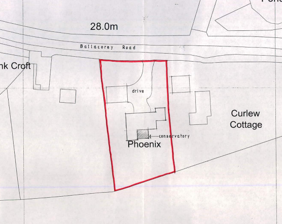
This image displays a site plan showing the property boundary in red for a residence named 'Phoenix' on Ballacorey Road. It details the layout including a driveway, a conservatory, and adjacent properties like Curlew Cottage.
5.0 Assessment and conclusion
5.1 Whilst the site is not designated for development, there is a general acceptance of additional domestic buildings such as sheds and garages associated with residential properties and indeed, the property already has a garage associated with it.
5.2 The curtilage is not unsubstantial and the existing dwelling is a sizeable two storey property with spacious areas in front and behind the dwelling itself.
5.3 Both properties each side of the application site have detached garages which are taller or larger or both - than what exists at Phoenix Cottage. The character of this little group of buildings is therefore of houses which have garages of various sizes sitting between them and the highway.
5.4 The size of the dwelling will make it likely that the occupants will have a number of vehicles which indeed is the case here. Due to the exposed location of the property and the increasing desire to have electrically chargeable vehicles, it is becoming increasingly the case that additional garaging is required, particularly in the countryside which is more distant from public charging points and where there are greater distances than more urban locations.
5.5 Whilst not referred to in the Housing Policy, it is important that development in the countryside, whether on land designated for development or not, complies with the standards of development expected on other land in the Island. General Policy 2 sets out these standards and the Residential Design Guide complements this by providing information on how the impact of new development on
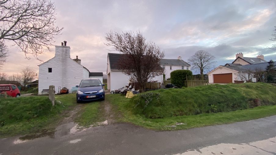
A street-level photograph showing a rural residential scene with white-washed buildings, a driveway with a parked car, and a grassy verge.
existing dwellings will be measured. The proposed building will be finished to match the existing house and of a size and scale to match the existing garage alongside at Ballachrink Croft.
5.6 General Policy 2 requires that development has an acceptable impact on the character of the area. This relates to the Landscape Character Assessment which makes reference to the suburban appearance of some properties and the overwhelming natural character of the area. What is proposed is not in conflict with this.
5.7 GP2 also requires that new development has an acceptable impact on the living conditions of those in adjacent dwelling with the RDG providing the means of measuring this. The 25 degree, 45 degree and 20m rules contained in the RDG are all observed and the distance and mature vegetation between the proposed works and the nearest houses means that there will be no adverse impact on the living conditions of those in adjacent property.
5.8 The property retains a high number of parking spaces (many more than 2 which is what is required by the Strategic Plan) which are not affected by the development and with adequate turning and manoeuvring space. The development will not increase traffic coming to or going from the site as the facilities are for domestic use in conjunction with the occupation of the dwelling.
5.9 There are no protected trees or vegetation affected by the proposal and no ecological impact. In respect of the latter the applicant has, over the years, erected a significant number of bird nest boxes including ones on the existing garage which will be relocated to the new garage, and encourages wildlife. The site is not in an area at risk of flooding.
5.10 It is submitted that the proposal accords with all of the relevant policies and has no adverse impact on the environment.
Sarah Corlett 13th March, 2023
Appendix One - Landscape Character Assessment
F3 ANDREAS AND JURBY Key Characteristics
• Swathe of farmland (covering the breadth of the Island).
• Irregular pattern of medium-sized arable and pasture fields.
• Field boundaries demarcated by traditional Manx hedges and simple post and wire fences.
• Inter-linking network of minor rural roads serve the area, together with the A10, A17 and A19.
• Generally few vertical elements, other than occasional telegraph poles.
• Scattered and relatively isolated settlement pattern.
• Traditional farm buildings (characteristically white, with grey roofs).
• Key settlements include the small town of Andreas and the villages of Bride, Jurby and Sandygate.
• The Isle of Man Government Industrial Estate and adjacent Jurby Aerodrome
• Disused airfield at Andreas
• Churches provide prominent landmarks within views.
• Views to dramatic upland backdrop to the south provide strong sense of place.
• Strong sense of openness and tranquillity (at distance from main A19 and A17 roads).
• Slightly marked sinuous valley of Lhen Trench.
• Sandpit at Cronk-y-Scotty
Overall Character Description Situated to the north of the Island, this landscape character area encompasses a swathe of farmland underlain by the predominantly flat topography of the northern plain. To the west, the relatively narrow course of the Lhen trench meanders through the landscape, which exhibits an irregular pattern of medium-sized arable fields and rough grassland/pasture. A variety of different forms of hedgerows and simple post and wire fences demarcate field boundaries. To the west, mature, intact low, trimmed hedges dominate the hedgerow network. Several single mature deciduous trees within Manx hedgerows and fields also contribute to a mature recognisable landscape structure. The main A19 and A17 roads (a source of noise and visual intrusion) cross the area and an inter-linking network of minor roads, often lined with species-rich verges, help to provide access to farms and settlements.
Generally, few vertical elements punctuate the skyline of the area. However, telegraph poles and the telecommunications mast at Jurby Industrial Estate are a visible human influence. Settlement pattern is scattered and relatively isolated, with the Andreas and Jurby Industrial Estates providing the largest groups of buildings within the area. Several isolated farmsteads and individual houses also pepper the landscape. Traditional farm buildings characteristically exhibit white walls (which often provide a bright contrast to the muted upland backdrop to the north) and grey roofs. Alongside these traditional buildings, modern agricultural sheds and warehouses are sometimes visually intrusive. In addition, the distinctive churches of St. Andrews Church at Andreas (built predominantly from Sulby Glen stone) and St. Patrick’s Church to the west of Jurby and their associated medieval crosses are landmark features landscapes within the area. St. Patrick’s Church is particularly prominent within
views across the surrounding open, flat landscape. The prefabricated buildings on an old air force base and disused runway at Jurby (now housing several small businesses and shops, including Jurby Junk) exhibit a strong human influence over the character of this part of the area. Construction of the new prison development is also associated with this part of the area. Overall, there is a strong sense of tranquillity and openness throughout the area. A strong recognisable sense of place is provided by views to the dramatic backdrop of the Uplands to the south, views of St. Patrick’s Church and distant views to the sea at the eastern and western edges of the area.
Key Views
• Glimpsed views to the sea from the eastern and western edges of the area.
• Panoramic open views southwards towards a dramatic upland backdrop.
• Open views to landmark church towers (particularly St. Patrick’s Church) to the west of Jurby.
Historic Features
• St. Patrick’s Church and medieval crosses.
• St. Andrew’s Church and medieval crosses.
• Old airfields at Jurby and to the east of Andreas.
Ecological Features
• Species-rich verges.
• Mature hedgerows and single mature deciduous trees.
• Patches of rough grassland
• Area of Special Scientific Interest at Ballacrye
Evaluation of Inherent Landscape Sensitivities
• Strong sense of tranquillity.
• Scattered isolated settlement pattern.
• Enclosed minor rural roads.
• Vernacular character of buildings and churches.
• Presence of Manx Mile stones.
• Few tall vertical elements.
• Dramatic views south to Uplands.
• Field pattern delineated by a mixture of stone walls, relatively tall Manx hedge-banks and post and wire fences.
Landscape Strategy The overall strategy should be to conserve and enhance the character, quality and distinctiveness of this rural area including the scattered settlement pattern, relatively strong field pattern delineated by a mixture of stone walls and relatively tall Manx hedge-banks and its network of enclosed minor rural roads.
Appendix Two - Strategic Plan policies
General Policy 2: Development which is in accordance with the land-use zoning and proposals in the appropriate Area Plan and with other policies of this Strategic Plan will normally be permitted, provided that the development:
(a) is in accordance with the design brief in the Area Plan where there is such a brief;
(b) respects the site and surroundings in terms of the siting, layout, scale, form, design and landscaping of buildings and the spaces around them;
(c) does not affect adversely the character of the surrounding landscape or townscape;
(d) does not adversely affect the protected wildlife or locally important habitats on the site or adjacent land, including water courses;
(e) does not affect adversely public views of the sea;
(f) incorporates where possible existing topography and landscape features, particularly trees and sod banks;
(g) does not affect adversely the amenity of local residents or the character of the locality;
(h) provides satisfactory amenity standards in itself, including where appropriate safe and convenient access for all highway users, together with adequate parking, servicing and manoeuvring space;
(i) does not have an unacceptable effect on road safety or traffic flows on the local highways;
(j) can be provided with all necessary services;
(k) does not prejudice the use or development of adjoining land in accordance with the appropriate Area Plan;
(l) is not on contaminated land or subject to unreasonable risk of erosion or flooding;
(m) takes account of community and personal safety and security in the design of buildings and the spaces around them; and
(n) is designed having due regard to best practice in reducing energy consumption.
General Policy 3: Development will not be permitted outside of those areas which are zoned for development on the appropriate Area Plan with the exception of:
(a) essential housing for agricultural workers who have to live close to their place of work; (Housing Policies 7, 8, 9 and 10);
(b) conversion of redundant rural buildings which are of architectural, historic, or social value and interest; (Housing Policy 11);
(c) previously developed land(1) which contains a significant amount of building; where the continued use is redundant; where redevelopment would reduce the impact of the current situation on the landscape or the wider environment; and where the development proposed would result in improvements to the landscape or wider environment;
(d) the replacement of existing rural dwellings; (Housing Policies 12, 13 and 14);
(e) location-dependent development in connection with the working of minerals or the provision of necessary services;
(f) building and engineering operations which are essential for the conduct of agriculture or forestry;
(g) development recognised to be of overriding national need in land use planning terms and for which there is no reasonable and acceptable alternative; and
(h) buildings or works required for interpretation of the countryside, its wildlife or heritage.
Environment Policy 1: The countryside and its ecology will be protected for its own sake. For the purposes of this policy, the countryside comprises all land which is outside the settlements defined in Appendix 3 at A.3.6 or which is not designated for future development on an Area Plan. Development which would adversely affect the countryside will not be permitted unless there is an over-riding national need in land use planning terms which outweighs the requirement to protect these areas and for which there is no reasonable and acceptable alternative.
Environment Policy 2: The present system of landscape classification of Areas of High Landscape or Coastal Value and Scenic Significance (AHLV’s) as shown on the 1982 Development Plan and subsequent Local and Area Plans will be used as a basis for development control until such time as it is superseded by a landscape classification which will introduce different categories of landscape and policies and guidance for control therein. Within these areas the protection of the character of the landscape will be the most important consideration unless it can be shown that: (a) the development would not harm the character and quality of the landscape; or (b) the location for the development is essential.
Copyright in submitted documents remains with their authors. Request removal
Source & Provenance
Official reference
23/00383/B
Source authority
Isle of Man Government Planning & Building Control